First day. We set off towards the summit and its heights. On our shoulders, we have enough to last for several days. Food, equipment, we are autonomous, left to ourselves :)
When I think about it, we didn't even have a battery to recharge a phone and call for help... Fortunately, nothing happened. It will not have escaped you that I am speaking in the past tense and indeed, this hike goes back a few years - to the time before the Covid - and I recently came across this folder of images, which made me want to dive back in.
The more I looked at the images, the more I wanted to share with you the visual and written account of this mountain outing in the Vercors Natural Park, in the Drôme region. A detail that is not so much a detail as it is the first excursion that we made together with my girlfriend. We were at the beginning of our relationship and almost years later, it's still something that lives in us, memories that we like to think about and remember :)
It will be in three articles that will follow in chronological order of our trajectory on the mountainous plateau that I will share this adventure !
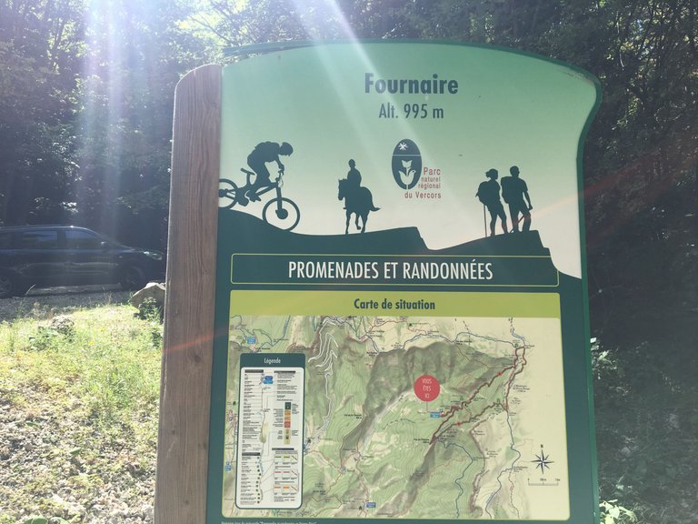
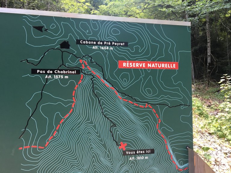
Here is some information about the site, topographical information anyway ^^ ! On the second picture, you can see the starting point of our hike and at the top, you have the "Cabane de Pré Peyret", which was our initial objective but we went a bit beyond it.
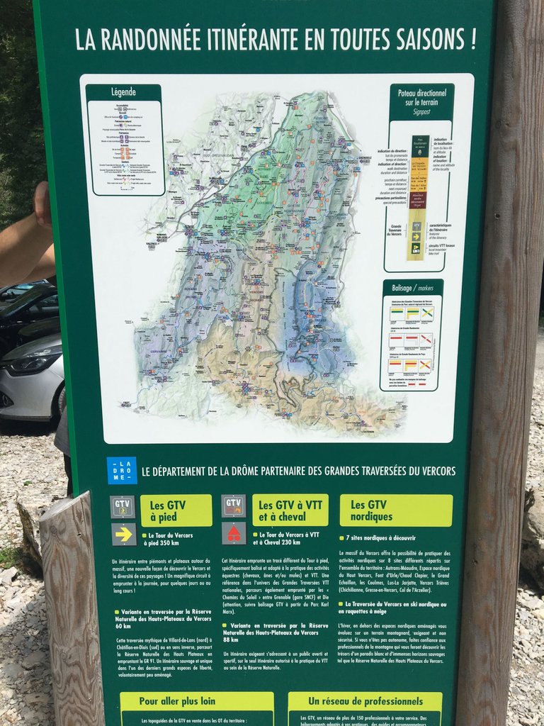
Above is a slightly larger map in which you can see more of this very large protected area. If you want to get an idea for yourself, look up "Vercors" "Drôme", but in general, you can situate the region as being equidistant from Lyon and Marseille and following the axis of the Rhône river.
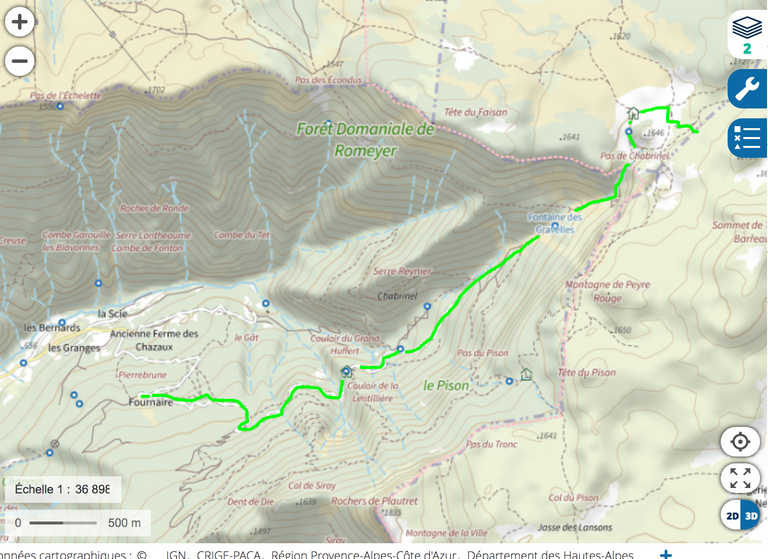
Here, our itinerary in a little more detail, but let's move on to the hike and the pictures themselves...!
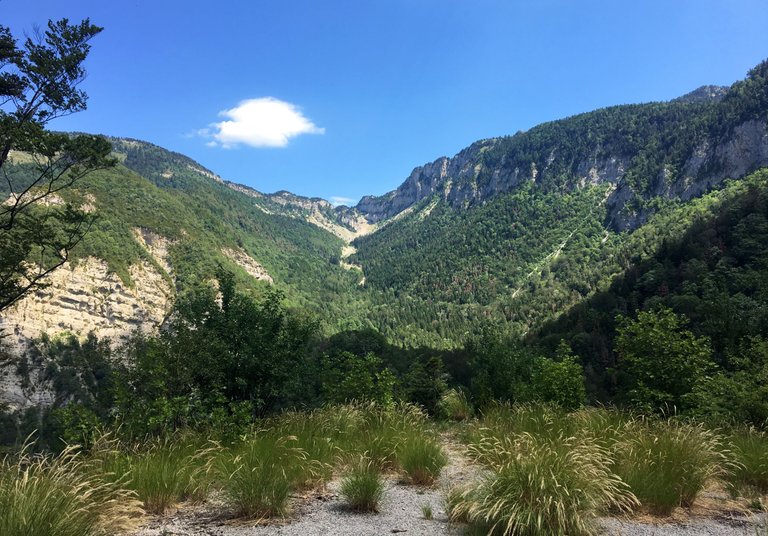
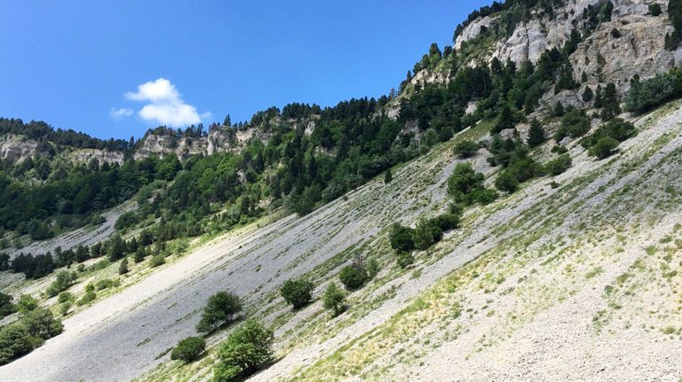
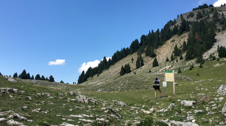
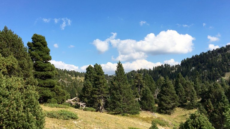
Apart from the series of maps, this is the first photo I took and it is perhaps (surely!) the most representative of the first of our days. Indeed, the site where we were going is a real plateau. So, to go hiking there, either you take the car up to a pass and then it's all flat afterwards... or you climb by force of your legs !
It is of course the second option that we chose. What would have been the point otherwise ? You can probably guess, but our objective is at the end of the maze of clear rocks. Over there, far up the pass.
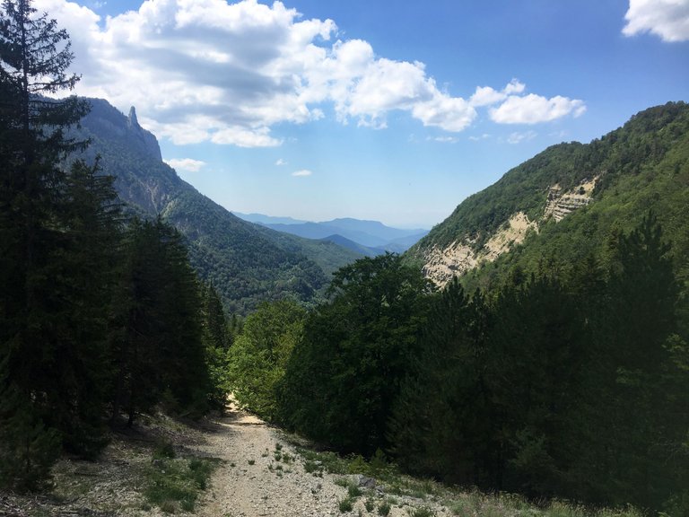
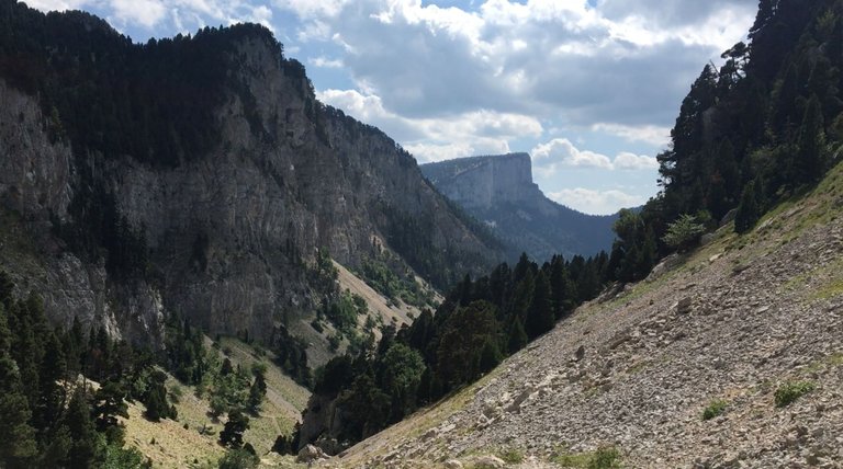
After several hours of walking in the forest where I feel my legs getting active again and during which I did not take any pictures, we end up in the long final challenge.
Here, with a little more height and a few more meters behind us... The test that awaits us is the scree that leads to the plateau, which is quite difficult.
Several details to take into account...
- Even if I had already done this hike twice with my family, I was still a pure fan of wilderness and autonomous outings and I have now improved.
- For my girlfriend, I think it was her first hike and we were real tourists - you'll see that later...
We were in the middle of August, the hottest time of the year, and I'm not lying when I tell you that we could have cooked an egg on one of those limestone blocks...!
That being said, let's continue our progress...

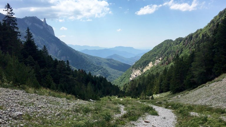
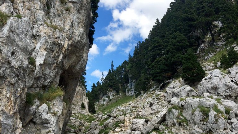
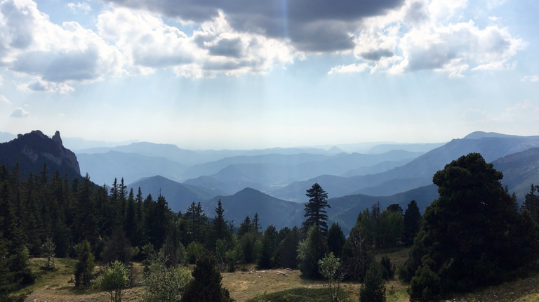
We start to attack the scree and I take fewer pictures as the walk becomes more difficult. The view is more and more beautiful, but it is earned by the strength of our calves...!
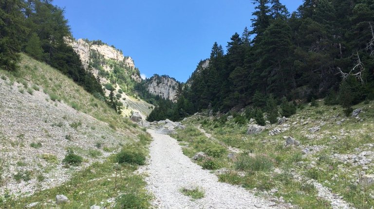
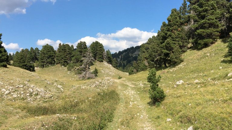
After a few turns where we discover that we haven't arrived yet... we reach the final exit, we are on the plateau...!
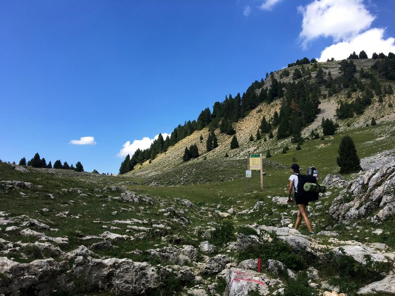
Take a good look at the pictures above, do you see anything that wouldn't fit in the equipment of two hikers, even almost amateurs ? I'll give you a little more time and you can see that a little further on.
An amusing anecdote, and one full of lessons, is that during the climb, I repeated several times to my girlfriend, "You'll see, at the top all the times I've been there before, it's barely if I've passed ten people in all." But when we arrived at the fountain near the hut, it was not one, not three, but more than twenty hikers that we passed queuing in front of a thin stream of water. We thought we would be quiet ^^ !
And there, we made our first mistake : we didn't stop... But we'll come back to that in a moment.
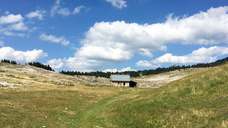
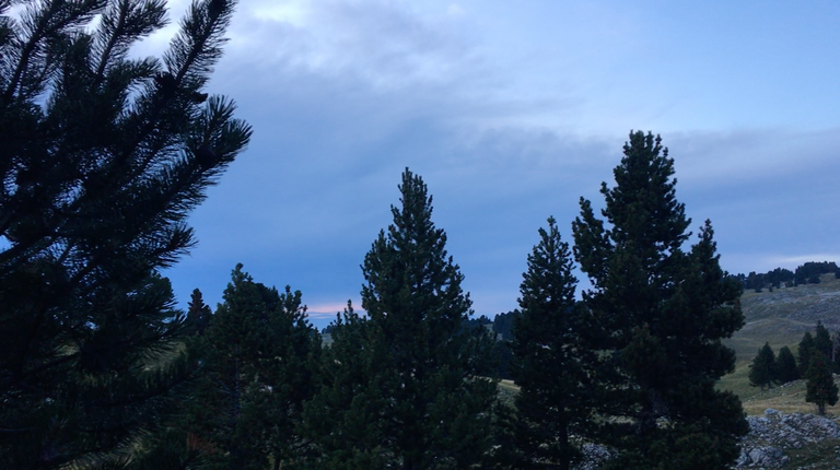
Just enough time to give you a little insight into the hut...
And the surrounding landscape...
No, our mistake was that we did not want to wait to refill our water reserves, which we had almost exhausted during the climb. Unforgivable mistake !
I had spotted another spring below... but this one was much further than we thought. And when we got there, there was just no water. First lesson : when there's water, that's where to get it !
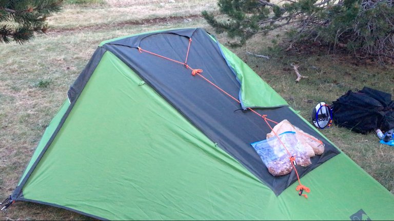
Finally, after we had exhausted ourselves a bit and returned to the first source, we set up our base camp.
For those who would not have spotted the incongruous detail, it is two badminton rackets ^^ ! Not once did we play as it was windy and we were tired in the evening. From this detail alone, you can see how amateurish we were at the time :D
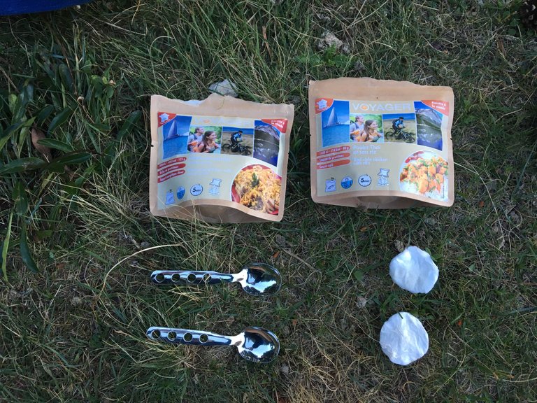
Here's our freeze-dried meal : Chicken pasta for me and Thai rice and chicken for my girlfriend and honestly, we're making you eat this effortlessly, you'd probably think it was downright bad, but after that day, it was like eating in a three stars restaurant !
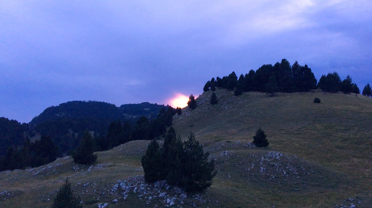
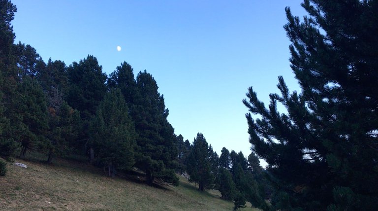
Last images of the last light of the day. We soon go to bed, with images in our heads and aches in every inch of our members !
I hope that this first episode has made you want to see the rest :) Thanks for visiting and reading, see you tomorrow !
<3
Première journée. Nous nous élançons vers le plateau et ses hauteurs. Sur le dos, nous avons de quoi tenir pendant plusieurs jours. Nourriture, matériel, nous sommes en autonomie, livrés à nous-mêmes :)
Quand j'y repense, nous n'avions même pas de batterie de secours pour recharger un téléphone et passer un appel à d'éventuels secours... Heureusement, il ne s'est rien passé. Il ne vous aura pas échappé que je parle au passé et en effet, cette randonnée remonte à quelques années - du temps avant le Covid - et je suis récemment retombé sur ce dossier d'images, ce qui m'a donné envie de m'y plonger à nouveau.
Plus j'observais les images, plus je souhaitais partager avec vous le récit visuel et écrit de cette sortie en montagne, en pleine nature dans le Parc Naturel du Vercors, dans la région de la Drôme. Détail qui n'en est finalement pas tant un que cela, cette excursion fut la première que nous faisions alors ensemble avec ma copine. Nous étions au début de notre relation et presque des années plus tard, c'est encore quelque chose qui nous habite, des souvenirs auxquels nous aimons repenser et nous rappeler en mémoire :)
Ce sera en trois article qui suivrons dans l'ordre chronologique de notre trajectoire sur le plateau montagneux que je partagerai cette aventure !
Voici un peu d'informations quand au site, renseignement topographique en tout cas ^^ ! Sur la deuxième image, vous pouvez voir le point de départ de notre randonnée et tout en haut, vous avez la "Cabane de Pré Peyret" c'était notre objectif initial mais nous l'avons un peu dépassé.
Ci-dessus une carte un peu plus large dans laquelle vous pouvez aller voir un peu plus en détail ce très grand domaine protégé. Si vous voulez vous faire une idée par vous-même, allez chercher : "Vercors" "Drôme", mais dans l'idée, vous pouvez vous situer la région comme étant équidistante de Lyon et de Marseille et suivant l'axe du fleuve du Rhône.
Ici, notre itinéraire un peu plus en détail, mais passons à la randonnée et aux images en tant que telles..!
En dehors de la série des cartes, voilà la première photo que j'ai pris et c'est peut-être (sûrement !) la plus représentative de la première de nos journées. En effet, le site où nous rendions est un véritable plateau. Aussi, pour aller y randonnée, soit vous prenez la voiture jusqu'à un col et puis c'est tout plat par la suite... soit vous monter à la force de vos jambes !
C'est bien entendu la seconde option que nous avons choisie. Quel aurait-été l'interêt sinon ? Vous vous en doutez sûrement, mais notre objectif est tout au bout du dédale de roches claires. Là-bas, loin dans le col.
Après plusieurs heures de marches dans la forêt où je sens mes jambes se remettre à la marche active et durant lesquelles je n'ai pas pris d'images, nous débouchons dans la longues épreuve finale.
Ici, avec un peu plus de hauteur et quelques mètres de plus derrière nous... L'épreuve qui nous attend, c'est le pierrier qui mène au plateau et qui est sacrement ardu.
Plusieurs détails à prendre en compte...
- Même si j'avais déjà parcouru deux fois cette randonnée avec ma famille, je restais un pur amateur des sorties en pleine nature et en autonomie et je me suis désormais amélioré.
- Pour ma copine, je pense que ce n'était pas loin d'être sa première randonnée et nous étions de véritables touristes - vous verrez cela plus loin..!
Nous étions en plein mois d'août, la période estivale la plus chaude et je ne vous ment pas en vous disant qu'on aurai pu faire cuire un oeuf sur une ces blocs de calcaire..!
Cela étant dit, continuons notre avancée...
Nous attaquons franchement le pierrier et je prends moins d'images à mesure que la marche se fait difficile. La vue est de plus en plus belle, mais elle se mérite à la force de nos mollets..!
Après quelques virages où l'on découvre que non, on est pas encore arrivé... nous parvenons au débouché final, nous voilà sur le plateau..!
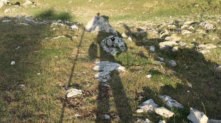
Observez bien les images ci-dessus, voyez-vous quelque chose qui n'aurait rien à faire dans le matériel de deux randonneurs, même presque amateurs ? Je vous laisse encore un peu de temps et vous pourrez voir cela un peu plus loin.
Une amusante anecdote et pleine de leçons, c'est que durant la montée, j'ai répété plusieurs fois à ma copine "Tu verras, en haut toutes les fois où je suis déjà venu, c'est à peine si j'ai croisé dix personnes en tout." Mais en arrivant à la fontaine près de la cabane, ce n'était pas une, ni trois, mais plus de vingt randonneurs que nous avons croisés en train de faire la queue devant un maigre filet d'eau. Nous qui pensions être tranquilles ^^ !
Et là, nous avons fait notre première erreur : nous ne nous sommes pas arrêtés... Mais nous y reviendrons dans un instant.
Juste le temps de vous donner un petit aperçu de la cabane...
Et des paysages environnants...
Non, notre erreur fut de ne pas avoir voulu patienter le temps de remplir nos réserves d'eau que nous avions presque épuisées durant l'ascension. Erreur impardonnable !
J'avais repéré une autre source en contrebas... mais celle-ci était bien plus loin que nous le pensions. Et arrivés à l'emplacement, il n'y avait juste pas d'eau. Première leçon : lorsqu'il y a de l'eau, c'est là qu'il faut en prendre !
Finalement, après que nous nous soyons un peu éreintés en pure perte et après être retournés à la première source, nous plantons notre camps de base.
Pour ceux qui n'auraient pas repéré le détail incongru, il s'agit de deux raquettes de badminton ^^ ! Pas une fois nous avons joué tant il y avait du vent et nous étions fatigués le soir. Rien qu'à ce détail, vous pouvez vous rendre compte de notre niveau d'amateurisme à l'époque :D
Voilà notre repas lyophilisé: Pâtes au poulet pour moi et Riz et poulet Thaï pour ma copine et honnêtement, on vous fait manger cela sans effort, vous trouveriez surement cela franchement mauvais, mais après cette journée, c'était comme manger dans un trois étoiles !
Dernières images des dernières lueurs de la journée. Nous ne tardons pas à nous coucher, des images pleins la tête et des courbatures à chaque centimètre de nos membres !
J'espère que ce premier épisode vous aura donné envie de voir la suite :) Merci pour votre visite et lecture, à demain !
<3
I love hiking, but camping is really nothing for me. When we want to go for hiking which lasts for a few days, we choose places where there is a cottage or some sort of a mountain hotel so that we don't need to sleep in a tent. My husband would love to sleep in a tent, but it's the worst nightmare for me.
Indeed, not a good idea to pass by a water source without refilling your bottles 🙂 I'm sure you learned from it and it doesn't happen to you anymore 😉
I'm looking forward to the next part of this hike!
My girlfriend used to be more up to this option as well and I can say the first nights were rather difficult for her... Me, well... when I sleep, I sleep and (almost) nothing can woke me up 😂 - I assume I’ve a typical man sleep !
When I was younger with my family we used to go from refuges to others places more or less comfortable, but I like it a bit ruff and wild I guess :)
Thanks you for visiting dear @delishtreats 😇
Oh yeah, that water story... I was rather stupid on that, but for sure the lesson was learned here and the other days, we were obsessed about our liquid supplies 😂
It seems so calm and quiet. Breathe nature and pure oxigen is one of the best experience anyone can have!
... And it is really corresponding to your impression !
Best hiking we had so far hehe :)
Very nice! I've never considered France as a hiking destination before.
Oh yeah ? And yet, there are many mountain ranges and nature reserves all over the country... The Massif Central, the Alps, the Vosges and the Pyrenees to name but a few... and then the Vercors of course ^^ !
Thanks you for visiting 😉✌️
These places are beautiful for cycling but also simply for a walk
Yes, indeed, there are quite a few bikes on the plateau... but if you want to go up, then I imagine that it must be quite difficult !
Thanks you @hotspotitaly ✌️
Hiya, @LivingUKTaiwan here, just swinging by to let you know that this post made it into our Honorable Mentions in Daily Travel Digest #1825.
Your post has been manually curated by the @pinmapple team. If you like what we're doing, please drop by to check out all the rest of today's great posts and consider supporting other authors like yourself and us so we can keep the project going!
Become part of our travel community:
Thanks you and congratulations to all travelers ;) !
Great trip and photos friend! Can't wait to read more adventures from you in the future.
Amazing trip guys
I feel like the world is so perfect when we're around them.
Have a nice trip
Thanks you 😉 !
There's more to come hehe :)
Have a good evening @furkanmamplam ✌️
Congratulations, your post has been added to Pinmapple! 🎉🥳🍍
Did you know you have your own profile map?
And every post has their own map too!
Want to have your post on the map too?
!PGM
!PIZZA