Read this post on TravelFeed.io for the best experience
The Western Tatras are made for hiking. Although their peaks are slightly lower than the peaks in the High Tatras, this does not detract from their beauty and sophistication.
We leave the house early in the morning to be there as soon as possible. We go to the Roháče-Spálená car park, where our hike begins. We have a good hour and a half from the house by car.
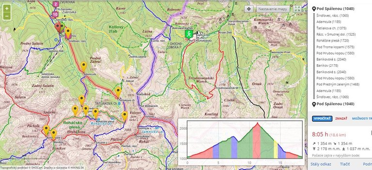
We park, we take our things and we go. We follow the asphalt road for about an hour until we reach Tatliak's cottage. The number of cars in the parking lot has already told us that we will not be alone in the mountains. This was confirmed at the outset. A group of tourists followed us and behind us.
We meet divers at Tatliak's cottage. With heavy diving equipment, they set off uphill. They are coming before us. We suspect that their goal will be one of the Roháče lakes. We are also going in that direction and after a few hundred meters our suspicion has been confirmed. They assembled their equipment right from the first.
I really like dancing among the hills. It completes the uniqueness of this country. I also choose my photographic equipment and take photos.
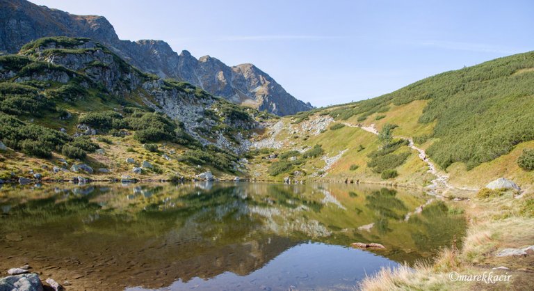
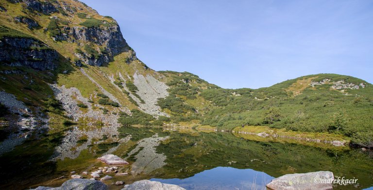
We continue along the hiking trail and gradually pass one lake after another. They are located on the so-called terraces.
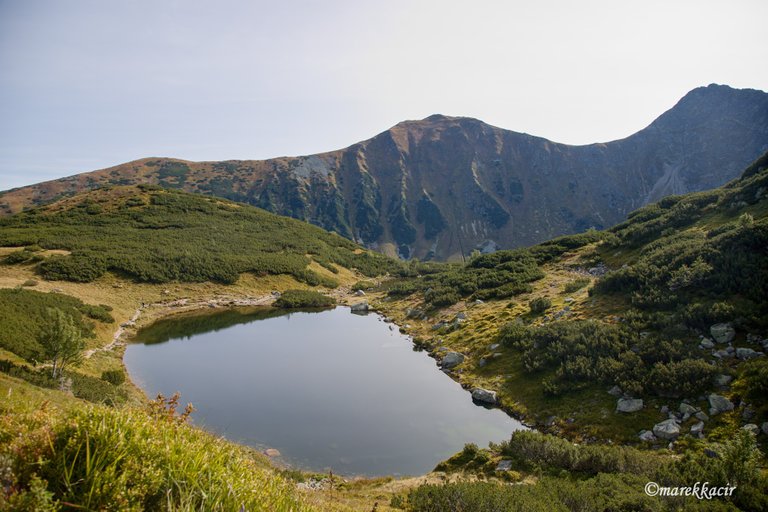
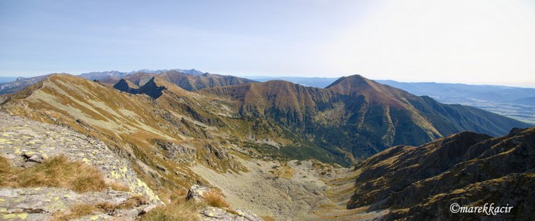
We come to the last of them, from where we have a beautiful view of the whole valley and the road that still awaits us. We have a climb of several hundred meters ahead of us, but the worst thing is that we must first descend about 200 meters to get to the tourist trail, which will continue to the top of Baníkov. That is the goal of our journey.
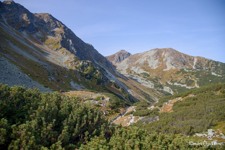
We will have a drink, take pictures of the views and continue. It's going down fast and we don't even think about it and we're at the signpost. From now on, we will only rise.
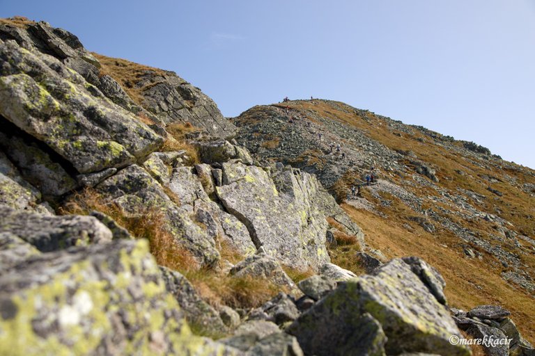
The ascent is even and all the time we see the saddle to which we are heading. We have miners on the left side, also still in sight. We take altitude meters and turn behind us. We are constantly comparing what altitude we are at with what we were at at the last ball. Finally, we are just as high, but the goal is much higher.
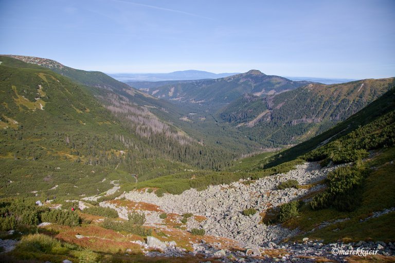
After a steep climb and a few breaks, we are finally at Baníkovské sedlo. From here we have a nice view of the valley and the path we went up.
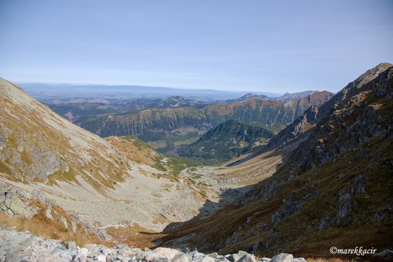
Here we refresh ourselves for the last time before the final ascent. The board states that we will be at the top in half an hour.
The board was not wrong. We walked along the ridge and in about half an hour we were there.
Several people are already resting on the hill. We join them. We have found a place to sit, we choose food from bag and we have lunch. Lunch tastes great with such beautiful mountain views.
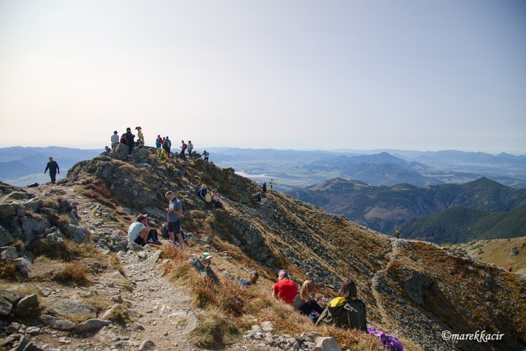
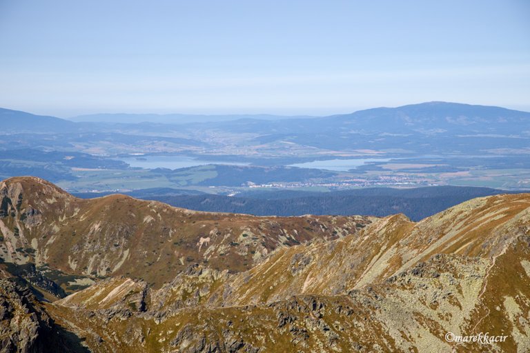
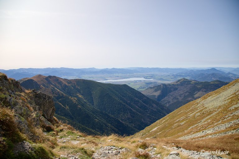
I move from one side of the top to the other to capture the views as best I can on my camera lens. From the top we can see the Western Tatras in their full beauty, Liptovská Mara, or Orava dam. We have no choice but to quietly admire this splendor.

After an hour of relaxation, we pack up and set off on the way back. We follow the same route to the crossroads we previously came from Roháčské lakes. We won't go to them this time. We go straight down to the car.
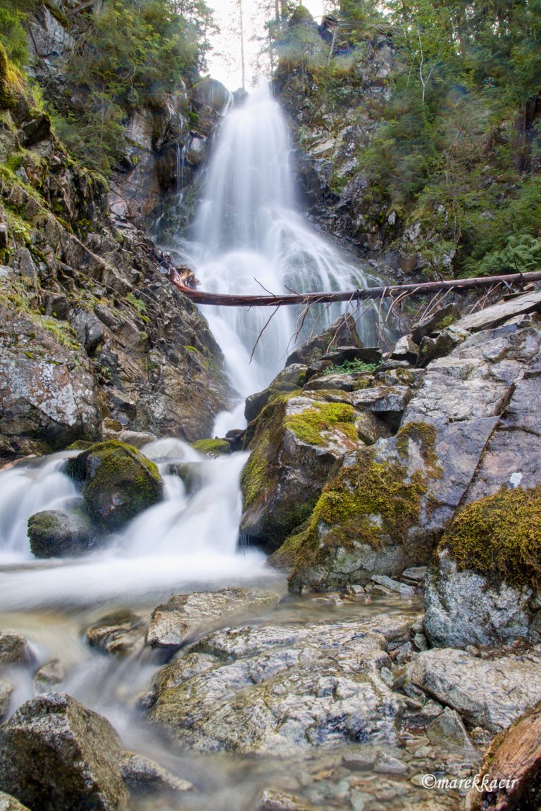
On the way we stop at one stop and that is Roháčsky waterfall. The waterfall is 23 meters high and is the largest waterfall in the Western Tatras.
It's the icing on the cake on our tourism today, which turned out great. It was an unforgettable hike full of beautiful views.
Well thank you
You can buy my work from these web sites:
http://www.shutterstock.com/g/marek+kacir?rid=4080112
https://www.dreamstime.com/Kacirmarek_portfolio_pg1#res17148223
https://cz.depositphotos.com/portfolio-12027296.html?ref=12027296
https://www.zazzle.com/store/landscapemk
Thank you 🐼
Congratulations, your post has been added to Pinmapple! 🎉🥳🍍
Did you know every user has their own profile map?
And so does every post as well!
Want to have your post on the map too?
Congratulations @photoparadise! You received the biggest smile and some love from TravelFeed! Keep up the amazing blog. 😍 Your post was also chosen as top pick of the day and is now featured on the TravelFeed.io front page.
Thanks for using TravelFeed!
@invisusmundi (TravelFeed team)
PS: You can now search for your travels on-the-go with our Android App. Download it on Google Play
Hiya, @ItchyfeetDonica here, just swinging by to let you know that this post made it into our Honorable Mentions in Daily Travel Digest #986.
Your post has been manually curated by the @pinmapple team. If you like what we're doing, please drop by to check out all the rest of today's great posts and consider supporting other authors like yourself and us so we can keep the project going!
Become part of our travel community: