"March 20th".
That's the date I look forward to every year with great anticipation. It depends on the country and region, but in the north of France, it's the date from which we really start to feel alive again:
- The nights are shorter;
- We can wear T-shirts;
- The landscapes start to turn green;
- We hear the sound of lawnmowers;
- Pollinating insects buzz in our ears;
- ...
This year, I wanted to celebrate with a longer walk than those I can usually take. I found this one on the Internet, downloaded the ".gpx" file, and imported it into my brand-new hiking app GPX Viewer Pro (7 EUR on the PlayStore).
Yes, I wanted to invest in a hiking app, and this one is really well made.
Here is the route:
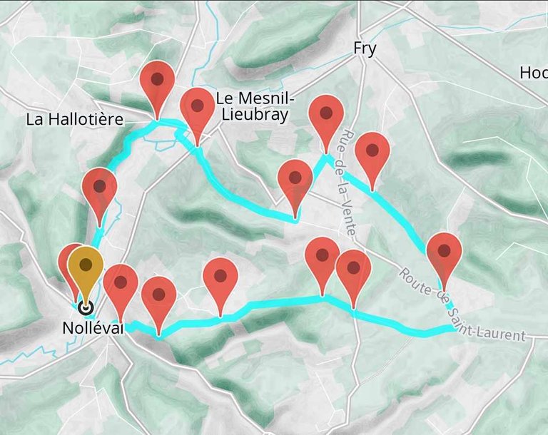
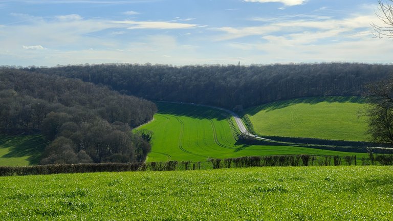
A little over 15km of walking/hiking starting from the small village of Nolléval in Normandy. As you can see on the map of the route, there's a bit of elevation. Nothing too severe, just some simple hills, but still a +250 meter elevation gain.
Once again, nothing too impressive. But it's mainly because the positive elevation was concentrated on a very short section of the walk, so it was an intense climb. The same goes for the descent.
My partner and I worked until 2 am on our freelance missions so we could take this walk the next day and not be overloaded with work after the walk. This is important for what follows.
Now, onto the hike!
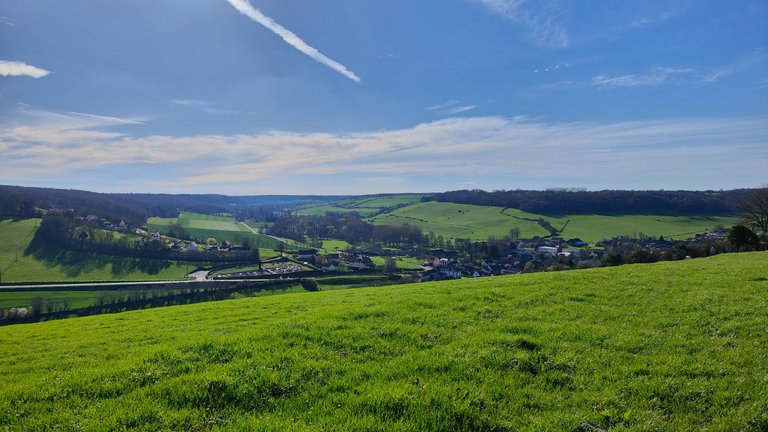
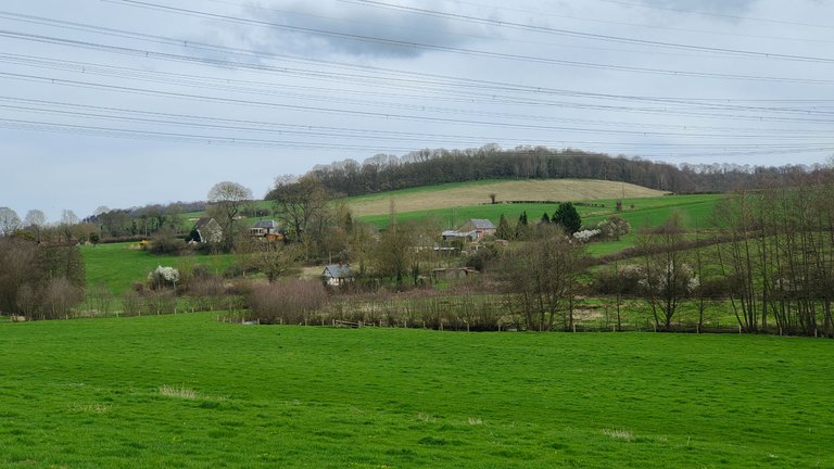
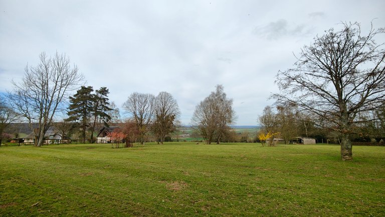
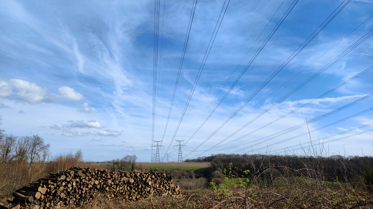
We parked the car on this small communal parking lot. In front of us was a small hill, surrounded by similar small hills. It's hard to see in the photos, but according to my hiking app, each of these hills has a summit around 200 meters high.
There was a thin layer of clouds at that time of the day (12:30 PM). But according to the weather forecast, it was going to clear up.
Even so, it was already quite warm. I even allowed myself not to take anything to cover up and just left with a T-shirt and a backpack.
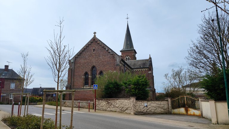
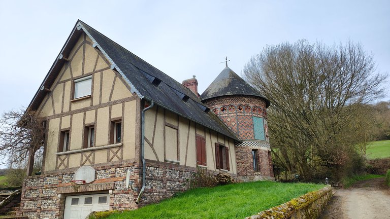
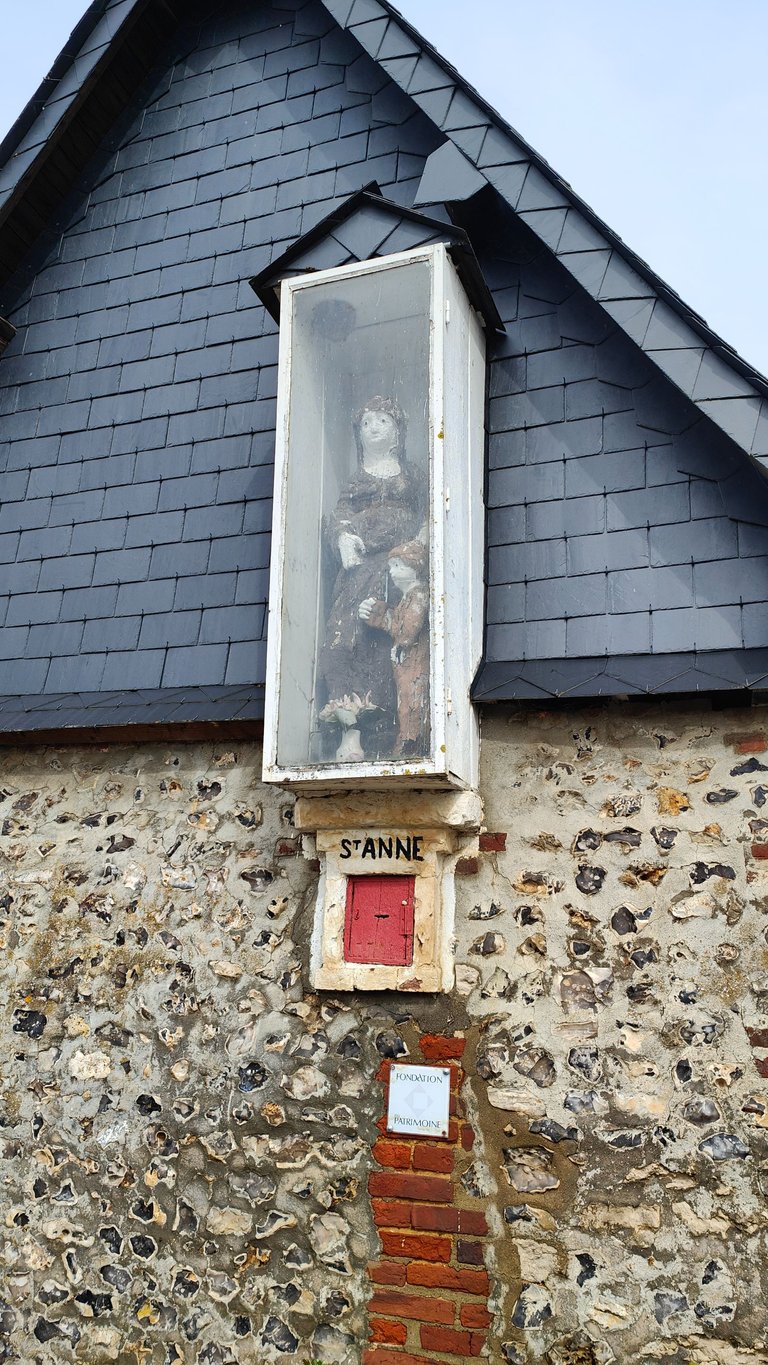
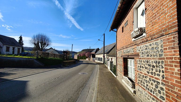
The beginning of the hike took us through Nolléval, a very small Norman agricultural village like many in Normandy.
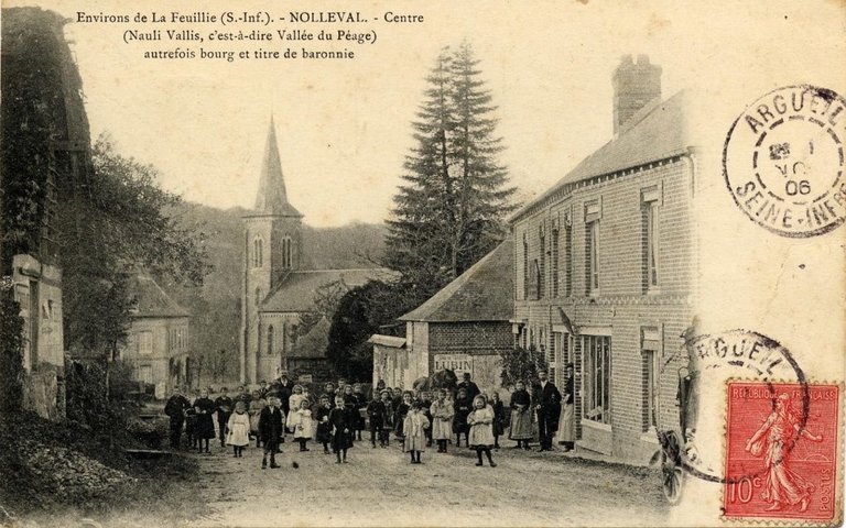
While writing these lines, I stumbled upon this photo on Wikipedia. I wish I had found it earlier to attempt replicating the shot during my visit.
Admiring the architecture, we noticed its timeless beauty, distinct from modern constructions. These buildings are not only historical relics but also homes to some, undergoing renovations to preserve their legacy.
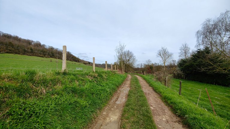
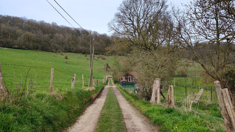
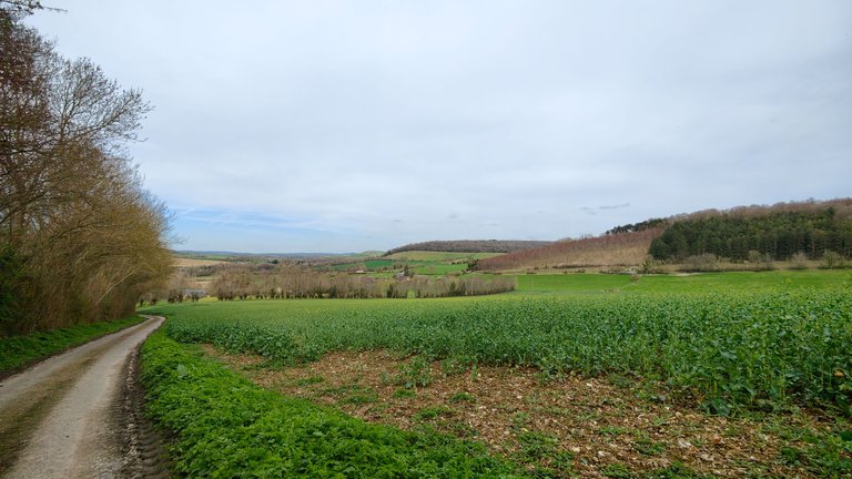
Venturing further, we followed a dirt path away from the village, immersing ourselves in the serene landscape that lay ahead.
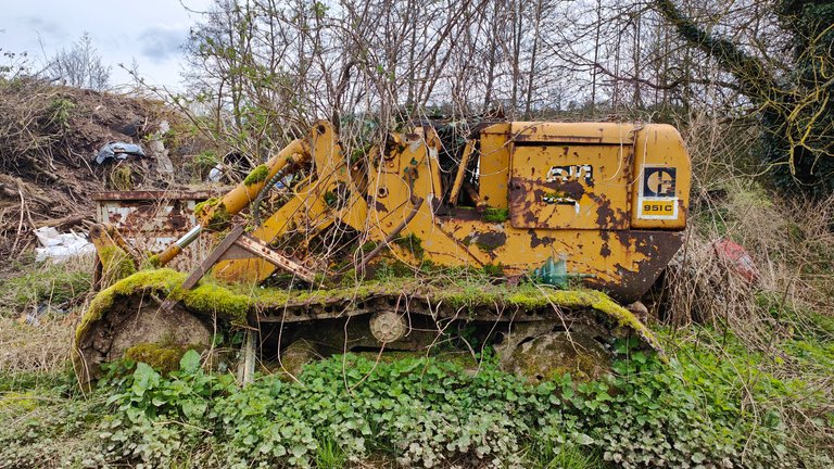
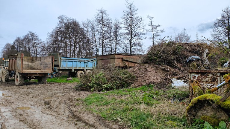
Our path led us through a farm, where many machines were left abandoned.
It's not good for the environment. However, it made for beautiful scenes to photograph.
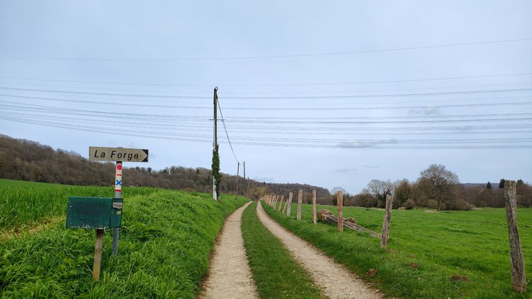
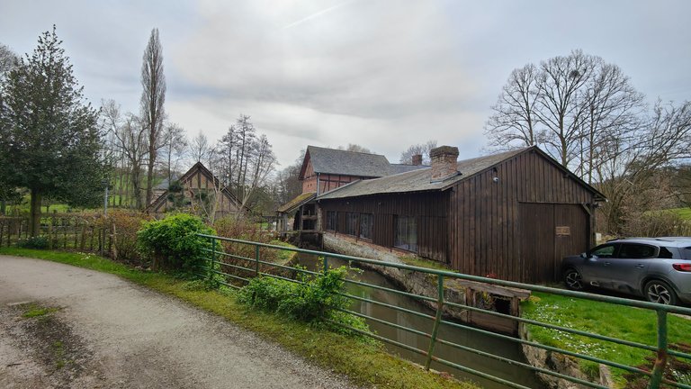
Leaving the farm, we continued on our way to "La Forge."
As you can see in the photo with the sign, beneath it, there is a red circle, below that a blue cross, and beneath that a white and red line.
The "white and red" marker indicates a GR hiking trail. There are several GRs, this one is brand new and not yet "approved." Generally, all have a length allowing for hikes of several days or weeks.
When this one is approved, it will allow for a hike of more than 190km.
I concluded that the sign indicating "La Forge" actually led us to this small house.
I didn't dare to photograph it closer because there were people inside. But the owners have recently done some renovation work, and they must have hired an architect and landscape designer because it was done with great skill, modern yet fitting seamlessly into the landscape.
In fact, the renovation perfectly complements the environment.
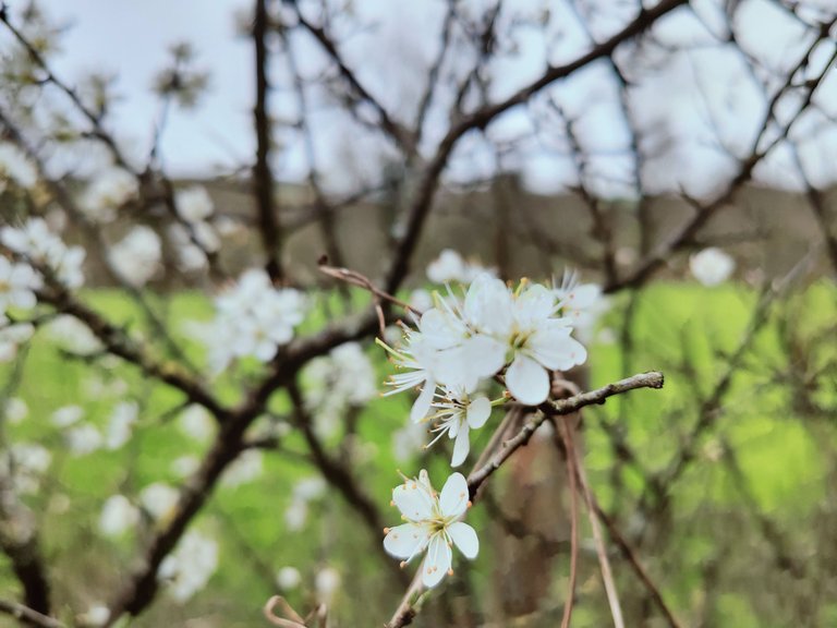
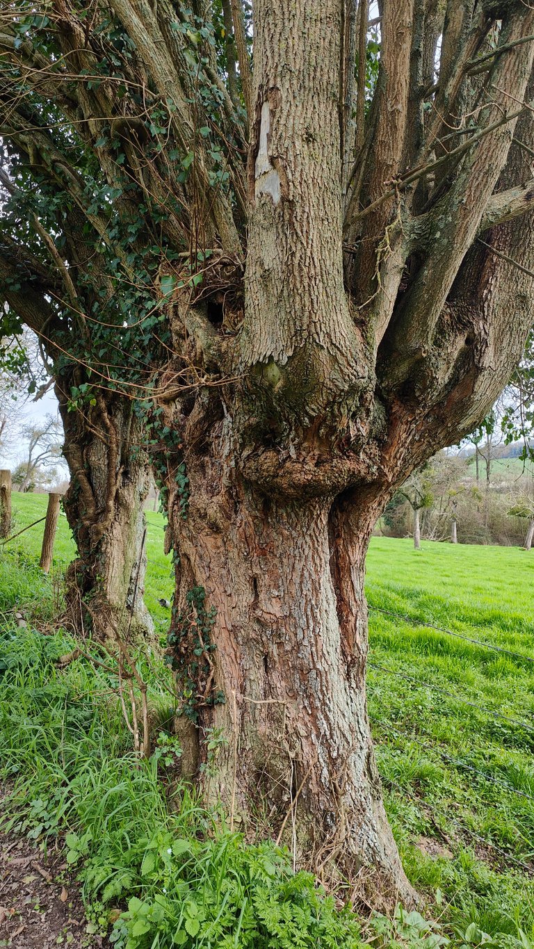
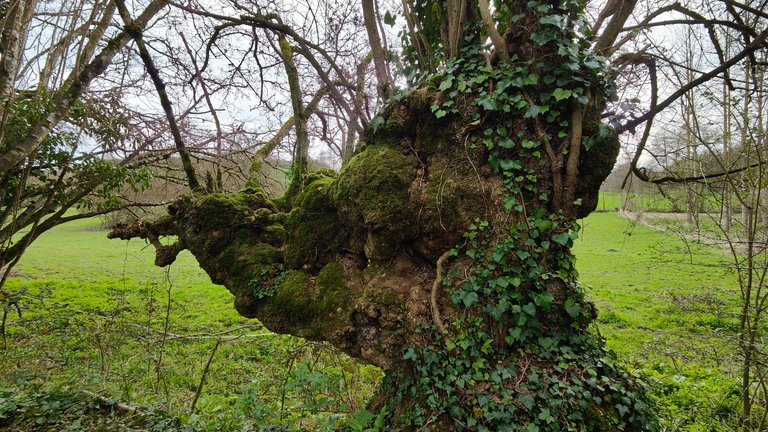
Here, an astonishing tree and the beginnings of spring's wonders.
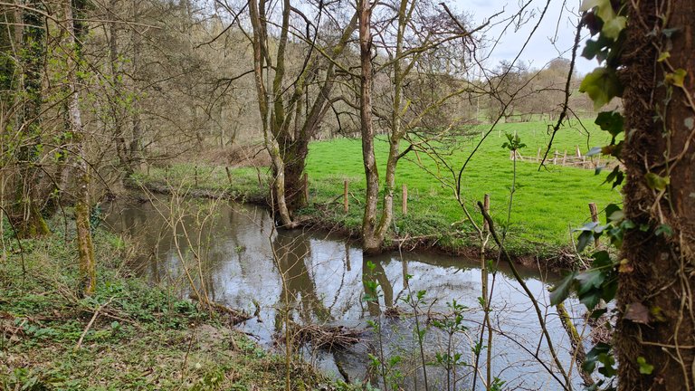
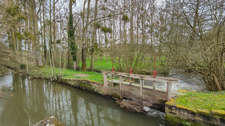
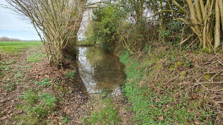
Throughout this section of the walk, we followed the Andelle, a quiet little river or stream.
There must be many trout in it. I recently learned that to fish in France, you need a fishing card, and there are specific dates for fishing, similar to hunting.
Otherwise, it's considered poaching. It's good to know to avoid ending up with a hefty fine. I don't fish, but maybe one day I will, especially on my property where I have a pond and a stream.
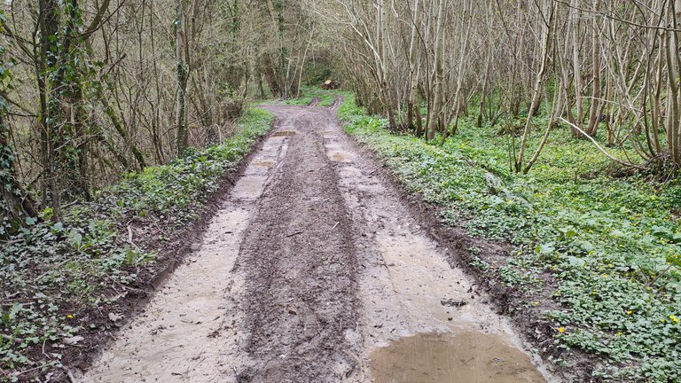
Here, there were still signs of the recent heavy rains.
And at that very moment, a 4x4 passed by and completely splashed us. No big deal, we were starting to get warm.
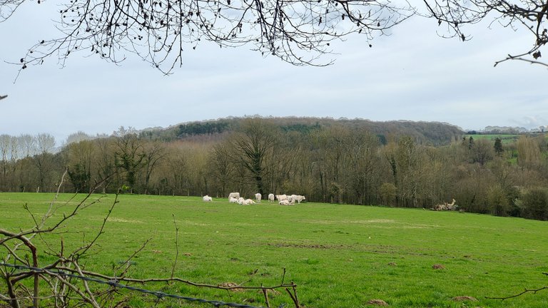
A tree that reminded me of a Curly (the snack), cows, and lovely little flowers.
Now, let's return to civilization with this art company. I don't know exactly what they do here, but the facade was labeled "Art."
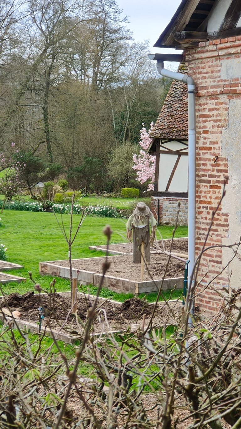
This business had several small vegetable plots. On one of them, a scarecrow. At first glance, it gave me the chills.
It's beautiful, but I don't know how you get one of these for your garden. I mean, if I wake up in the middle of the night and see this in my garden, I wouldn't be able to go back to sleep... Yes, even if I was the one who made it.
But maybe I watch too many movies and read too many books!
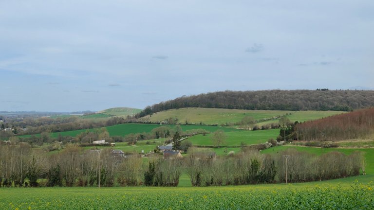
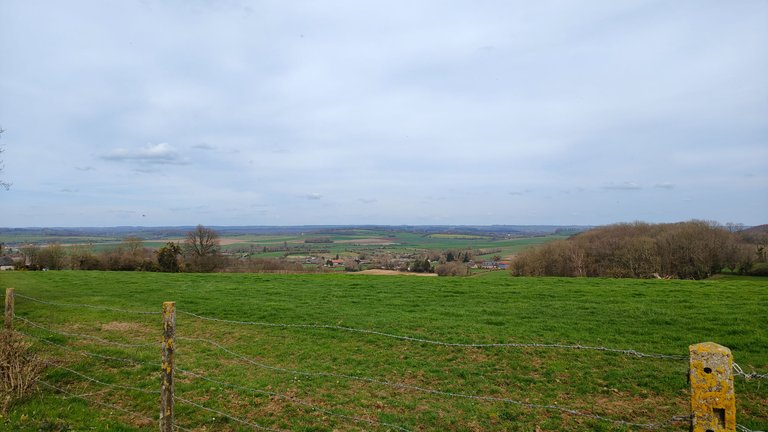
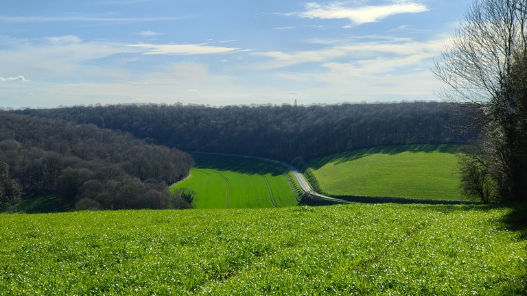
Now, we reached the section of the walk that climbed sharply and quickly (+250 meters in less than 500 meters). But it offered us some beautiful panoramas, making it well worth the effort.
It's at times like these that I wish I had a paraglider on my back to take off. I plan to try it one day, but there's no point in saying "I think I'll do it." What's necessary is to actually do it. Otherwise, we don't move forward and spend our time imagining another life instead of living our own.
The person who created this hike might have imagined we had a canoe on our backs. I don't think so. However, this place was quite curious. It was indeed the path, but completely flooded.
Yet, we were on a plateau, the highest point of the hike. Nothing could overflow here. This made me think there must be a water source underneath.
Here, we were halfway through the hike. So we had almost walked 8 km and were really starting to get hungry.
It was 12:30 PM when we parked the car. So, we could have eaten before starting to walk. But we wanted to eat in the middle of the hike. It allows for a break and divides the hike into two.
So, we started looking for a place to sit, making sure not to stray from our main path.
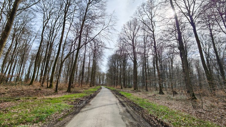
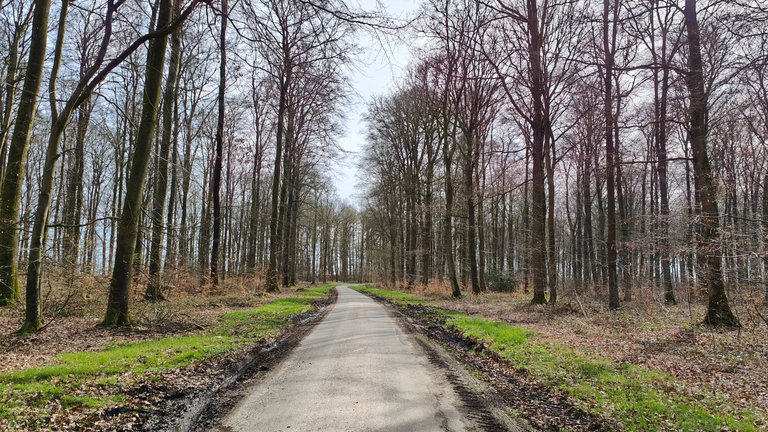
After another 30 minutes of walking, we arrived in this forest. For the record, this is the same forest from my WednesdayWalk last week.
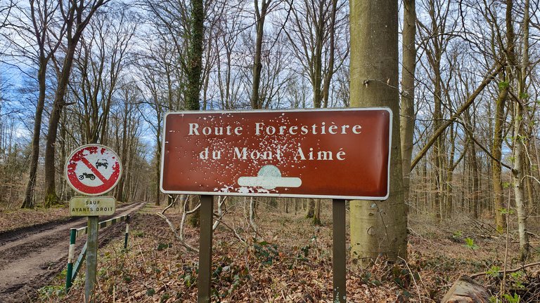
In the last photo, it seems some hunters had used this sign for target practice.
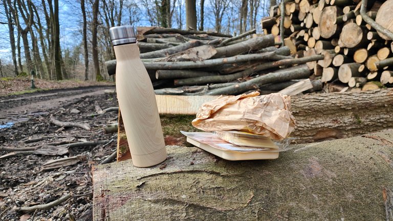
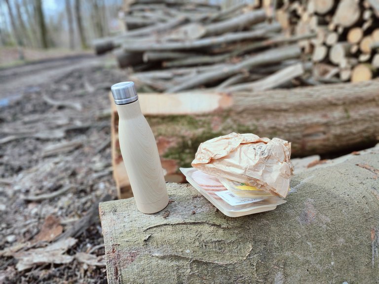
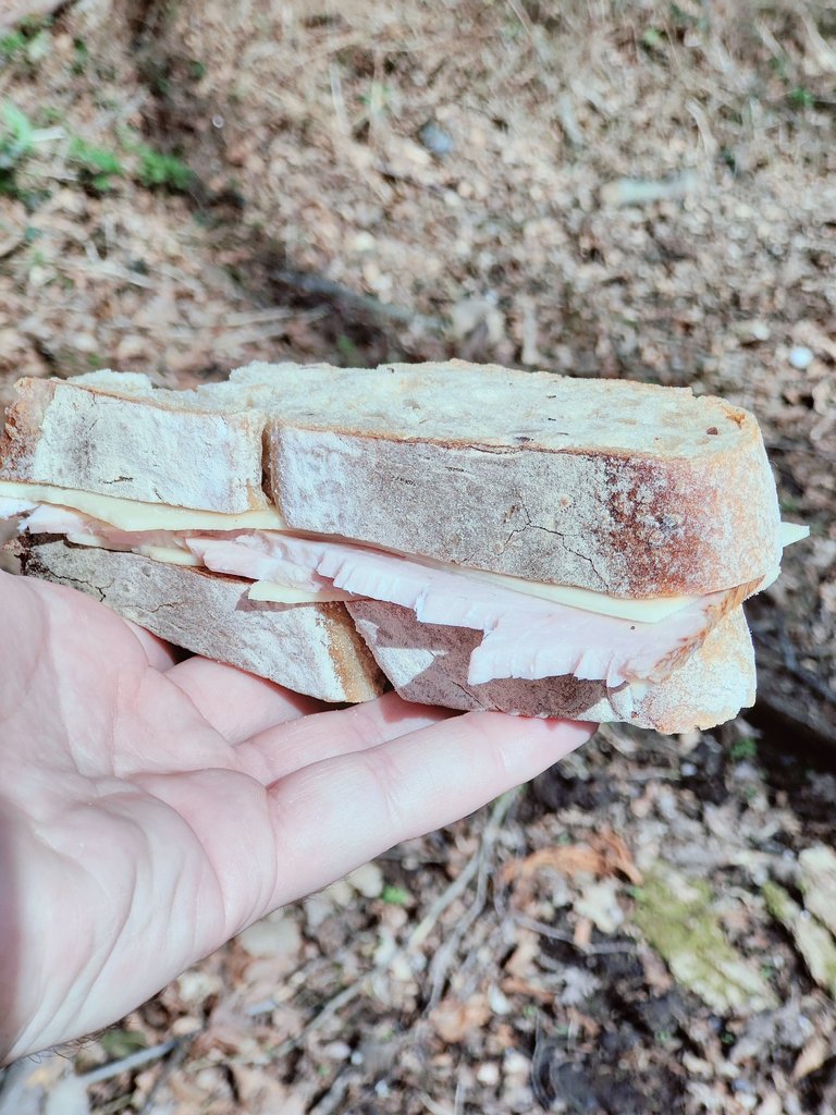
And it was here that we decided to have our meal, using a tree trunk as both seat and table.
For the sandwich, nothing too complicated:
- Homemade bread;
- A bit of industrial cheese;
- Two slices of pork (it's not from our butcher, but it's certified meat, so in theory, it aligns with our values).
After this well-deserved break, we continued on our way. Checking my hiking app, I realized we only had about 1 hour of walking left.
Actually, between deciding to find a place to eat and actually eating, we had walked a few kilometers.
This news pleased my partner, who was starting to have sore feet. Another piece of good news was that it was now very sunny.
Eventually, the path led us into a field. Zooming in on my app, we indeed were in a field, but it affirmed this was the correct way. At that moment, the hike instructions indicated (at the end of the field, turn right).
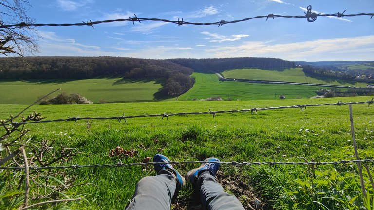
As you can see in the second photo, at the end of the field there was only a hedge. So, we went under it, being careful not to get caught on the barbed wire. This gave the nettles a chance to tickle us and leave some marks.
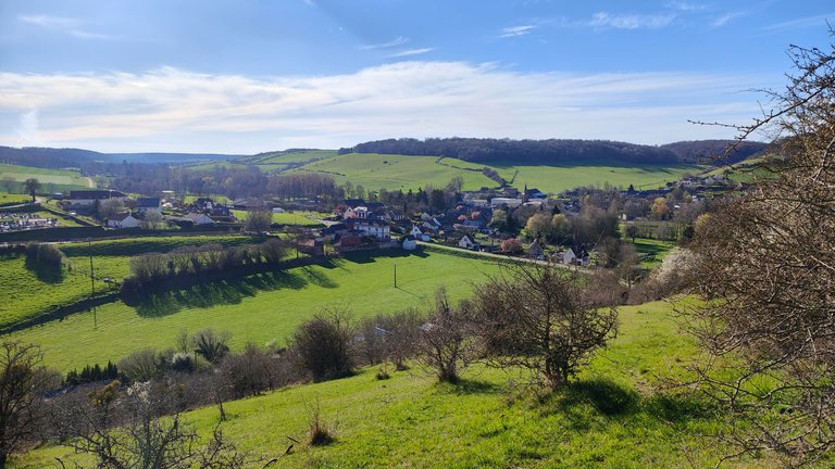
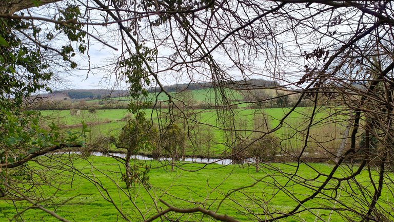
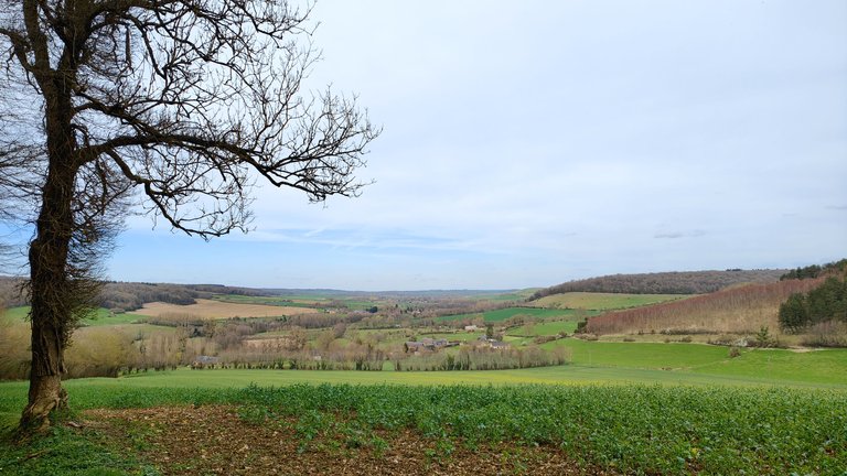
Following the invisible path provided by our app religiously, we descended the meadow for 2km, hoping not to encounter a herd of cows.
This allowed us to contemplate Nolléval from an aerial view.
Finally, we found a marked trail (the GR trail) that led us over a small barrier for walkers that cows cannot cross.
And there we were, after a little more than 4 hours of walking, back at the car, leaving behind us fond memories of this first day of spring.
As I explained at the beginning of the article, my partner and I worked until 2 AM on our freelance missions so we could enjoy this walk the next day without being overwhelmed with work afterwards.
We thought we would be exhausted after the hike, but it turned out not to be the case. On the contrary, we were even invigorated. After enjoying the sun for more than four hours, we were brimming with energy.
To be entirely honest with you, I am convinced that if we hadn't undertaken this hike, we would have ended our workday with a severe headache and in a state of advanced to very advanced irritation ^^. However, getting some fresh air, enjoying nature, and walking several kilometers truly benefited us.
Thank you very much for reading this far. I hope I succeeded in my mission to take you on a walk with me.
All photos were taken with my phone, and the English translation was done with DeepL.
"20 mars".
C'est la date que j'attends chaque année avec impatience. Ca dépend des pays et des région, mais dans le nord de la France, c'est la date à partir de laquelle on a vraiment l'impression de revivre :
- Les nuits sont moins longues ;
- On peut se mettre en t-shirt ;
- Les paysages commencent à verdir ;
- On entend le bruit des tondeuses ;
- Les insectes polinisateurs bourdonnent dans nos oreilles ;
- ...
Cette année, je voulais fêter ça avec une balade plus longue que celles que je peux faire habituellement. J'ai trouvé celle-ci sur Internet, j'ai téléchargé le fichier ".gpx" et je l'ai importé dans ma toute nouvelle application de randonnée GPX Viewer Pro (7 EUR sur le PlayStore).
Oui, j'ai voulu investir dans une application de randonnée et celle-ci est vraiment bien faite.
Voici le tracé :
Un peu plus de 15km de balade/randonnée au départ du petit village Nolléval en Normandie. Comme vous pouvez le voir sur la carte du tracé, il y a un peu de relief. Rien de bien méchant, ceux sont de simples collines, mais tout de même du +250 mètre en dénivelé.
Encore une fois, rien de bien impressionnant. Mais c'est surtout que le dénivelé positif s'est fait sur un tronçon très court de la balade donc c'était une montée intense. Idem pour la descente d'ailleurs.
Avec ma compagne, nous avons travaillé jusqu'à 2h du matin sur nos missions freelance pour pouvoir faire cette balade le lendemain et ne pas être surchargé de travail après la balade. Cela a son importance pour le suite.
Maintenant, place à la randonnée !
Nous avons posé la voiture sur ce petit parking communal. En face, une petite colline. Nous étions entouré de petites collines de ce style. C'est dur à voir sur les photos, mais d'après mon application de randonnée, chacune de ces colline à un sommet culminant à environ 200 mètres.
Il y avait un petit voile nuageux à cette heure de la journée (12h30). Mais d'après la météo, ça allait se dégageait.
Cela dit, il faisait déjà relativement bon. Je me suis même autorisé à ne pas prendre de quoi me couvrir et à partir uniquement avec un tshirt et un sac à dos.
Le début de la randonnée nous faisait passer par Nolléval. Un tout petit village agricole Normand comme il y en a beaucoup en Normandie.
En rédigeant ces lignes, je suis tombé sur cette photo sur Wikipedia. Dommage que je ne l'ai pas découverte plus tôt, j'aurais pu essayer de prendre la même.
C'est quelque chose que je vais me noter dans un coin de ma tête pour les prochaines balades.
Regardez comme cette architecture est magnifique. On ne construis plus du tout de la même manière aujourd'hui. Il reste que des vestiges.
Ici, ceux sont des personnes qui y habitent. Ils sont en train de faire des rénovations. En tout cas, c'est ce qu'on a pu en conclure en regardant le reste de la maison.
Tout doucement, nous avons quitté le village en empruntant un chemin de terre.
Notre chemin nous a fait traverser une exploitation agricole. Beaucoup de machines sont laissées à l'abandon ici.
Ce n'est pas une bonne chose pour l'environnement. En revanche, ça faisait de belle scènes à photographier.
En sortant de l'exploitation agricole, nous avons continué notre chemin. Un chemin nous emmenant à "La Forge".
Comme vous pouvez le voir sur la photo sur laquelle il y a le panneau, sous ce dernier, il y a un rond rouge, en dessous une croix bleue et en dessous un trait blanc et rouge.
La balise "blanc et rouge" indique une randonnée GR. Il y a plusieurs GR, celui-ci est tout nouveau et n'est pas encore "homologué". En général, tous on une longueur permettant d'effectuer des randonnées de plusieurs jours ou semaines.
Quand celui-ci sera homologué, il permettra d'effectuer une randonnée de plus de 190km.
J'ai conclu que le panneau qui indiquait "La Forge", nous emmenait en fait à cette petite maison.
Je n'ai pas osé la photographier de plus près car il y avait des gens à l'intérieur. Mais les propriétaires ont récemment fait quelques travaux de rénovations et ils ont dû faire appel à un architecte et paysagiste parce que ça a vraiment été fait dans les règles de l'art et c'est à la fois moderne sans pour autant casser le paysage.
En fait, la rénovation s'accorde parfaitement avec l'environnement.
Ici, un arbre étonnant et le printemps qui commence à faire quelques merveilles.
Sur tout ce tronçon de la balade, nous avons longé l'Andelle. Une petite rivière, ou plutôt, un petit ruisseau très calme.
Il y a sûrement beaucoup de truites là-dedans. D'ailleurs, j'ai récemment appris que pour pêcher en France, il faut avoir une carte de pêche et qu'il y a des dates pour pêcher. Comme pour la chasse en fait.
Sinon, c'est considéré comme du braconnage. C'est bon à savoir pour éviter de finir avec une grosse amende. Je ne pêche pas, mais peut-être qu'un jour oui. Surtout sur mon terrain où j'ai un étang et un ruisseau.
Ici, il y avait encore des traces des dernières grosses pluies.
Et d'ailleurs, pile à ce moment là, un 4x4 est passé et nous a complètement éclaboussé. Pas grave, on commençait à avoir chaud.
Un arbre qui m'a fait penser à un Curly (le biscuit apéro), des vaches et de jolies petites fleurs.
Maintenant, revenons un peu à la civilisation avec cette entreprise d'art. Je en sais pas exactement ce qu'ils font ici, mais sur la devanture, il y avait écrit "Art".
Cette entreprise avait plusieurs petits carrés potager. Sur l'un d'entre eux, un épouvantail. Au premier coup d'œil, il m'a fait froid dans le dos.
C'est beau, mais je ne sais pas comment on fait pour avoir ça dans son jardin. Ce que je veux dire, c'est que si je me lève en pleine nuit et que je vois ça dans mon jardin, je ne pourrais plus me rendormir... Oui, même si c'est moi qui l'aurait fabriqué.
Mais peut-être que je regarde trop de films et que je lis trop de livres !
Nous voici maintenant le tronçon de la balade qui montait fort et vite (+250 mètres en moins de 500 mètres). Mais il nous a offert quelques beaux panoramas. Donc ça valait largement le coup.
C'est dans ces moments là que j'aimerais avoir un parapente dans le dos et m'envoler. Je pense essayer un jour, mais ça ne sert à rien de dire "je pense le faire". Ce qu'il faut, c'est le faire. Sinon, on n'avance pas et on passe notre temps à imaginer une autre vie au lieu de vivre la nôtre.
Le mec qui a créé cette randonnée s'imaginait peut-être qu'on avait un canoë sur notre dos. Je ne pense pas. Par contre, cet endroit était assez curieux. C'était bien le chemin, mais complètement inondé.
Pourtant, nous étions sur un plateau donc au point le plus haut de la balade. Rien ne peut se déverser ici. Ce qui m'a fait penser qu'il y a sûrement une source d'eau en dessous.
Ici, nous en étions à la moitié dans la randonnée. Donc nous venions de faire presque 8 km de marche et on commençait vraiment à avoir faim.
Il était 12h30 quand nous avons garé la voiture. Donc on aurait pu manger avant de commencer à marcher. Mais on voulait manger au milieu de la randonnée. Ca permet de faire une pause et de séparer la randonnée en deux.
Donc nous avons commencé à chercher un endroit où se mettre. Tout en veillant à ne pas nous éloigner de notre chemin principal.
Au bout de 30 minutes de marche supplémentaire, nous sommes arrivés dans cette forêt. Pour l'anecdote, c'est la même forêt que celle de mon WednesdayWalk de la semaine dernière.
Sur la dernière photo, on dirait que quelques chasseurs se sont entraînés sur ce panneau.
Et c'est finalement ici que nous avons décidé de manger. En nous servant d'un tronc d'arbre comme siège et table.
Pour le sandwich, rien de bien compliqué :
- Du pain fait maison ;
- Un peu de fromage industriel ;
- Deux tranches de porc (ce n'est pas de la viande de notre boucher, mais c'est une viande labelisée donc en théorie en accord avec nos valeurs).
Après cette pose bien méritée, nous avons continué notre chemin. En jetant un coup d'œil sur mon application de randonnée, je me suis rendu compte qu'il nous restait seulement 1h de marche.
En fait, entre le moment où on s'est dit qu'on allait se chercher un endroit où se poser pour manger et le moment où on a mangé, nous avons marché quelques kilomètres.
Cette nouvelle a ravie ma compagne qui commençait a avoir mal aux pieds. Autre bonne nouvelle, il faisait à présent très beau.
Au bout d'un moment, le chemin nous a laissé dans un champs. En zoomant sur mon application, effectivement nous étions dans un champs mais il disait que c'était bien là. D'ailleurs, à ce moment là, la randonnée indiquait (au fond du champs, tourner à droite).
Comme vous pouvez le voir sur la deuxième photo, au fond du champs il n'y avait qu'une haie. Nous sommes donc passé en dessous en faisant attention de ne pas nous accrocher avec les barbelés. L'occasion pour les orties de nous chatouiller et de nous laisser quelques boutons.
En suivant religieusement la chemin invisible que donnait notre application, nous avons descendu la prairie sur 2km en espérant ne pas tomber sur un troupeau de vaches.
Cela nous a permis de contempler Nolléval avec une vue aérienne.
Et finalement, nous avons retrouvé un chemin balisé (celui du GR) qui nous a fait passer au dessus d'une petite barrière pour les marcheurs que les vaches ne peuvent pas passer.
Et nous voilà après un peu plus de 4h de marche, de retour à la voiture. Laissant derrière nous, de bons souvenirs de cette première journée printanière.
Comme je l'expliquais en début d'article, ma compagne et moi avons travaillé jusqu'à 2 heures du matin sur nos missions en freelance, afin de pouvoir profiter de cette balade le lendemain sans être submergés de travail par la suite.
Nous pensions que nous serions épuisés après la randonnée, mais il s'est avéré que ce n'était pas le cas. Au contraire, nous étions même revigorés. Après avoir profité du soleil pendant plus de quatre heures, nous étions débordants d'énergie.
Pour être tout à fait honnête avec vous, je suis convaincu que si nous n'avions pas entrepris cette randonnée, nous aurions terminé notre journée de travail avec un sévère mal de tête et dans un état d'irritation avancé à très avancé ^^. Cependant, le fait de prendre l'air, de profiter de la nature et de marcher plusieurs kilomètres nous a véritablement été bénéfique.
Merci beaucoup de m'avoir lu jusque ici. J'espère avoir réussi ma mission de vous emmener en balade avec moi.
Toutes les photos sont prises avec mon téléphone et la traduction anglaise est faite avec DeepL.
It truly is a magical time of year. I love the bumble bees so much.. we don't have them on mainland Australia.
Hi Gabriel! I am crossing your region next Monday with the van. Would be good to do a HIVE vanlife walk...or some beer tasting :)
Hey! I'm not in Normandy anymore since yesterday, I've been there for the last 7 days because I had business appointments in Normandy and a lot of freelance work so I stopped by my parents' house to enjoy some peace and quiet.
But I left again yesterday. Where exactly are you going? What's your route?
If not next week, I'm sure our paths will cross one day, I'm not worried about that. I always meet people in the most unlikely places!
I driving to Spain from The Netherlands. Route is not planned exactly...like always :) Check your DM
That's a nice place for a walk, quiet and lesser crowd, truly peaceful.
Yes, I only came across one person walking his dogs along the 15km-plus hike. So to be peaceful, it was peaceful!! ^^
!PGM
Your post has been manually reviewed for curation.
Principality of Bastion's Tavern - Our Leit Motiv? Let's Grow Together.
Discord | ECU | Site | Twitch | Donations | Paypal via Streamlabs
One click delegations: 500 HP | 1500 HP | 5000 HP |25000 HP | 100000 HP
Or delegate the amount you decide to @hive-143869, using peakd's wallet, for example.
BUY AND STAKE THE PGM TO SEND A LOT OF TOKENS!
The tokens that the command sends are: 0.1 PGM-0.1 LVL-0.1 THGAMING-0.05 DEC-15 SBT-1 STARBITS-[0.00000001 BTC (SWAP.BTC) only if you have 2500 PGM in stake or more ]
5000 PGM IN STAKE = 2x rewards!
Discord
Support the curation account @ pgm-curator with a delegation 10 HP - 50 HP - 100 HP - 500 HP - 1000 HP
Get potential votes from @ pgm-curator by paying in PGM, here is a guide
I'm a bot, if you want a hand ask @ zottone444