I love visiting the seashore, even when it's just miles and miles of mud.
Although probably the least popular and coast-like of the 3 coasts (Korea is a peninsula), the west coast is the best coast of Korea in my opinion.
The West Coast of Korea
Korea's west coast is on the east-side of the Yellow Sea, roughly 400-500km from the Shandong peninsula of China.
The west-sea is very shallow compared to the other seas. It also has a lot of islands and inlets (similar to the south sea). However, it is most famous for it's tidal flats and mud which is unique among Korea's coasts.
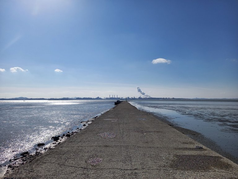
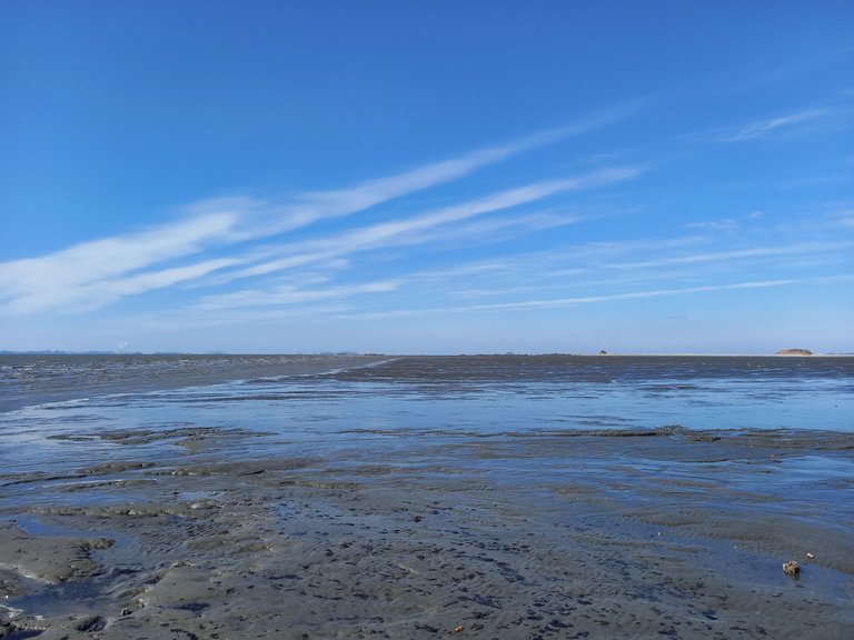
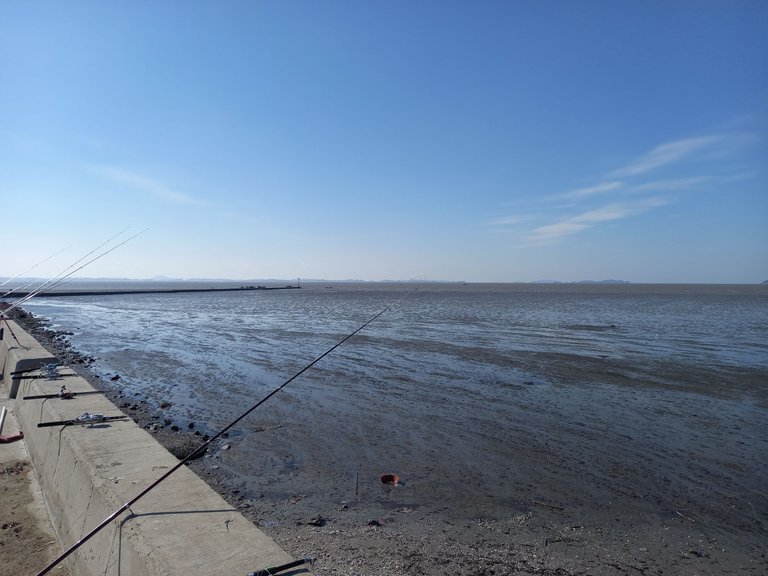
Here I can take a long walk on a long pier. From the natural shoreline where I parked it's about 1km to the end of this causeway. However, during high tide, this is underwater. This part of Korea has very high tides, often exceeding 9m or 30feet, especially in the spring.
Heavy Industry
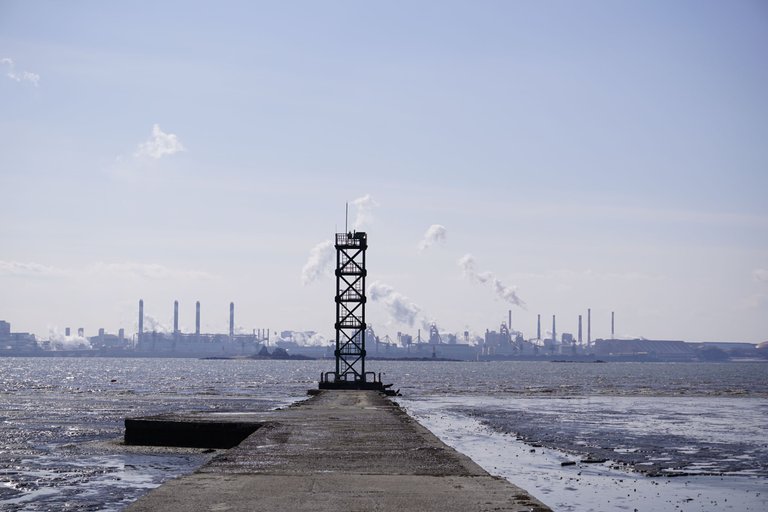
As I get a little closer, you can see that there is actually a 5 story tower at the end of the pier and a wide sea channel. Don't be fooled by the zoom, this channel is about 5km across here (4 at the tower). I told you it was a long pier.
In case you are wondering, you are staring at Hyundai's Dangjin Integrated Steelworks, a "Mecca of Cutting-Edge & Eco-Friendly Facilities". Nothing says environmentally friendly like a forest of smokestacks generating the heat and electricity needed to produce 12 million tons of steel per year.
Looking the other direction we get a much more serene view. You are looking at the once quaint fishing village of Mae Hyang Ri. To the Left is the Hwaseong Sea Dyke (more on this later). And to the right is the Kia Motors Hwaseong Plant.
You can't really see the car plant or get any idea of its scale from this photo, but according to some websites it's the 4th largest in the world (2nd biggest in Korea) and according to Wikipedia
the plant covers 3,199,636 square metres (34,440,600 sq ft) of land and manufactures the Kia Optima/K5, Kia Cadenza/K7, Kia Forte/Cerato, Kia Sorento, and Kia Mohave/Borrego
Looking left off the pier (southeast) towards the shore, we can see Pyeongtaek in the distance. Pyeongtaek is another industrial city in Korea famous for having the largest US military base outside of the US, among other things.
In the center is the KOGAS LNG terminal, and you can kind of make out the large refinery behind it. There are a few medium-sized ports and navy bases in there too (not pictured for obvious reasons). To the right, you can make out the Seohan Bridge which is a 5km expressway bridge across the inlet, popular for its rest stop on an island.
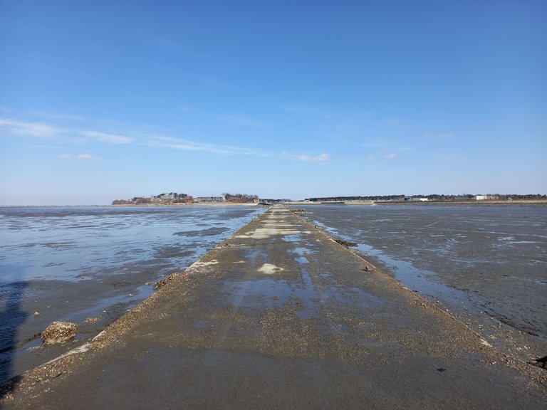
My favourite part of the photo is the left side. What you are seeing is where the tide meets the tidal flat. To the left is the shore where I parked my car. It's easy to get disorientated here.
Tidal Flats
I'm sick of industry (choking pollution at the best of times). Although it has a cyberpunk or steampunk feeling to it, industrial Disneyland is not for me. I much prefer nature.
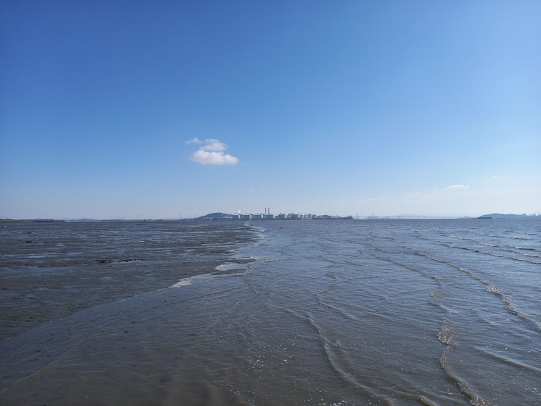
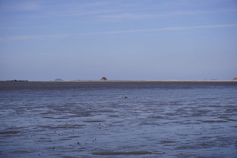
Here we are looking northwest, out to sea, although, most of it seems like quiet shoreline and small islands, again you are being fooled by the scale. Some of those islands, especially towards the left are like 30km ~50km away.
There is also a lot of heavy industry in that direction too, including the largest airport in the country and the third-largest coal plant, producing a humble 5000MW of power. FYI, the 2nd largest coal plant is just beside the steel mill I mentioned earlier and the largest is about 30km south. There is a lot of heavy industry in Korea and nature is in between it.
Uncommon and Rare Sea Birds
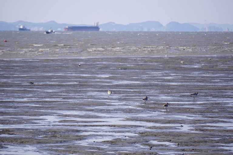
I come to the tidal flats mostly to look for birds. When I'm lucky, I can spot endangered and less common ones. Here are a few Far Eastern Curlews. They aren't common, although, they are easy to find here, especially if you come at the right time. Apparently, they breed in Mongolia, Siberia and the Far-east of Russia and winter in South East Asia and even Australia.
However, given this was early February (ie. the middle of winter), it's obvious a lot of the curlews can't be bothered to go that far south. Besides, there are a lot of yummy snacks in the mud that are easy to dig up when you have a long curved beak. I don't blame them for hanging out in Korea, our winters are generally mild and the mud-flats are vast.
Here you can actually see the Hwaseong Dyke and Tidal flat. This is one of the famous seabird watching places in Korea and if you are extremely lucky or very determined, you may also spot a Black Faced Spoon Bill or a Spoon-billed sandpiper.
Usually, I don't bother looking for very-rare birds because if they are around, there will be dozens of people with very-expensive cameras. If I don't see professional birdwatchers, I don't pay too much attention. Also, I'm not the best at identifying birds, so unless it's also unique, I wouldn't know a rare gull from a common seagull.
Bomb Range
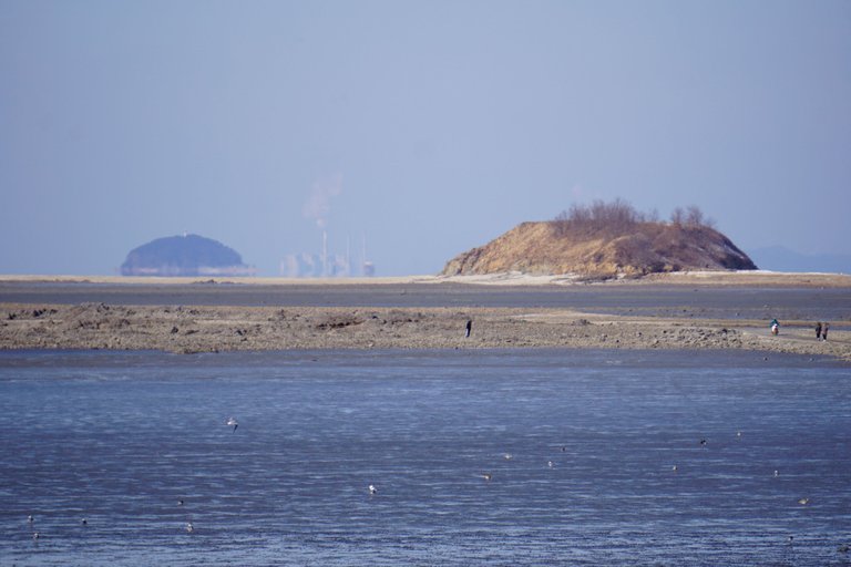
Here we can see Ryongdo Island. Before the Hwaseong Dyke and the Kia Plant were built starting in the 1990s, this area was very isolated. It was the perfect spot for a bomb range. In fact, the US military used this place as a bomb range from the mid 1950s until the early 2000s. You can read the fascinating story of the Koon-ni Bomb range,here.
TL:DR:
Enviornmental issues initially led the ROK to be reticient to accept the area without cleanup, but in July 2006 the ROK agreed to accept the facility without any conditions.
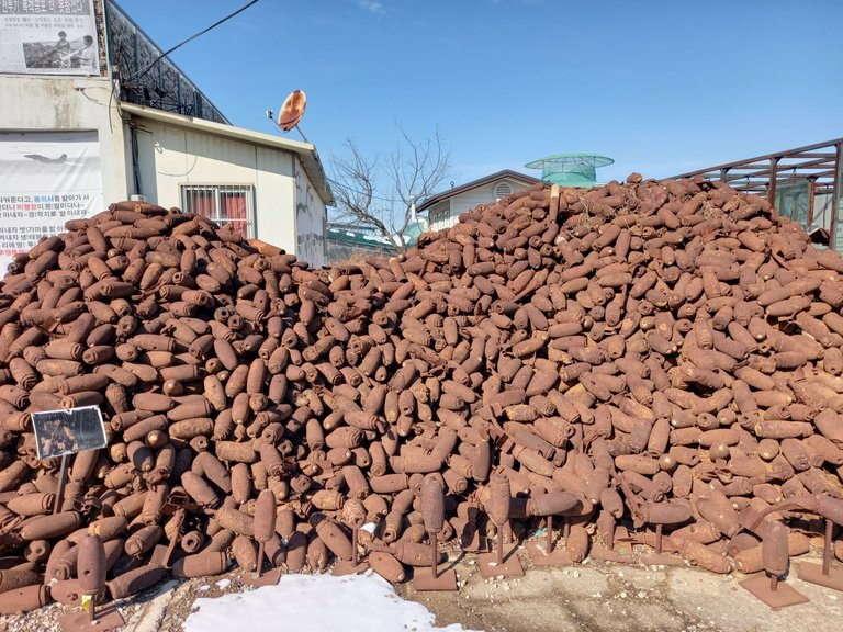
Usually, when you are driving along the road and you see a large pile of what looks like rusty bombs, you take interest. Welcome to the Maehyangri Peace Village. Nothing says peaceful like a mountain of decaying ordnance.
Personally, I think after using the area as a bomb range for 50 years, the least the US army could do would be to clean up. Actually, until the mid-1980s, Korea was poor and scrap metal was valuable, so I can imagine there were unauthorized people picking it up and recycling it (ie. cleaning up). They probably weren't supposed to be there because it is dangerous, to say the least. But what are you gonna do chase scavengers off the mudflats? If a bombing range won't deter people, I'm not sure what will.
In any case, someone cleaned up a lot of the smaller shells and mortars. I'm guessing these weren't dropped from planes, but what do I know? It's likely they were buried under the mud or picked up by workers because scavengers didn't get them.
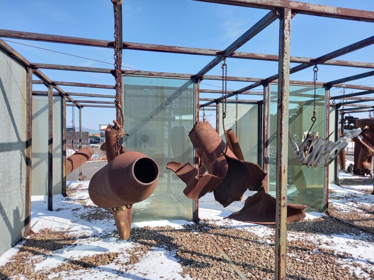
The actual museum was closed, but the outdoor exhibition area was open. It's kind of grim seeing rusty twisted bombs hanging from meat hooks. I'm not sure what kind of look they were going for, but this place is definitely worth a revisit. Maybe I'll bring my son, the rusty bomb museum, I mean peace village, is fun for the whole family.
No kidding a lot of the sea birds are rare between heavy industry, intense land reclamation and bombing shit, I know I wouldn't want to hang around if I was a bird.
Hwaesong Dyke
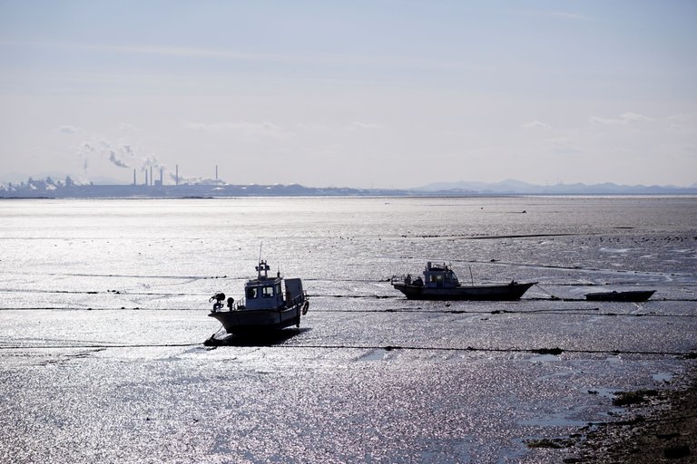
Technically MaeHyangRi is a fishing village and a small port. And being a port there are fishing boats. Right now it's low tide, so the boats are just sitting in the mud. They are specially designed to sit in the mud. Eventually, the tide will come up and they will go out and fish.
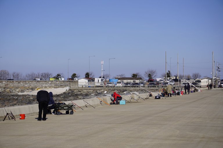
There are also hobbyists fishing too. They are also waiting for the tide to come in because there is no water below them. During low tide, if you don't want to dig in the mud for slimy, yet satisfying, snacks, you wait.
This is a pier and port in the middle of Hwaseong Dyke. It's called MiHyangri 2 port. If you are wondering, Port 1 is where I parked my car at the shore where that long pier starts. It's more of a village because it's not built in the middle of a 10 km seawall that didn't exist 30 years ago.
Here you can see what they are doing. As I said, there is no water and if you want to fish, water increases your chances of catching fish. Don't worry, the tide is now coming in. Although they are earlier, they just want a good spot.
Even though I called this a small pier, it's still about 700m to that lighthouse at the end and we are about 3km from the natural shoreline here. But at high tide, the fish will follow all the nutrients right to the walls of the sea dyke.
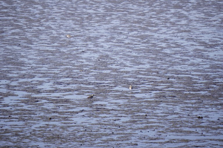
Here are some more Curlews. They prefer low tide because it's when they can eat. I'm not sure why they hang around in this particular area. I don't really see them even 20km to the north on the other side of the dyke in Gungpyeong Hang, Jebudo, or Daemado very often. To me, it all looks similar, miles and miles of mud.
Speaking of the Hwaseong Dyke, here is finally a clear view of the northern half of it. It's about 7km to Gungpyeong Hang Port which is the northern end of Hwaseong Lake. In case you are confused. Hwaseong Lake is the lake on the other side of the dyke. It used to be a channel.
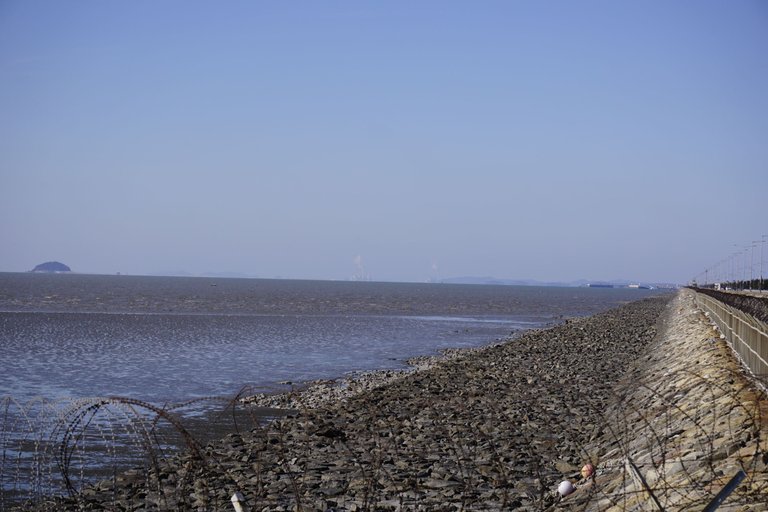
I'm not sure what the razor wire is here for. Hard to see what they are protecting since there is no razor wire like 10m from here. Technically there is a gate, but it's never closed and there is nothing to steal. Who knows? Korea is well-prepared for defending against an invasion and we are only like 80km from North Korea here. In any case, Korea loves its razorwire. There is a church next to my apartment surrounded by it.
Looking inside, we see a road that is closed. This is where I look my cover photo for my previous blog that I edited to look like the Ukraine Flag. Although I was looking North/left in that photo.
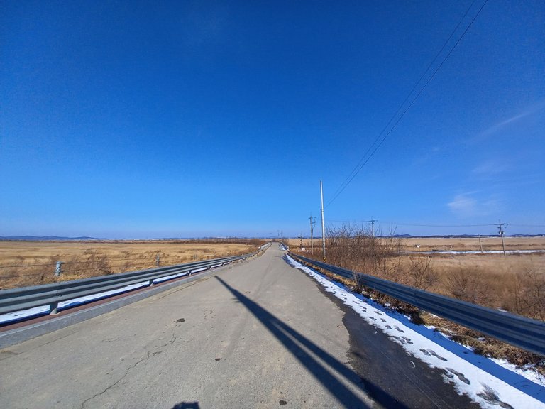
I like the landscape here, too. Nice and flat. It looks like the prairies. However, this is reclaimed sea. On the right it is farmland and on the left is natural grasslands and then a coastal artificial lake or a coastal lagoon (I don't know the difference). Some seabirds prefer living in grasslands instead of rocky seashores when the tide is high and they can't dig in the mud.
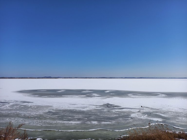
We finish off with a view of the lake. I think I mentioned it was winter in this photo. Since there is ice and Korea is not cold enough for sea ice, this lake is obviously freshwater now, even though it used to be part of the sea.
This view is actually from the other side near Gyungpyeong Hang in the North. So the dyke is to the right and that natural shoreline across (not counting the grass and farms which you can barely see) is about 5km away on the left and 10km away on the right. If you ever wondered how to make a lake, build a sea dyke where a few streams make a channel to the sea and wait 30 years.
I hope you enjoyed Mi Hyangri and the Hwaseong Dyke.
Hiya, @LivingUKTaiwan here, just swinging by to let you know that this post made it into our Top 3 in Daily Travel Digest #1491.
Your post has been manually curated by the @pinmapple team. If you like what we're doing, please drop by to check out all the rest of today's great posts and consider supporting other authors like yourself and us so we can keep the project going!
Become part of our travel community:
The rewards earned on this comment will go directly to the person sharing the post on Twitter as long as they are registered with @poshtoken. Sign up at https://hiveposh.com.
Congratulations, your post has been added to Pinmapple! 🎉🥳🍍
Did you know you have your own profile map?
And every post has their own map too!
Want to have your post on the map too?