In the province of British Columbia on the far side of Vancouver is where you can discover Kootenay National Park. When entering the park from the Radium side, the first thing you notice is the Sinclair Canyon. Just before you drive through the rocks there is parking on the side of the road and the start of the Juniper Trailhead.
We descend down into the valley, BC is far more lush than the Albertan side of the Canadian Rockies. On this side we are in the Columbia River Valley, near the headwaters. The tourist destination of Invermere is close to the town of Radium.
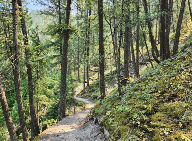
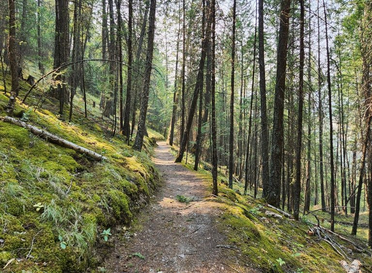
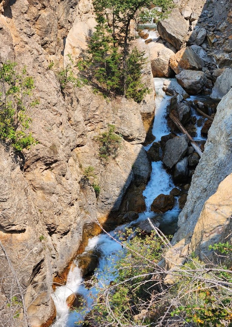
A small stream flows down the mountain through the Sinclair Canyon which is just noticeable beyond the dense forest. The park is left to nature and trees grow in all sorts of places one would not expect.
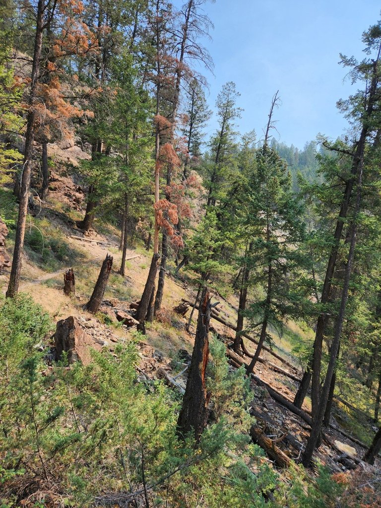
Fires are common in Western North America. The cycle is all part of nature. We are a couple thousand kilometers North of where the Southern California were this year but it's the same situation, every once and a while a fire rages through and there is little that can be done. The forest recovers and nature carries on.
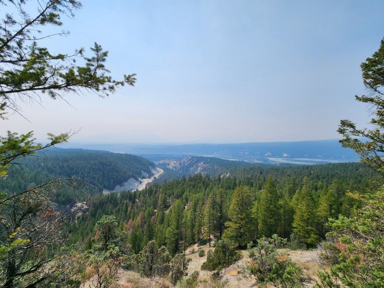
The haze in the sky is from a fire somewhere else in the province of BC. During the Summer fires are a common occurrence. During the winter, Panorama Ski hill is barely noticeable in the background across the Columbia River Valley.
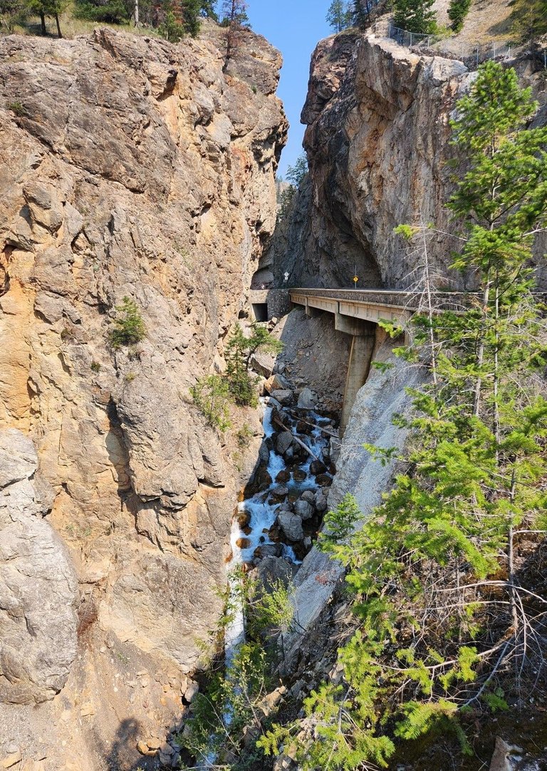
The trail takes us along a ledge above the Sinclair Canyon. We get to see incredible views to the West away from the Rocky Mountains and towards the Purcells, a sub mountain range separated from the Rockies by the Columbian River.
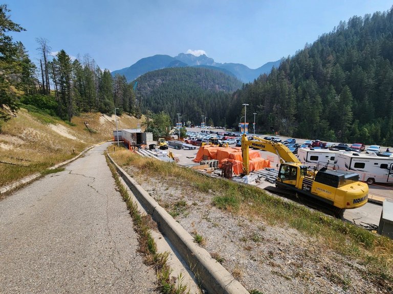
They are always working on some sort of construction project in the mountains. Improving roads, clearing avalanches or modernizing tourist infrastructure. This is the parking lot for the Radium Hot Springs, the biggest reason why people flock to these parts.
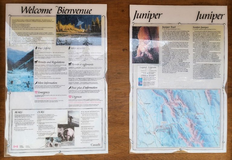
A welcome sign warns us of bears and cougars. The trails in National Parks are typically well marked making it difficult to get lost. When there are roads running through canyons it is even harder to get lost, just don't walk over a cliff.
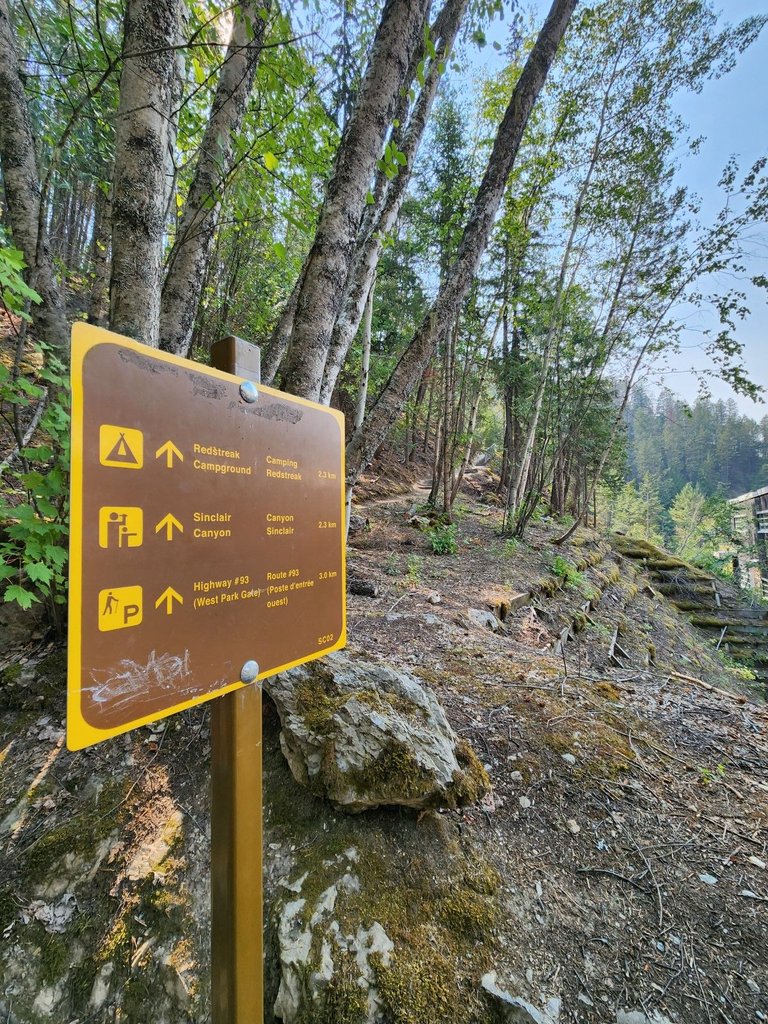
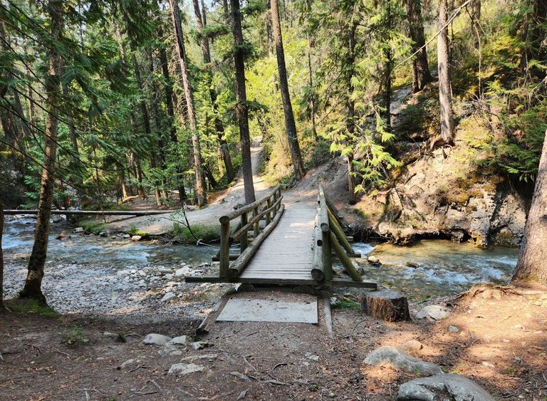
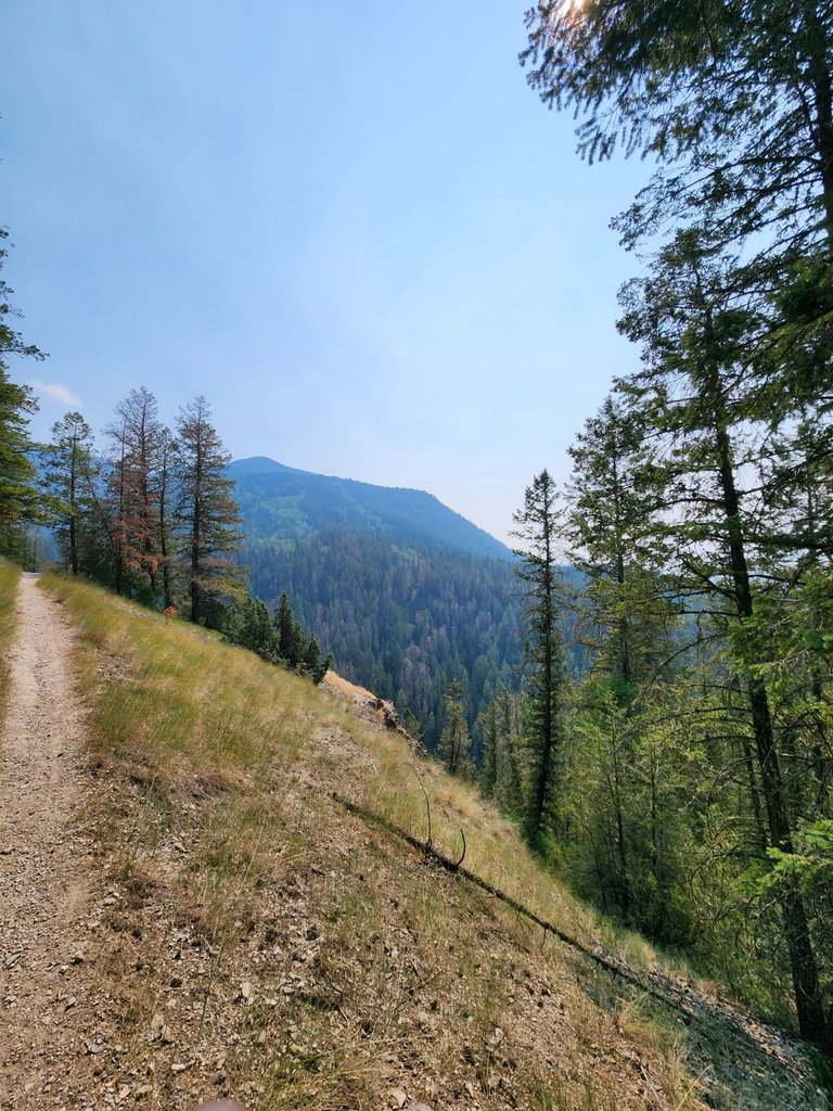
The trail goes up one side of the Canyon and loops back down the other. You must cross Highway 93 twice. This is close to the end of the 'Icefields Highway' which goes from Radium to Jasper in the North. The loop is around seven kilometers in total and I would give it moderate difficulty since some sections are steep or narrow and minding one's step is highly advisable.

A view of the hotsprings through the trees. They built a place where one can shower, change and pay to enter. The construction in the area is to expand the parking as the building was already modernized. These springs are very popular and can get crowded. I was surprised they were not busier on a Summer weekend however there are plenty of other soaking options in the area like the Fairmont Hot Springs just south of Invermere.
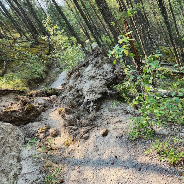
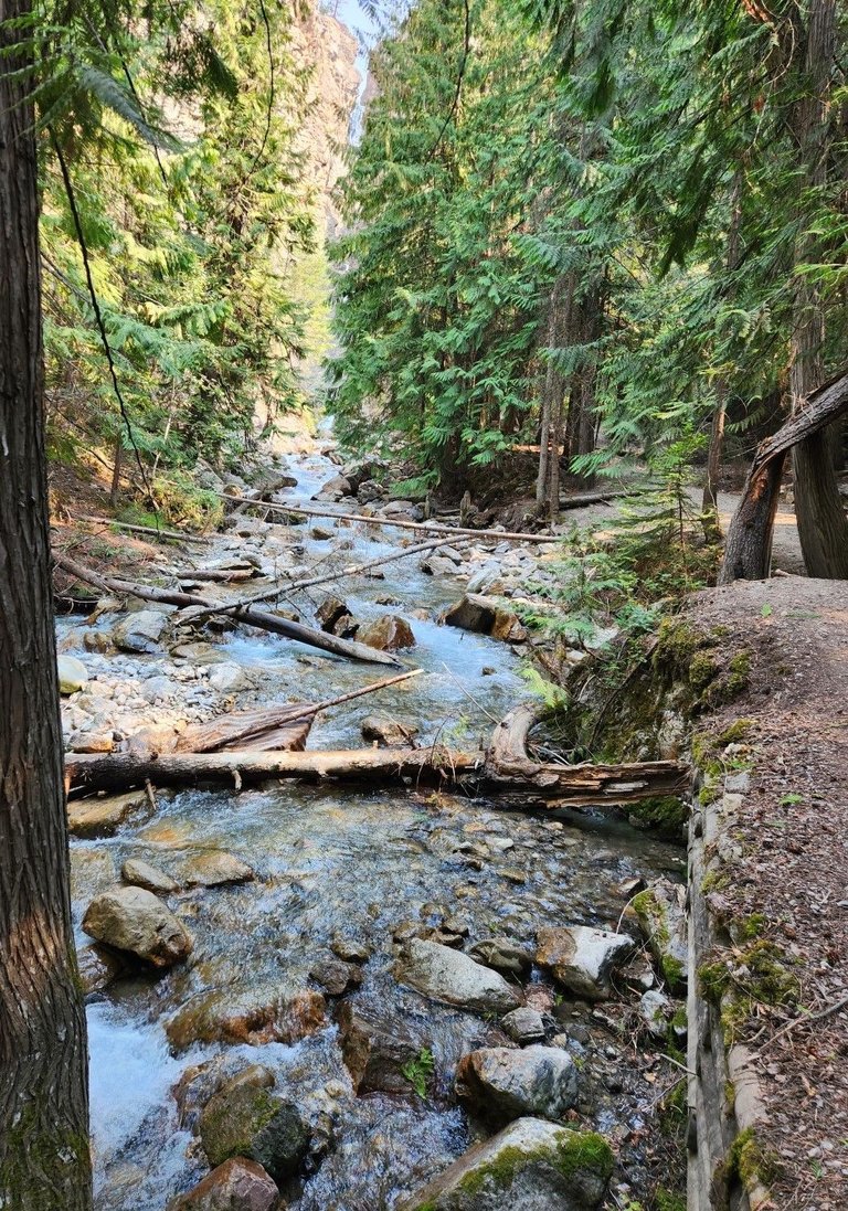
A few days prior to our hike, heavy rain caused some damage. The trees do not have much to grip onto in the mountains and can be easily toppled over.
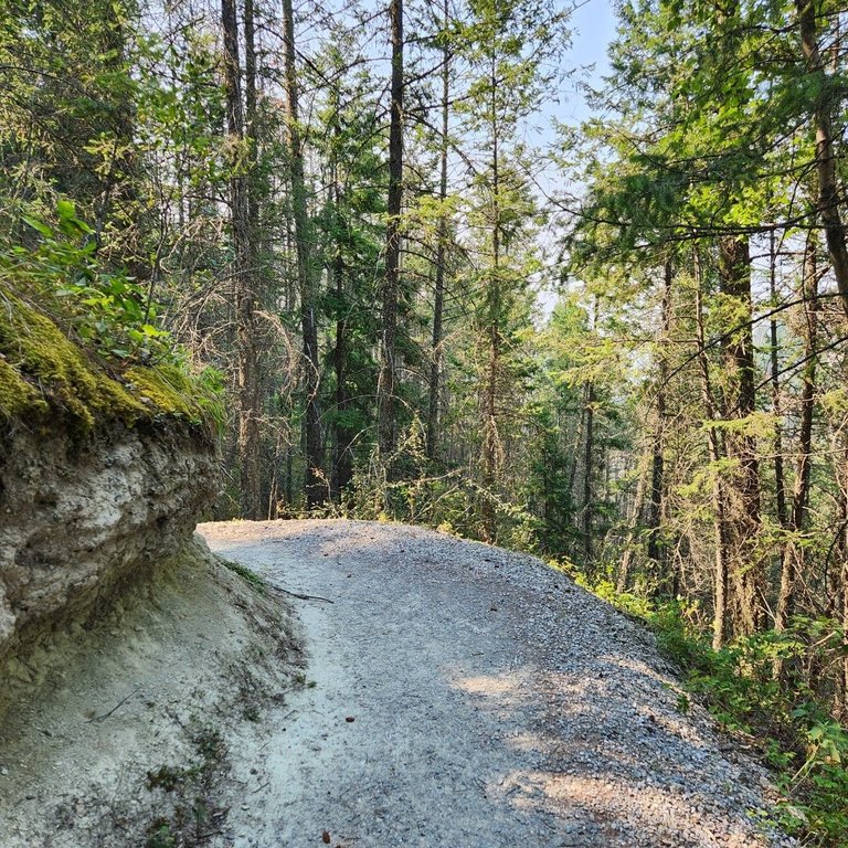
Paths, trails and roads all require thoughtful design and constant maintenance. We should not take these parks for granted. Even a few months of limited use or no maintenance can make trails overgrown or impassable. Frequent avalanches, rain and mudslides bury trails and they have to be cleared. This one was cut into the hillside.
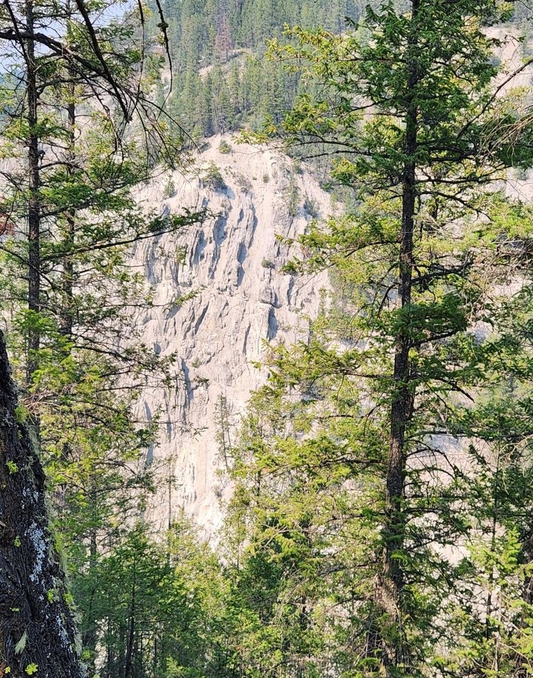
The canyon walls are most visible from the South side of the trail. We are near Red Streak campground which has hundreds of spots for both tents and trailers. The earlier pictures with the views were from on top of that cliff face.
We are nearing the end of the hike descending back towards the road at the start of the canyon. Instead of walking through the campground we decided to follow the highway. Signs speak of the history in the area.
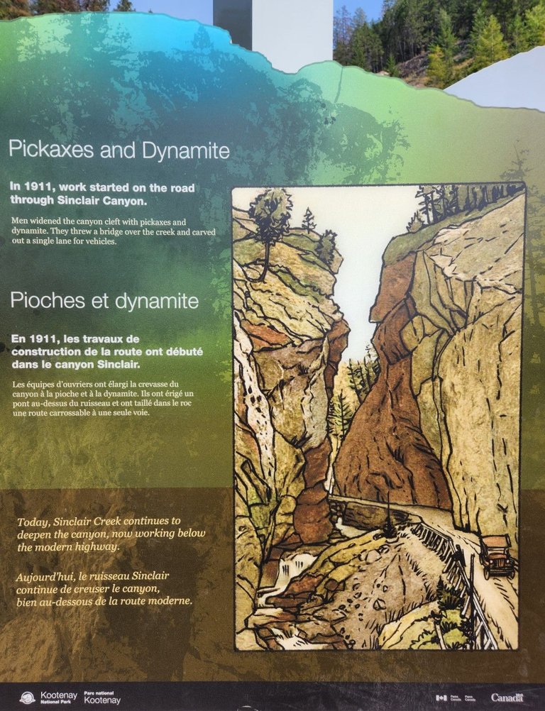
In 1911 they built a road so cars could access the hot springs. Notice how the canyon has changed in the past 123 years from the print above to the photo below. The road sure has improved.
The beauty of nature and its power never cease to amaze us. It's the opposite time of year from when these photos were taken and now the canyon would be filled with ice, snow and the park would be closed for the most part.
Thank you for reading and have a nice week.
[//]:# ([//]:# (!worldmappin 50.63380 lat -116.04624 long Sinclair Canyon d3scr))
Thank you @ewkaw
What a beautiful place, check out some of the amazing natural scenery photos, ❤️
thanks
You're welcome, friends, have a nice day ❤️
there is a paradise for climbers, where you can see at least clean nature and also a fast flowing river. A charming climb.
It's not really climbing, for that you need to use hands. This was more like walking.
The beauty of this destination is truly mesmerizing, with its stunning landscapes, vibrant colors, and peaceful atmosphere. It’s the perfect place to escape, relax, and appreciate the magic of the world around us.
It sure is!
You can check out this post and your own profile on the map. Be part of the Worldmappin Community and join our Discord Channel to get in touch with other travelers, ask questions or just be updated on our latest features.
Congratulations @crypticat! You have completed the following achievement on the Hive blockchain And have been rewarded with New badge(s)
Your next target is to reach 140000 upvotes.
You can view your badges on your board and compare yourself to others in the Ranking
If you no longer want to receive notifications, reply to this comment with the word
STOP