Hello!
Today I decided to create a post full of black and white photos; a post of which I had previously created an Italian version with color photos. This is the English translation of the whole report of my trip. But let's get to us.
After leaving home with my bike, I cycled towards Seravezza, following the course of the river that runs alongside the town and which comes from a hidden path in the nearby mountains. So I reached Pontestazzemese and I continued towards Mulina, to cross the top of the hill: Stazzema.
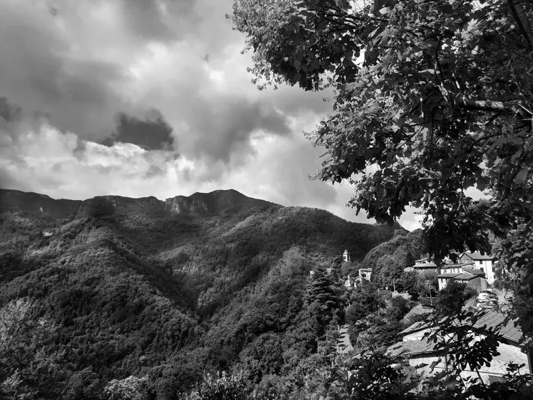
Stazzema is a Versilian town where I usually stop with my bike at least a couple of times a year. It is located about 450 meters above sea level and offers a corner of quiet at the foot of the Apuan Alps. Yes, well, not really at the feet, let's say at the knees, considering that to get there we have to cover those hundreds of meters in altitude that I mentioned before.
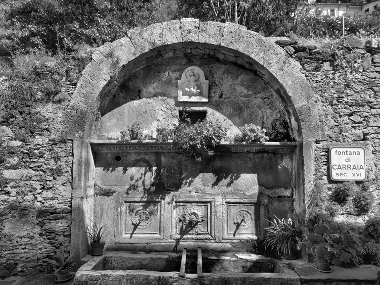
And what do I do when I arrive in Stazzema? As usual, I take some photos. The town boasts some interesting monuments, the first of which I found while walking along an alley at the end of the paved road. An identification plate on the side allowed me to know its name and approximate dating: the Fontana di Carraia (Carraia's Fountain), dating back to the sixteenth century. I found it on the left as I was walking up the alley and I decided to look for some info on the web, but the Internet connection was slow. At home, I discovered little about it, even if I discovered that the origins of Stazzema as an inhabited place are really very ancient, even many years before the birth of Christ.
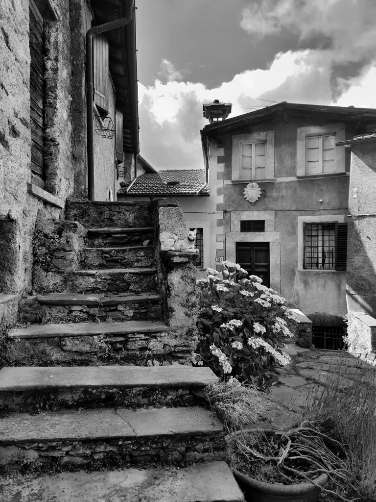
I photographed some other glimpses. First, taking up a few corners of daily life between the houses, then focusing on the surrounding landscape. Stazzema is surrounded by mountains, although it's only 20 kilometers away from the sea. A half curiosity is that the town hall building is not located in the town of Stazzema, but further downstream, in that center that I named at the beginning of the article as Pontestazzemese.
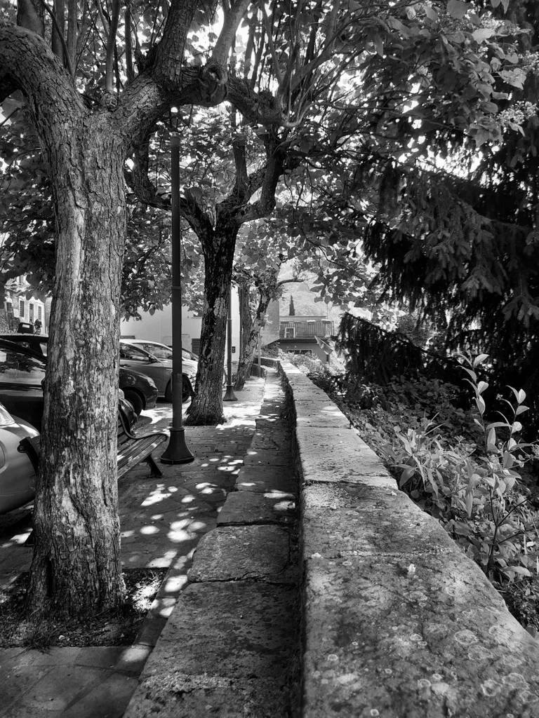
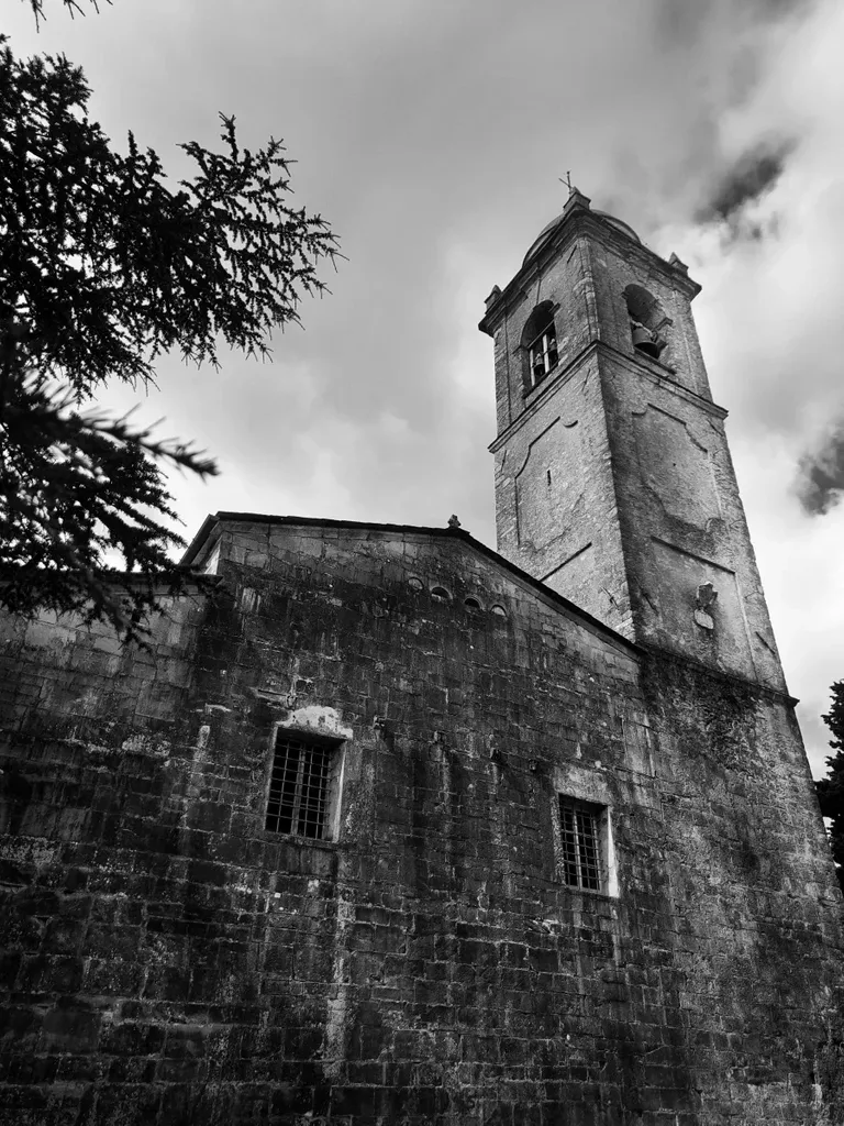
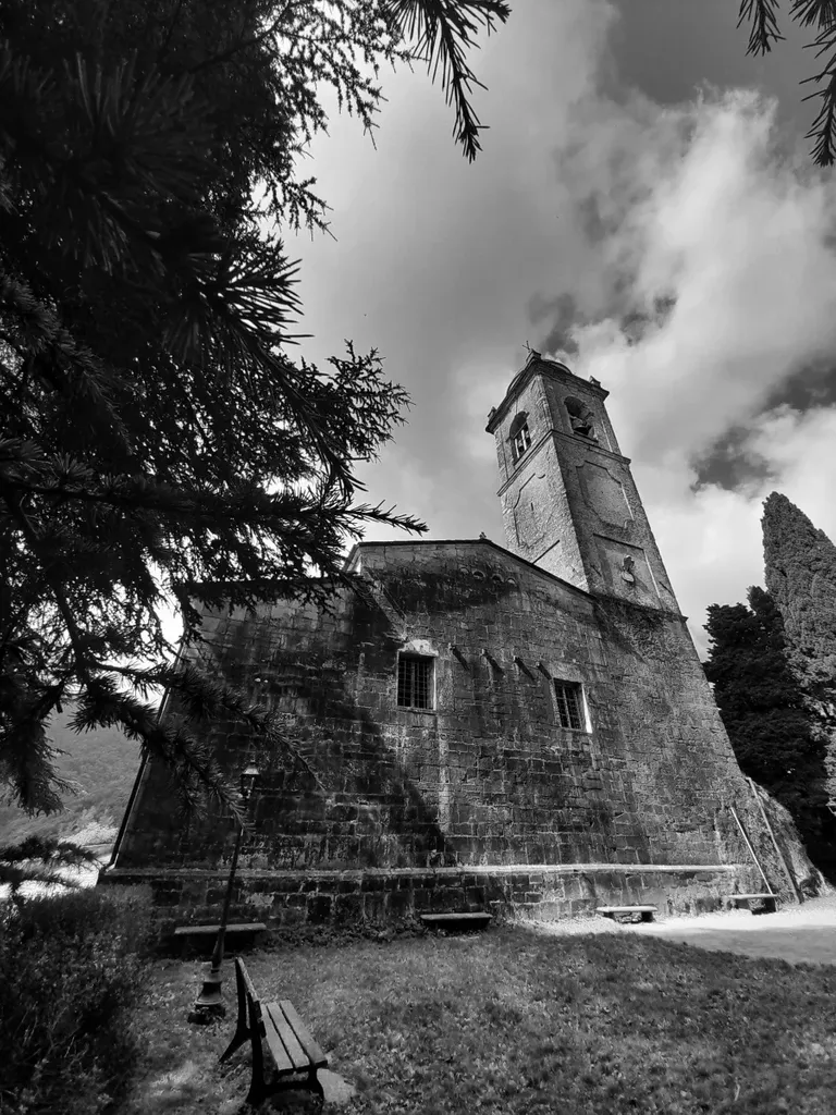
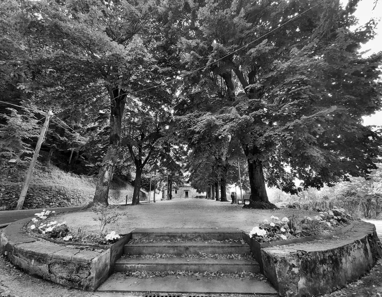
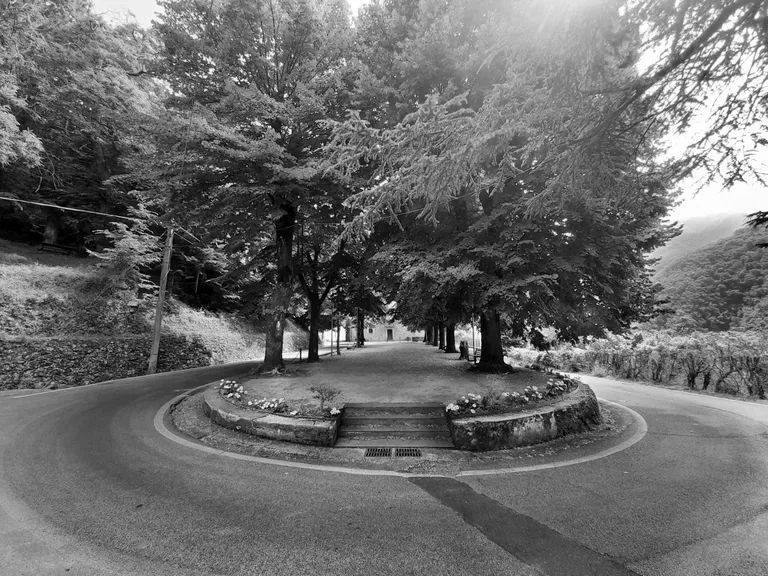
As I looked at the mountains from my smartphone screen, an eye fell on a distant bell tower. I then took the bike back and headed to where I had seen soaring the signs of the church. And there, on a hairpin bend that I had traveled but where I was perhaps too foggy to observe the outline, I found a square and the side facade of a church, which paved the way for a much wider tree-lined pedestrian avenue, located on the opposite side of the roadway. I photographed everything: first there is the pedestrian street, with some benches and some colors and contrasts retouched on the computer.
And then the church, seen from the side and portrayed in two different guises, obtained by changing some parameters of the camera inside my smartphone. The building would seem to be the Church of Santa Maria Assunta, whose birth with modern connotations seems to date back to the XIII century, but whose history draws its roots from hints of a parish church present here since the IX century A.D. I have not visited the interior. Perhaps, in the future, I will remedy this.
Ending the break, I returned home, but I would like to point out that some interesting hiking trails for enthusiasts start from this area, including the one that allows you to reach the Rifugio Forte dei Marmi. Furthermore, Stazzema is remembered for being awarded a Gold Medal for Military Valor due to the events that occurred during the Second World War. Some will also know this place because a locality within the municipal territory - Sant'Anna di Stazzema - was the scene of one of the most famous massacres that took place in the period mentioned. Stazzema and Sant'Anna di Stazzema are part of the same municipality, but it should be noted that they are located on different mountain fronts and that, referring to an asphalted road, they are about 30 kilometers away. It's possible to reduce this route only by footpaths.
And nothing, even for today I have finished, I hope I have given you some useful information.
I greet you, and I hope to find you in a future post.
For the best experience view this post on Liketu
The rewards earned on this comment will go directly to the people( @davidesimoncini ) sharing the post on Twitter as long as they are registered with @poshtoken. Sign up at https://hiveposh.com.
Congratulations, your post has been added to Pinmapple! 🎉🥳🍍
Did you know you have your own profile map?
And every post has their own map too!
Want to have your post on the map too?
Link to the previous post
Reposting previous posts or parts of them without significant additional original content/changes is considered fraud and exploitation of the "Hive Reward Pool".
Publishing such content may result in the account being Blacklisted.
Please refrain from copying and pasting previous posts going forward.
If you believe this comment is in error, please contact us in #appeals in Discord.