What in my head had started out as a short five kilometer hike one way ended up turning into the longest trek I had done so far. Because of a mistake when looking for information about the route, our day's walk was extended until almost nightfall. Luckily the summer day with its late sunset allowed us to go and return safe and sound to the Argentina-Chile border. There were not so many complications along the way, but if we had known from the start that it would be so many kilometers in total, we would have given it a little more thought 😅.
Lo que en mi cabeza había empezado como una pequeña caminata de cinco kilómetros de ida terminó transformándose en el trekking más largo que había hecho hasta el momento. Y es que por un error al momento de buscar la información sobre la ruta, nuestro paseo del día se extendió hasta casi la noche. Por suerte la jornada de verano con su puesta de sol tardía nos permitió ir y volver sanos y salvos hasta la frontera Argentina-Chile. No hubo tantas complicaciones en el trayecto, pero si hubiésemos sabido de entrada que serían tantos kilómetros en total, lo hubiésemos pensado un poco más 😅.
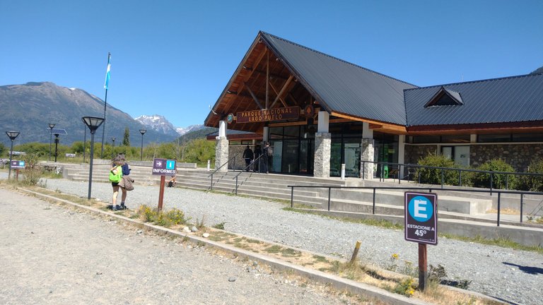
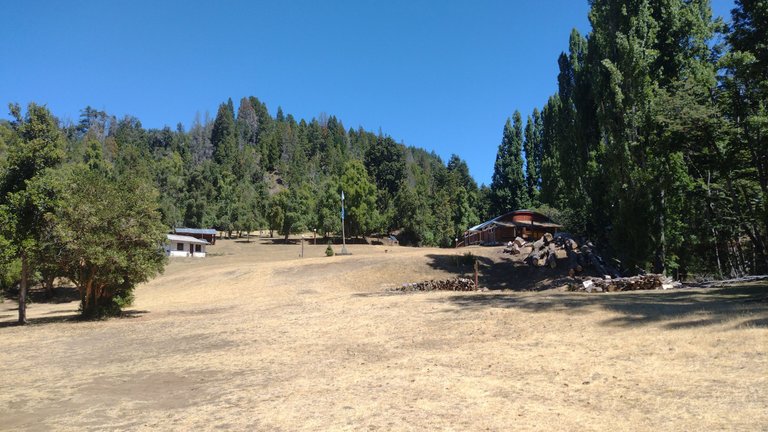
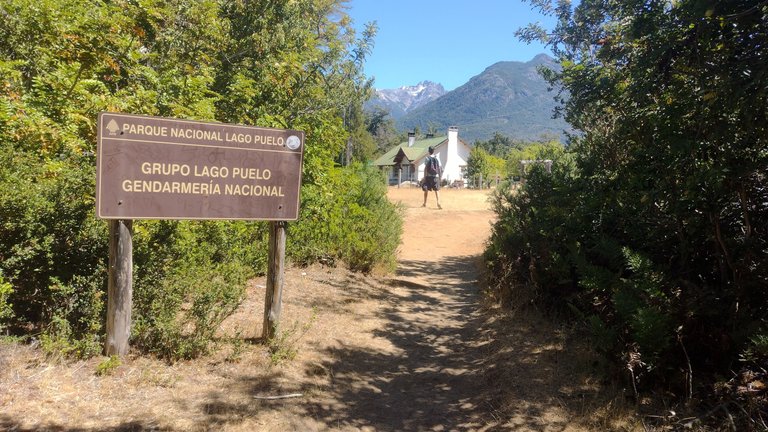
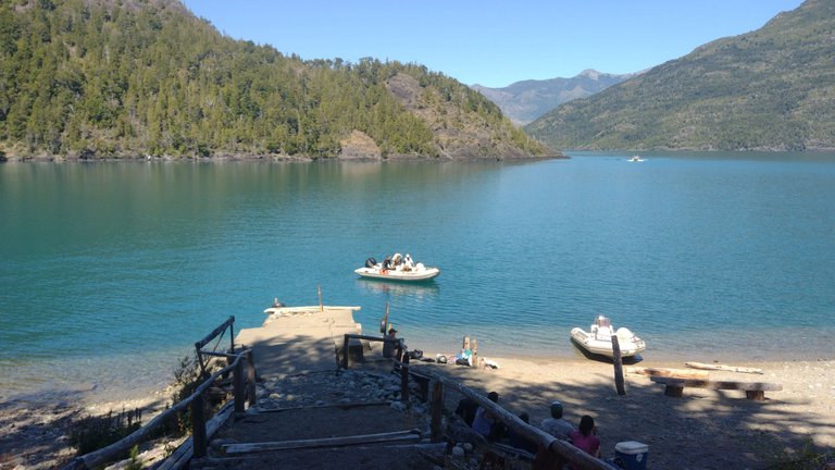
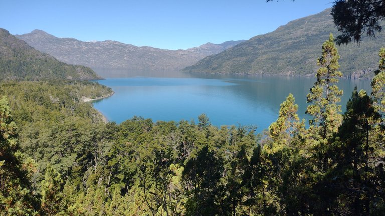
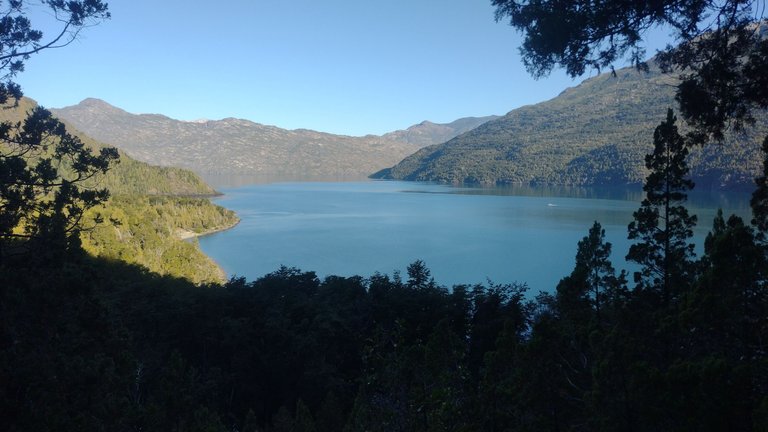
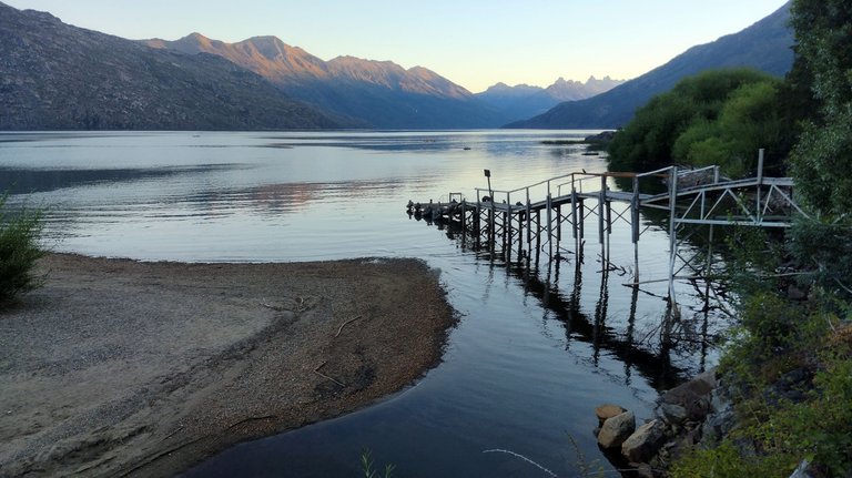
In addition to exploring much of the area around El Bolsón, another place I visited quite often this summer was Lago Puelo. These two towns are 15 km apart and in different provinces, but they are easily connected by bus. This bus drops you off at the entrance to Lago Puelo National Park, where there are a variety of trails to hike, as well as the lake of the same name to visit and spend the day on its shores 😃.
Además de explorar gran parte de los alrededores de El Bolsón, otro lugar que visité bastante seguido este verano fue Lago Puelo. Estos dos pueblos distan 15 km entre sí y quedan en provincias diferentes, pero están fácilmente conectados con un colectivo de línea. Este colectivo te deja en la entrada del Parque Nacional Lago Puelo, en donde hay variedad de senderos para recorrer, además del lago homónimo para visitar y pasar el día en sus costas 😃.
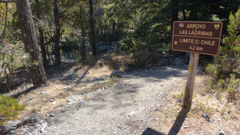
So far I had not done any trails in the park area because I was always going to do beach day, but this time I had gotten a companion to go for a little walk. My companion didn't usually hike that much regularly, but I had taken it upon myself to find a "short trail" for us. So I found that we could walk to the milestones that mark the border with our neighboring country Chile. It would be about 5 km, which seemed short because the internet said it would be an hour one way 😃.
Hasta el momento no había hecho ningún sendero en la zona del parque porque siempre iba a hacer día de playa, pero esta vez había conseguido un acompañante para ir a caminar un poco. Mi compañero no solía caminar tanto regularmente, pero yo me había encargado de encontrar un "sendero corto" para nosotros. Así fue que encontré que podíamos ir caminando hasta los hitos que marcan la frontera con nuestro país vecino Chile. Serían unos 5 km, lo que parecía poco porque en internet decía que sería una hora de ida 😃.
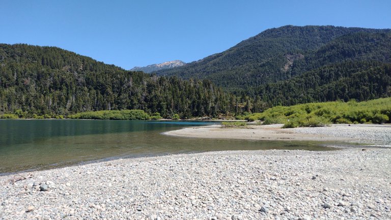
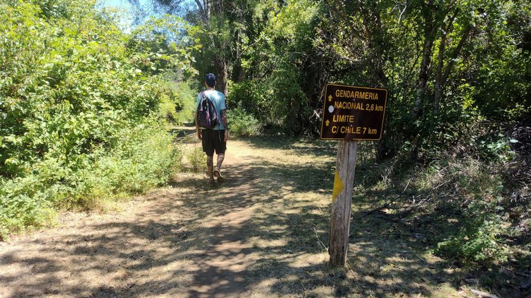
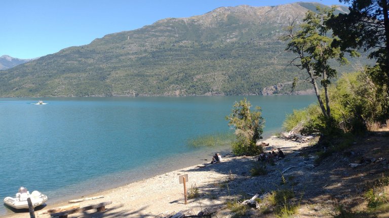
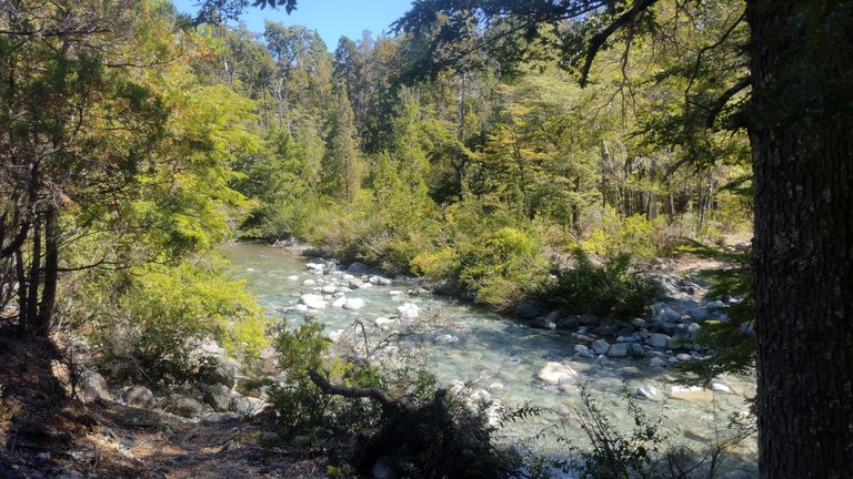
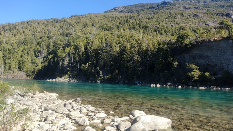
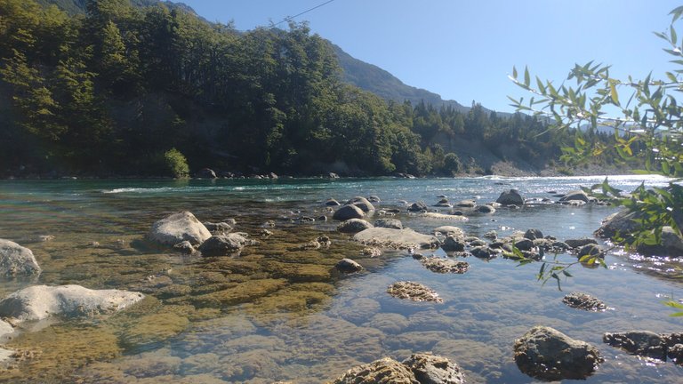
I had read that to find the trail to the landmarks it was necessary to ford the mouth of the Azul River in Lago Puelo. As we approached the lake we found this spot, and saw that the river was running quite fast everywhere. We had to cross this slippery stretch of about 20 meters quite carefully, and that was the most complicated part of this trail. After that, we easily found indicative signage 😃.
Yo había leído que para encontrar el sendero hacia los hitos era necesario vadear la desembocadura del Río Azul en el Lago Puelo. Cuando nos acercamos al lago encontramos este lugar, y vimos que el río corría bastante rápido en todas partes. Tuvimos que cruzar con bastante cuidado este tramo resbaloso de unos 20 metros, y eso fue lo más complicado de este camino. Después de eso, fácilmente encontramos cartelería indicativa 😃.
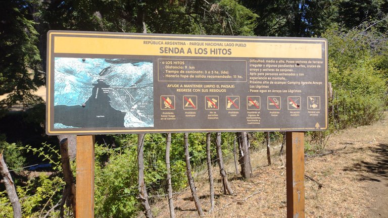
Since this trail was supposed to be only 5 km, my partner and I didn't even bother to go early. We took the 11 AM colectivo and will have started hiking after noon, which in our heads was plenty of time to get there and back. But after walking for an hour and thinking we would be arriving, we found a sign indicating that the border with Chile was 9 km away and about three more hours of walking were needed. There we looked at each other and said WHAT? 😂
Como supuestamente este sendero sería solo de 5 km, mi compañero y yo ni siquiera nos preocupamos por ir temprano. Nos tomamos el colectivo de las 11 AM y habremos empezado a caminar después del mediodía, lo que en nuestra cabeza era tiempo suficiente para ir y volver. Pero después de caminar por una hora y pensar que estaríamos llegando, encontramos un cartel que indicaba que la frontera con Chile quedaba a 9 km y eran necesarias unas tres horas más de caminata. Ahí nos miramos y dijimos ¿QUÉ? 😂
We had a small debate about whether we would have enough time to get there given the time of day and the extra distance not contemplated, and luckily my partner agreed to continue. We both said that we were already there and that we had to go for it all. This unforeseen event made us speed up our pace a little, we were not walking as calmly as before, but it was necessary if we wanted to arrive on time 😃.
Tuvimos un pequeño debate sobre si nos alcanzaría el tiempo para llegar siendo la hora que era y además la distancia extra no contemplada, y por suerte mi compañero accedió a continuar. Ambos dijimos que ya estábamos ahí y que había que ir a por todo. Este imprevisto nos hizo acelerar el paso un poco, ya no íbamos caminando tan tranquilos como antes, pero era necesario si queríamos llegar a tiempo 😃.
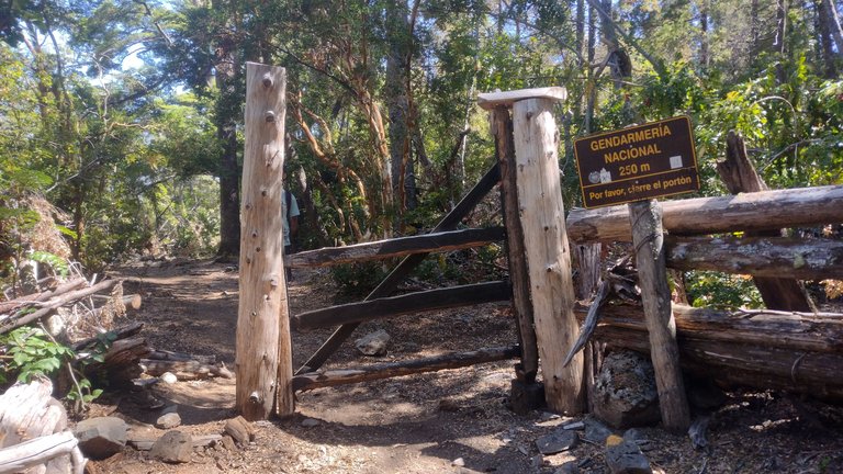
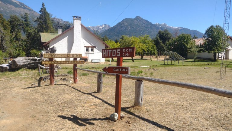
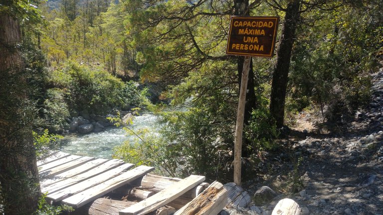
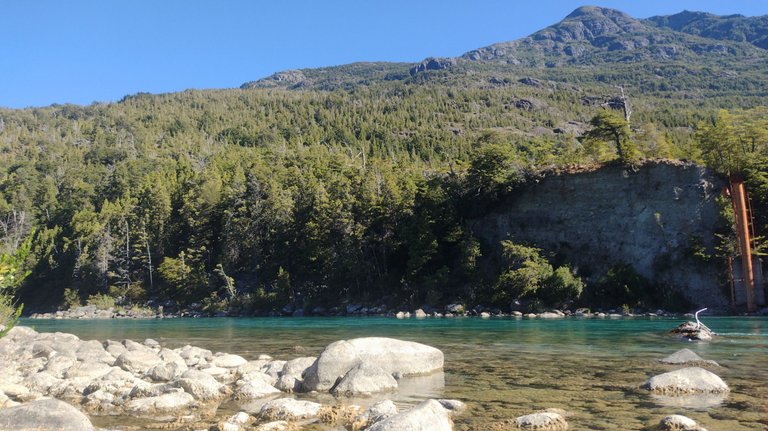
Four kilometers later, we arrived at the famous Gendarmerie Campground that was mentioned everywhere. This is the border control post on our Argentine side, and they also offer free camping space. It was here that we saw a sign indicating that the border milestones were 5 km from there, so that was probably the information I read wrongly. It was 5 km after walking 9 km before, a small error of interpretation 😂.
Cuatro kilómetros después, llegamos al famoso Camping de Gendarmería que se mencionaba en todos lados. Este es el puesto de control fronterizo de nuestro lado argentino, y además, ofrecen espacio para acampar libremente. Acá fue cuando vimos un cartel que indicaba que los hitos fronterizos quedaban a 5 km desde ahí, por lo que seguramente ese fue el dato que leí erróneamente. Eran 5 km después de caminar 9 km antes, pequeño gran error de interpretación 😂.
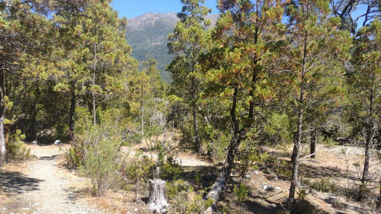
Between the breaks in between and our lunch stop, it was almost 5 PM and we still hadn't even gotten to where we wanted to go. But the euphoria of getting closer and closer is what gets you going, so we kept going. So far, the trail had been quiet, but in this last stretch there were quite a few inclines that made our legs a little tired. But we were not going to abandon our mission 😂.
Entre los descansos intermedios y nuestra parada para comer, ya eran casi las 5 PM y todavía ni siquiera habíamos llegado a donde queríamos. Pero la euforia de estar cada vez más cerca es lo que te mueve, así que seguimos camino adelante. Hasta el momento, el sendero había sido tranquilo, pero en este último tramo hubieron bastantes desniveles que nos hicieron fatigar un poco las piernas. Pero no íbamos a abandonar nuestra misión 😂.
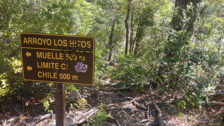
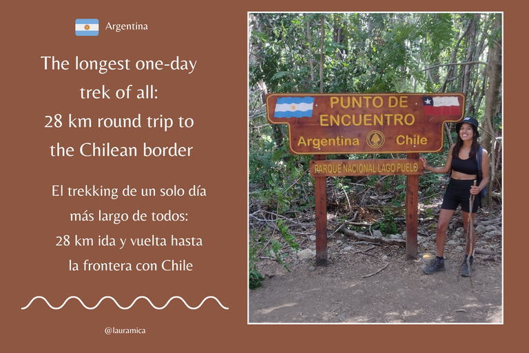
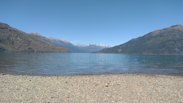
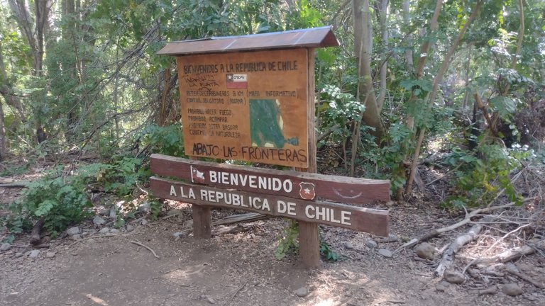
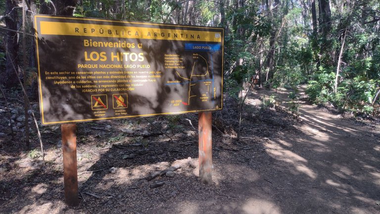
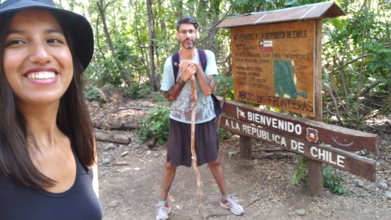
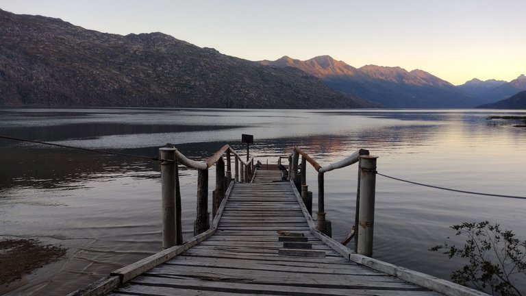
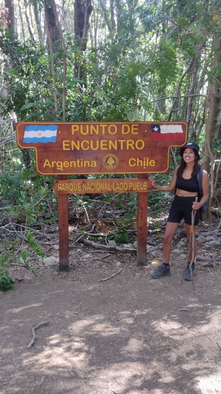
And at almost 6 PM, we finally arrived at the famous Chilean border. On the other side, if we kept walking another 8 km, we would find the Chilean carabineros post, but that was not in our plans. If you ask me what else was super interesting here, I'll just say that it was the signs, because the truth is that nothing super cool happened. Ok, we walked 14 km just to take a picture with some signs? Of course we did 😂.
Y casi a las 6 PM, finalmente llegamos a la famosa frontera chilena. Del otro lado, si seguíamos caminando otros 8 km, nos encontraríamos con el puesto de carabineros de Chile, pero eso sí que no estaba en nuestros planes. Si me preguntan que más había de super interesante acá, solo voy a decir que eran los carteles indicativos, porque la verdad es que nada super genial pasaba. ¿Ok, caminamos 14 km solo para sacarnos una foto con unos carteles? Pues claro que sí 😂.
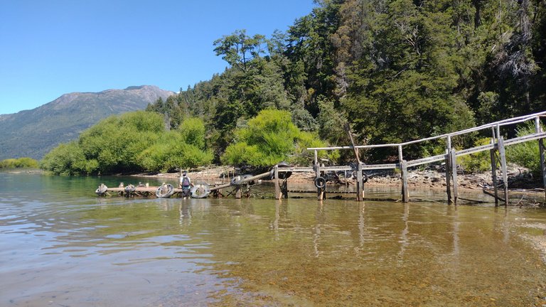
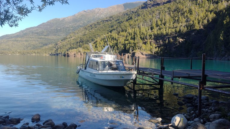
Walking a little around, you could access a small port, which is where the ships arrive that bring you to this place to see the same signs that we saw. These boats leave from the park entrance and arrive here in about 40 minutes, without a doubt much easier than the long walk we had done 😅.
Caminando un poco por los alrededores, se podía acceder a un pequeño puerto, que es donde llegan las navegaciones que te traen hasta este lugar a ver los mismos carteles que vimos nosotros. Estas navegaciones parten de la entrada del parque y llegan acá en unos 40 minutos, sin dudas mucho más sencillo que la gran caminata que habíamos hecho nosotros 😅.
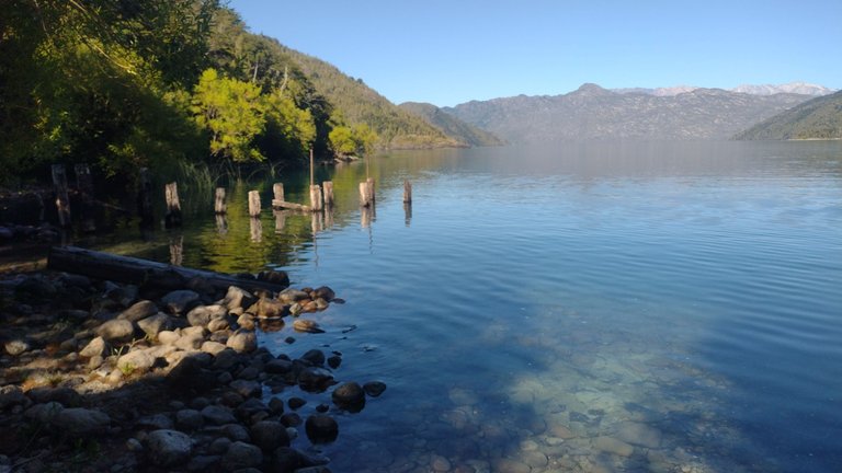
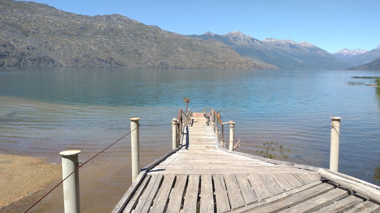
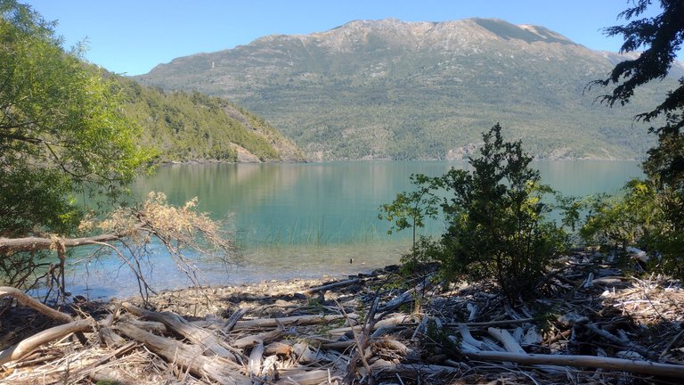
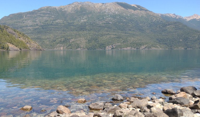
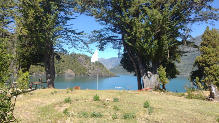
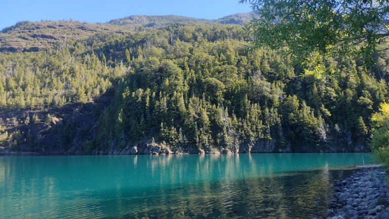
There was also a small part to go down to the mouth of the lake, where the color of the water looked amazing. All this scenery is beautiful with the mountains in the background, but the color in this part was much more special. My partner and I rested here for a while, thinking about how we got so confused about the distance to walk, but glad we made it anyway 💕.
También había una pequeña parte para bajar a la desembocadura del lago, en donde el color del agua se veía increíble. Todo este paisaje es hermoso con las montañas de fondo, pero el color en esta parte era mucho más especial. Mi compañero y yo nos quedamos un rato descansando acá, pensando en cómo nos confundimos tanto con la distancia a caminar, pero conformes por haberlo logrado de todos modos 💕.
Everything was going well, until we realized that it was after 6 PM and we were 14 km away from where we had started walking. What scared me most was that the night would catch us at the beginning of the path, right where we had to ford that dangerous river. I must say that we made the return walking, almost running because of my insistence on this, so we arrived just in time to see a beautiful sunset. In the end, we could have gone back a little calmer 😅.
Todo estaba marchando bien, hasta que nos dimos cuenta de que eran más de las 6 PM y estábamos 14 km lejos de donde habíamos empezado a caminar. Lo que más miedo me daba era que nos agarrara la noche en la parte incial del camino, justo donde teníamos que vadear ese peligroso río. Debo decir que la vuelta la hicimos caminando, casi corriendo por mi insistencia con esto, así que llegamos con la hora justa para ver un atardecer hermoso. Al final, podríamos haber vuelto un poco más tranquilos 😅.
By the time I checked my step counter, I saw that I had broken my own record for walking in one day with 17 miles total. I was glad for this, and I didn't feel that tired either so surely if I had started earlier, I could have walked further. As for the border with Chile, this is just one of the few border crossings that both countries share, but I am happy to say that I reached one of them on foot. Maybe this will motivate me to take a trip to our neighboring country in the future 💖.
Para cuando revisé mi contador de pasos, ví que había roto mi propio récord de caminata en un día con 28 kilómetros en total. Me alegré por esto, y tampoco me sentí tan cansada así que seguramente si hubiese empezado más temprano, podría haber caminado más. En cuanto a la frontera con Chile, este es apenas uno de los cuantos pasos fronterizos que comparten ambos países, pero me alegra decir que llegué a uno de ellos a pie. Quizás esto me motive para hacer un paseo a nuestro país vecino en algún futuro 💖.
❤️ Hope you liked this post! Thanks for reading. ❤️
❤️¡Espero que les haya gustado este post! Gracias por leer. ❤️
Lau 💕.
📸 Portada creada en Canva. Todas las imágenes son de mi propiedad 💕.
Congratulations, your post has been added to WorldMapPin! 🎉
Did you know you have your own profile map?
And every post has their own map too!
Want to have your post on the map too?
What a beautiful place you have visited, without a doubt it was worth all that walk that was out of the plans, it is good that you went in the company of a person who was willing to continue forward even though they were misinformed about the distances.
Your photographs are beautiful as always, dear friend @lauramica.
Good night Luis. Luckily my hiking partner didn't give up and we were able to complete the entire journey, it was great.
Thanks for stopping by and for your constant support :)
What a big trekking walk and charming natural places ❤️
Yes, it was beautiful 💕
hola, muy lindas fotos, yo estaré alli pronto
Que bueno, te va a encantar ❣️