But what once was a site of destruction is now a place of excitement for many. The summit turned into caldera is now a welcome scene for locals and tourists.
And I, along with a group of hikers from Cebu, were one of the lucky who did not only see Mt. Pinatubo's crater but also experienced its trails. I talked about it in my blog before and I decided to also share more of it with you guys here.
Our Journey
Mt. Pinatubo is an active stratovolcano that straddles at the tripoint boundary of the provinces of Zambales, Tarlac and Pampanga. The most popular gateway is in Capas, Tarlac. Here, it involves an hour 4×4 ride in a lahar field and a 3km trek to the crater lake. However, there is an alternative route passing through the Golden Trail in Porac, Pampanga, which offers a completely different experience. A relatively new trail compared to the Delta V Trail (via Sapang Uwak) which is known to most hikers, Golden Trail flaunts a 42km trek that would take you to sandy flats, shallow streams and rocky terrain.
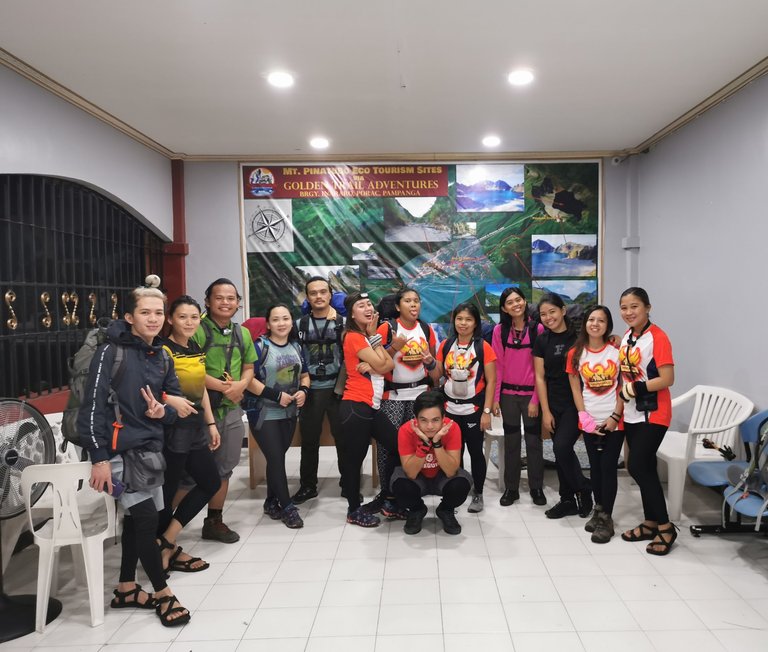
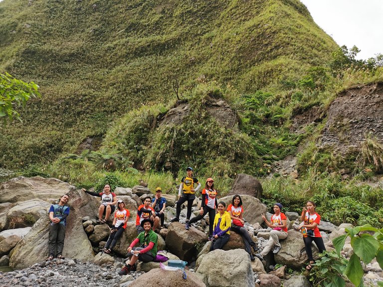
The event was organized by Jeffrey of Bandana Stories. Apart from three people, James, Chiarra and Carol, the rest of the hikers were strangers to me. But as the old saying goes, strangers are just friends waiting to happen. So I set aside my worries and anxieties and headed to my very first climb outside of Visayas.
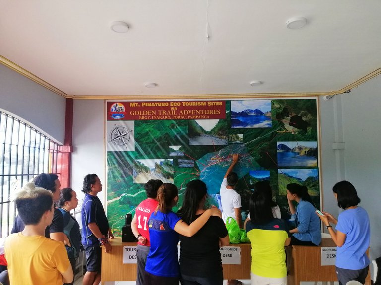
It was already past 12 noon when we reached Pampanga. After buying our last-minute errands, we headed to Porac where we were scheduled for orientation. Our guide briefed us about the trail, what to expect, and what to avoid. He also told us to get enough rest during the night since we were up for a long, grueling hike the next day.
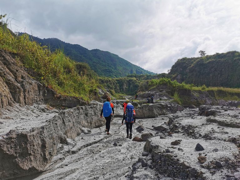
Walking on Lahar
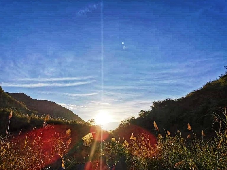
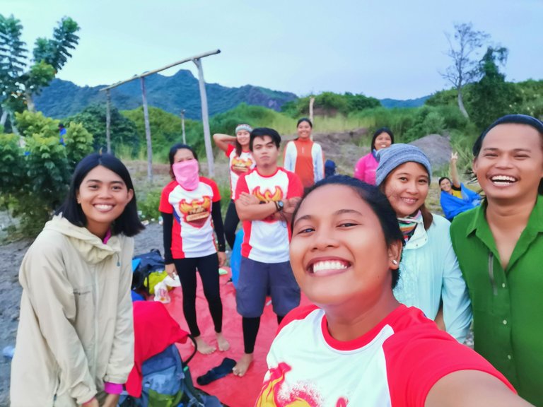
By midnight, most of us were already awake and making final preparations. We left the jump off point at 1 am with hearts full of anticipation and excitement.
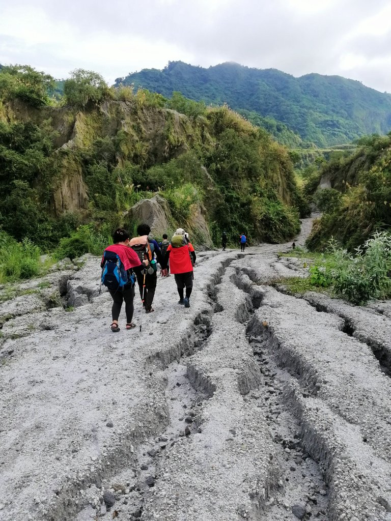
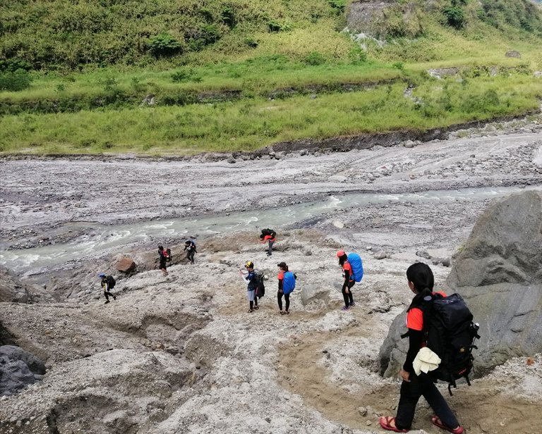
During the first few hours, we hiked through a seemingly endless volcanic sand. The trail was mostly plain and open which can be arduous to those who climb during the day when the sun is up. Thankfully, dawn came with cool air and we didn't have to worry with our sweats.

It took almost three hours on dusty lahar before we reached the first campsite. We were supposed to have our breakfast here but due to unforeseen circumstances, our porters (who carried all our food and cooksets) arrived two hours late. Despite being hungry and a little frustrated, we just decided to laugh it off and move on.
With our itinerary delayed, each of us knew that we’d have to double our next pacing to reach our target. It was a silent concensus among the group that we must not spend too much time resting or taking pictures in one area.
However, upon reaching the lahar cliffs, we just had to stop and be amazed with the view. The rugged and triangular hills looked like huge toblerones from afar. Meanwhile, some of us also thought of Jurassic park. Chocolates or dinosaurs, which is which?
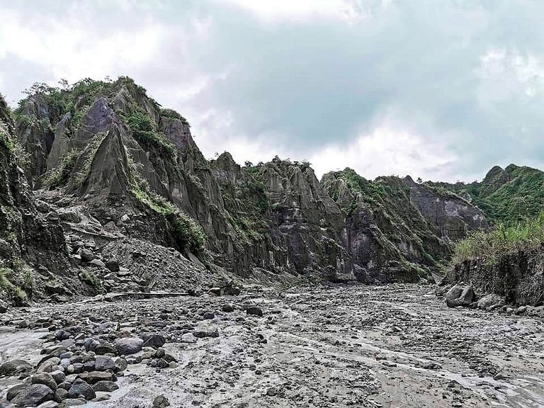
After eating, we continued hiking into the barren plains and soon reached the landslide area which caught most of us by surprise.
This used to be part of the mountains surrounding the plains where 4×4 trail mods pass through. Now, they’re huge sand boulders that we needed to walk into.
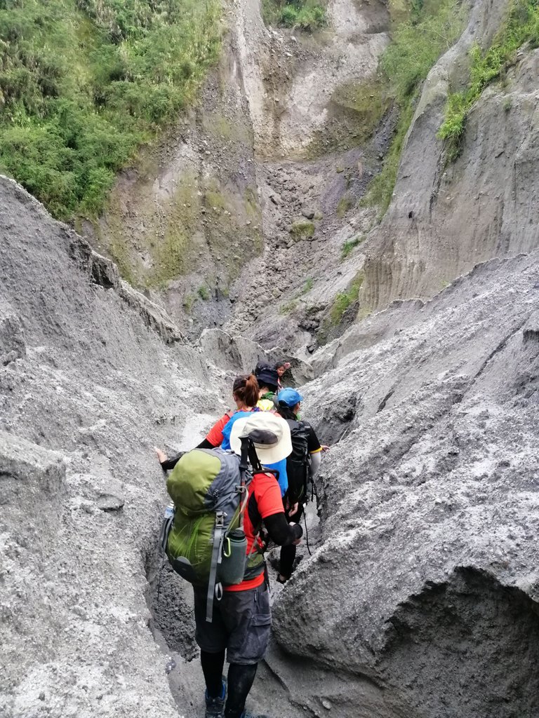
We skidded and slid, scooting and crawling on fours. At some point, our guides had to take our backpacks because we can’t fit into the gap.
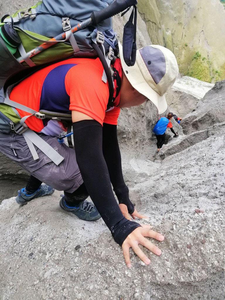

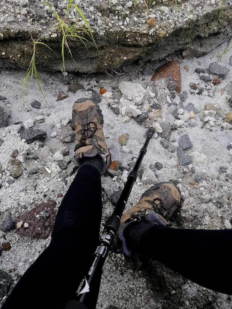
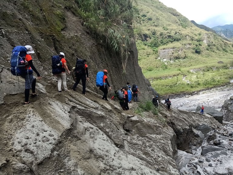
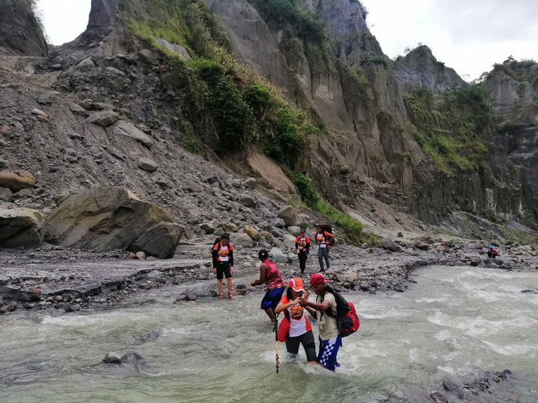
The first leg of the hike ended with a final descent to the river. But even the trail going down was not an easy one. We had to be careful with our steps since the sand was porous.
River trekking and chasing waterfalls
By the time we reached the riverbed, most of us changed from hiking shoes to sandals. This part of the 42km trek requires multiple river crossings for hours. The water is mostly shallow but the current could be strong at times. It’s a good and refreshing shift from hours of walking on dry sand.
Along the way, we saw several interesting formations — or deformations — that we just had to take a snap.
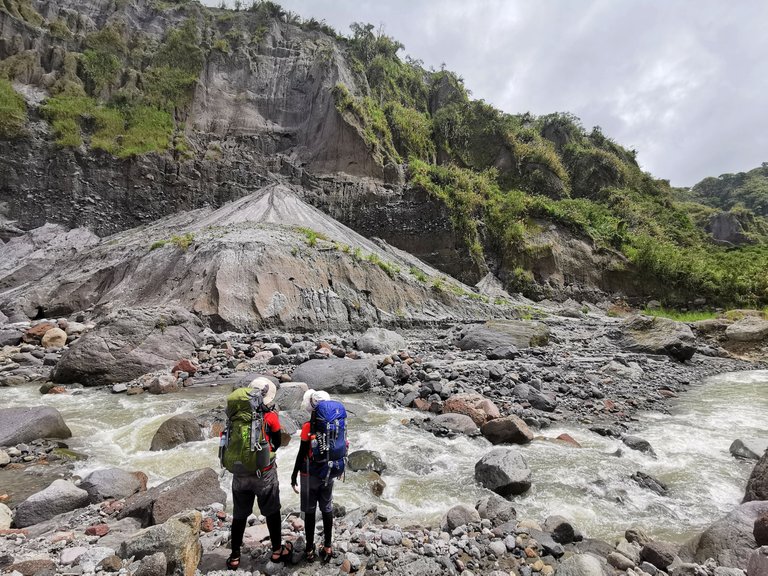
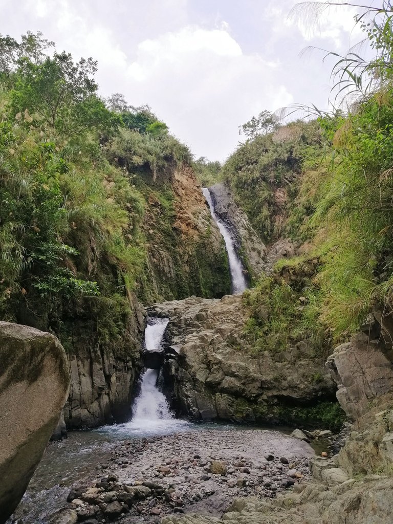
Soon, the river that we were following got narrower. This meant that we were finally close to the waterfalls.
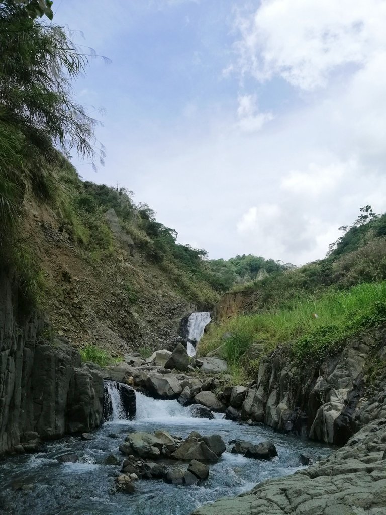

And, indeed, after a few minutes, we reached Inararo Falls. It is a 50-feet high single-tiered cascade that for some reason reminded me of Mt. Talinis' waterfall — its unsecluded version. After taking some quick photos we then moved forward with the hike.
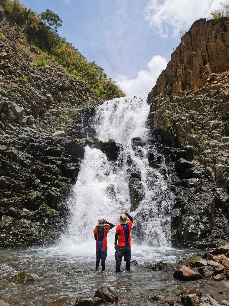
It was almost 11:30 when we saw Ana-an falls, also known as Twin Falls. We had to climb atop the waterfalls where the campsite is located. Gathering our remaining strength, we faced the ascending trail and arrived just in time for the light rain.
After having our lunch and pitching our tents, we continued with our hike to the crater lake which was still 2 hours away.
Into the heart of Mt. Pinatubo
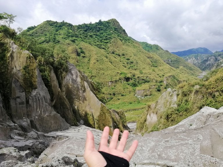
In contrast to the barren plains we passed by earlier, the terrain going to the summit was ringed with lush mountains.
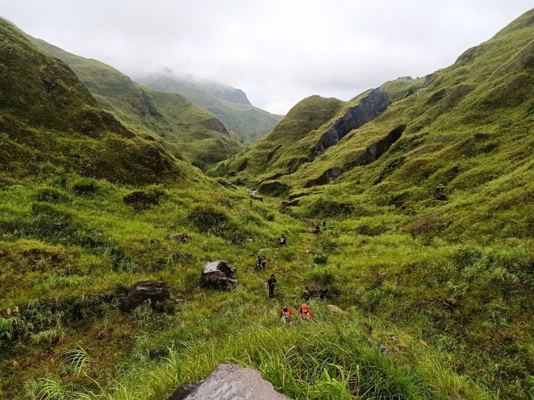
It reminded us of Dalaguete’s landscapes. Who would have thought spew of lahar devastated these verdant greens?
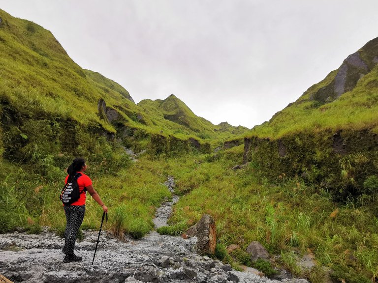
The trek this time was easier since we were not carrying full packs. Soon enough, we got a glimpse of the crater lake which took our breaths away. It was a sweet reward after a day of long walk, sun burn, and sticky sweat.
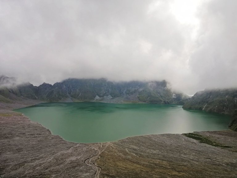
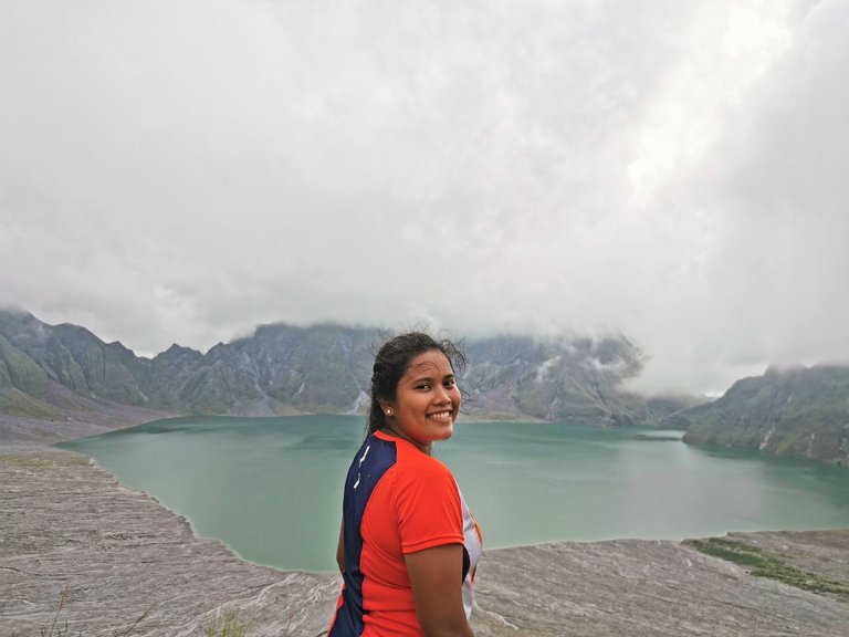
The beauty of Mt. Pinatubo is not only seen on its summit. Looking back, we saw and experienced the beauty in its disaster. The long stretch of lahar field that glimmered like gem, the sand boulders that awakened our sense of thrill, the river and falls that made us appreciate every drop of water, and the green mountains that proved us that nature always finds a way to thrive.
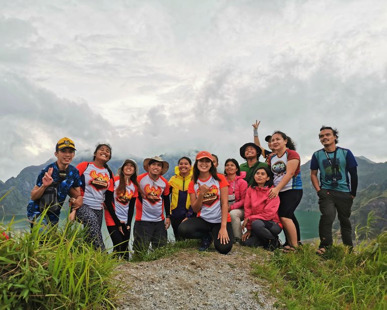
This 42km adventure was indeed a golden one. It came with imperfections but our treasure trove was filled with memories, laughter and new bonds.

Hello! I'm Maria, a hopeless romantic who travels in pages and places. I hope to share my love for words and the world with you here in HIVE.
If you like this content, don't forget to follow, upvote, and leave a comment to show some love. You can also reblog if you want to. Let's connect! 🤍
Wooow kanindot ani mega oi!
someday aheeem @ybanezkim26 ta ta ta!
and the falls in between jud amazing!
"Strangers are just friends waiting to happen" -glad we had our own strangers to friends happening, too :)
Yayyyy. Kanus-a mo mag Pinatubo? Gora na dayon mo 😁
In the right time hahahha unsaon jud ang right time 😅
Goals sad raba nako ang Pinatubo. Bahala pabebe lang. Like dili lang hike. HAHAHA
ta ta kadtung ATV madi @ybanezkim26 heheh
Congratulations, your post has been added to Pinmapple! 🎉🥳🍍
Did you know you have your own profile map?
And every post has their own map too!
Want to have your post on the map too?
Congratulations @mariasalve! You have completed the following achievement on the Hive blockchain And have been rewarded with New badge(s)
Your next target is to reach 4500 upvotes.
You can view your badges on your board and compare yourself to others in the Ranking
If you no longer want to receive notifications, reply to this comment with the word
STOPCheck out our last posts:
Support the HiveBuzz project. Vote for our proposal!
I was planning to climb Mt. Pinatubo in 2020, but COVID happened haha
Time to make it happen now, sir arc! Go na dayon!
Such an interesting trip! On one side lots of rocks and rough terrain, and on the other hand SO much of greenery. Beautiful! That crater looks stunning too.
42 km must have been so challenging! Thank you for sharing, it was fun to go with you on this trip 🙂
Thanks for reading. Glad you enjoyed it. It was a one-of-a-kind trip 😁
Wow! I repeated it for many times. Looking at the pictures alone makes me amazed by the wonders of God's creation.
You're so blessed to witness it's wonders in person. It's so relaxing and satisfying reaching your destination and witnessing the beauty of nature.
Yes indeed. The contrasting scenery of lahar mountains and grass-covered hills was quite interesting 😊
Your content has been voted as a part of Encouragement program. Keep up the good work!
Use Ecency daily to boost your growth on platform!
Support Ecency
Vote for new Proposal
Delegate HP and earn more
That crater is beautiful! 😍. What a wonderful adventure you experienced and I am happy you were determined to see this journey regardless of the delay in the arrival of the porters carrying your food and cooksets. Lovely pictures, I feel I am was there with you all. I enjoyed reading your post! Fantastic! Keep up the good work. Cheers!
!discovery 43
Thank you! Glad I was able to take you to Mt. Pinatubo through this post. Perhaps one day you guys can experience it up close.😊
This post was shared and voted inside the discord by the curators team of discovery-it
Join our Community and follow our Curation Trail
Discovery-it is also a Witness, vote for us here
Delegate to us for passive income. Check our 80% fee-back Program
What a scenic hike! Very worth the 42 km hike. Wala lage ang pic sa tiil sal? hahaha jk! Ohoy late ang guide na nagdala pajud sa food. I remember the lesson from our BMC, that we should have at least 1 food pack on our bags if we have a porter so that in emergency cases, we still have something to eat. So lesson learned yarn :D
Hahaha bitaw nuh? ambot asa nato na save ang tiil. Dzaah gamit jud ang BMC oh. Unfortunately, wala pami ka BMC ani na time. Lesson learned jud.
What a beautiful place! It was challenging, especially the part where you can't fit in the gap. I think I would give up along the way. But to see that beauty after is just so incredible!
True. We had to remove our bags to fit in those gap. What makes it more challenging is that the lahar hill could collapse anytime. We had to be careful not to exert too much force with our every move.
Hiya, @LivingUKTaiwan here, just swinging by to let you know that this post made it into our Honorable Mentions in Daily Travel Digest #1811.
Your post has been manually curated by the @pinmapple team. If you like what we're doing, please drop by to check out all the rest of today's great posts and consider supporting other authors like yourself and us so we can keep the project going!
Become part of our travel community:
The sight of the Crater lake is actually amazing! I couldn't help but stare at the picture.
Amidst the destruction cause many years ago, this mount still hold a lot of gems and beautiful sites.
Apart from the trekking and careful watching of step, mtpinatubo looks like a great place to visit.
Ka nice sa Mt. Pinatubo. Remember sa Elementary days, Mt. Pinatubo is one of the highlights sa mga anyung Lupa sa usa namo ka subject. You did a great travel, seems you have fun with your friends.
Haha true! From books to the actual thing. It was really a fun time. Thanks for reading 😁
True! If only we can teleport in just a second, we'd be able to see all the wonders of the Earth. 😊