[ENG]
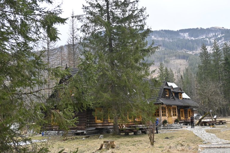
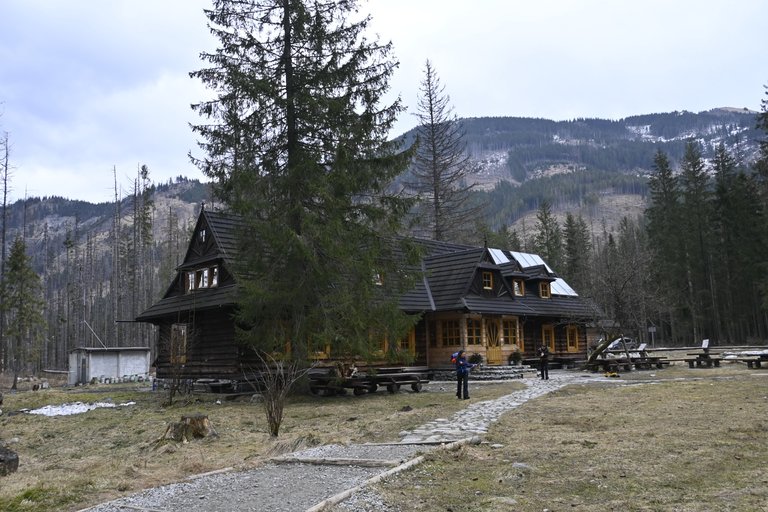
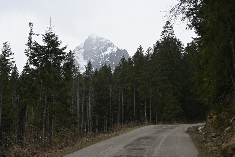
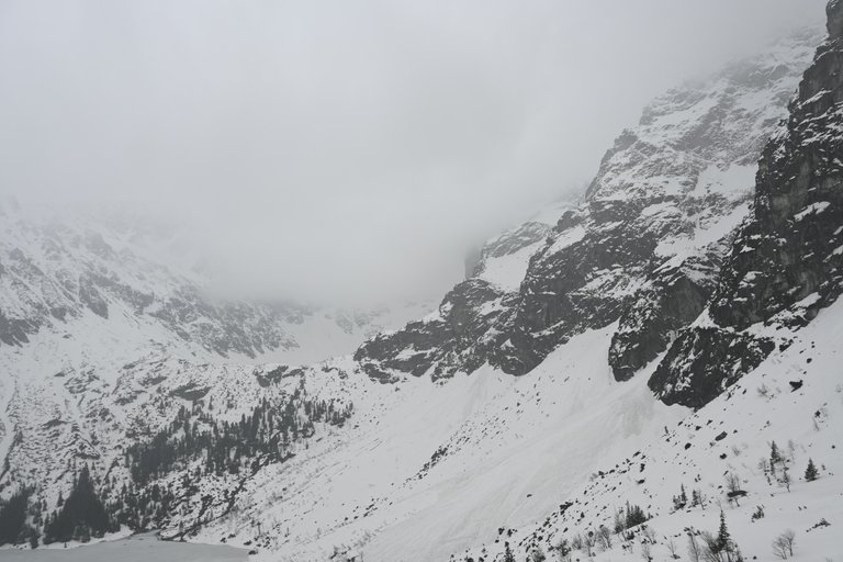
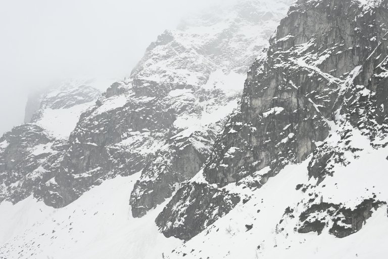
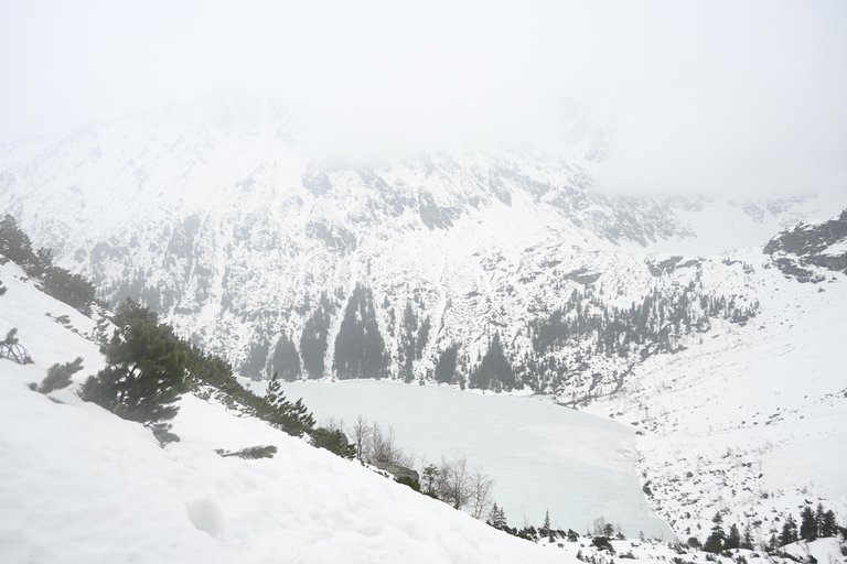
The weather can ruin any plan, especially a plan for hiking in the high mountains prepared several months before the departure. To use any shelter in the Polish Tatras on the weekend, you must plan your trip several months before the departure date. We booked accommodation for the night from Friday to Saturday in the PTTK shelter in the Roztoka Valley. The worst thing was that our trip coincided with the weather getting warmer and, as a result, the avalanche risk dramatically increased. Three days before our departure, the avalanche danger increased from level 2 to level 3. This situation continued until the next day, and only on the day before our departure to the mountains did the avalanche risk drop to level 2 again (which is still not a low value). However, the decision has been made and we are going! On Friday, immediately after leaving work, we packed into the car and headed towards the Tatra Mountains via Zakopane. We set off, which is too much to say, because by the time we left the administrative borders of Krakow, about an hour had passed, but that didn't matter, we still had time until 9 p.m., because it was only at that time that they closed the shelter in the Roztoka Valley. We arrived at the parking lot in Palenica Białczańska around 7 p.m., paid almost PLN 100 for parking for two days (theft) and set off along a wide asphalt road towards Morskie Oko. At this stage there was no snow at all, and I naively started to think that it would last longer. Unfortunately, after reaching Wodogrzmoty Mickiewicza we had to turn off the main road and go down a narrow path leading through the forest. This narrow path was completely icy, so it took us over 20 minutes to complete the section we planned to cover in no more than 10 minutes. Fortunately, the shelter was still open and, most importantly, the buffet was still open. We ordered a beer and one garlic soup for two and went to rest before the next day. People say that the PTTK shelter in the Roztoka Valley is the best in the Polish Tatra Mountains. When I say the best, I mean the tastiest cuisine, the highest standard, the most beautiful construction of the building and I must admit that these opinions are not exaggerated at all.
[PL]
Pogoda potrafi pokrzyżować każdy plan, a zwłaszcza plan wędrówki w wysokich górach układany na kilka miesięcy przed wyjazdem. By skorzystać w weekend z jakiegokolwiek schroniska w Polskich Tatrach trzeba planować wyjazd na kilka miesięcy przed terminem wyjazdu. Nocleg mieliśmy zarezerwowany na noc z piątku na sobotę w Schronisku PTTK w Dolinie Roztoki. Najgorsze było to, że nasz wyjazd przypadł na czas mocnego ocieplenia się pogody, a co za tym idzie radykalnemu wzrostowi zagrożenia lawinowego. Na trzy dni przed naszym wyjazdem stopień zagrożenia lawinowego wzrósł z 2 do 3 stopnia. Tak stan utrzymał się do kolejnego dnia i dopiero w dzień poprzedzający nasz wyjazd w góry zagrożenie lawinowe znów spadło do poziomu 2. (co i tak nie jest mała wartością). Jednak decyzja zapadła i jedziemy! W piątek bezpośrednio po wyjściu z pracy zapakowaliśmy się do samochodu i ruszyliśmy zakopianką w kierunku Tatr. Ruszyliśmy, to za dużo powiedziane, bo nim opuściliśmy administracyjne granice Krakowa minęła już chyba z godzina, ale to nic i tak mieliśmy czas do 21, bo dopiero o tej godzinie zamykali Schronisko w Dolinie Roztoki. Na parking na Palenicy Białczańskiej dotarliśmy ok 19, zapłaciliśmy prawie 100 zł za parking na dwa dni (złodziejstwo) i ruszyliśmy szeroką asfaltową drogą w kierunku Morskiego Oka. Na tym etapie śniegu nie było wcale, a ja naiwnie zacząłem myśleć, że taki stan będzie trwał dłużej. Niestety, po dotarciu do Wodogrzmotów Mickiewicza musieliśmy skręcić z głównej drogi i zejść wąską ścieżka wiodącą przez las. Owa wąska ścieżka była całkowicie oblodzona, przez co odcinek który planowaliśmy pokonać w nie więcej niż 10 minut schodziliśmy ponad 20 minut. Całe szczęście schronisko było wciąż otwarte, a co najważniejsze bufet nadal czynny. Zamówiliśmy sobie piwko oraz jedna zupę czosnkową na dwoje i poszliśmy wypoczywać przed kolejnym dniem. Ludzie mówią, że Schronisko PTTK w Dolinie Roztoki jest najlepszym w polskich Tatrach. Mówiąc najlepsze mam na myśli najsmaczniejszą kuchnię, najwyższy standard najładniejsza konstrukcje budynku i musze przyznać, że te opinie wcale nie są przesadzone.
[ENG]
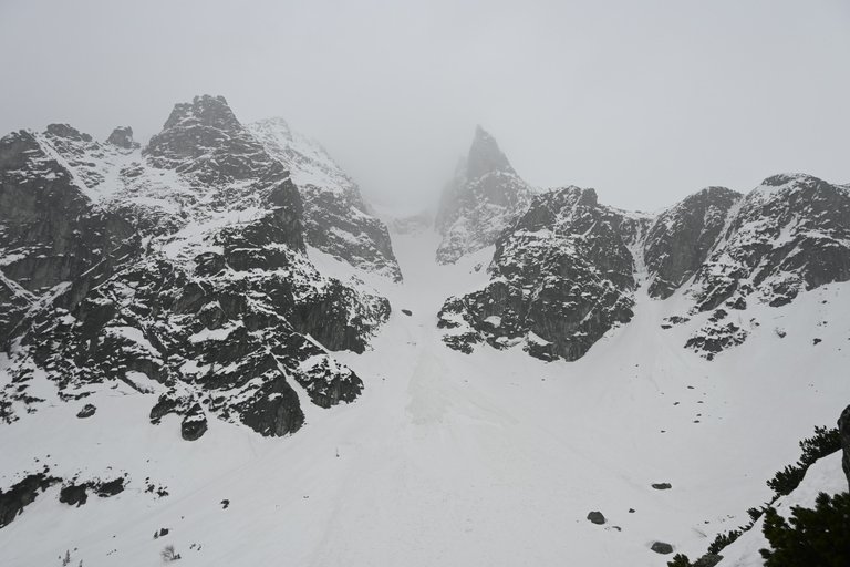
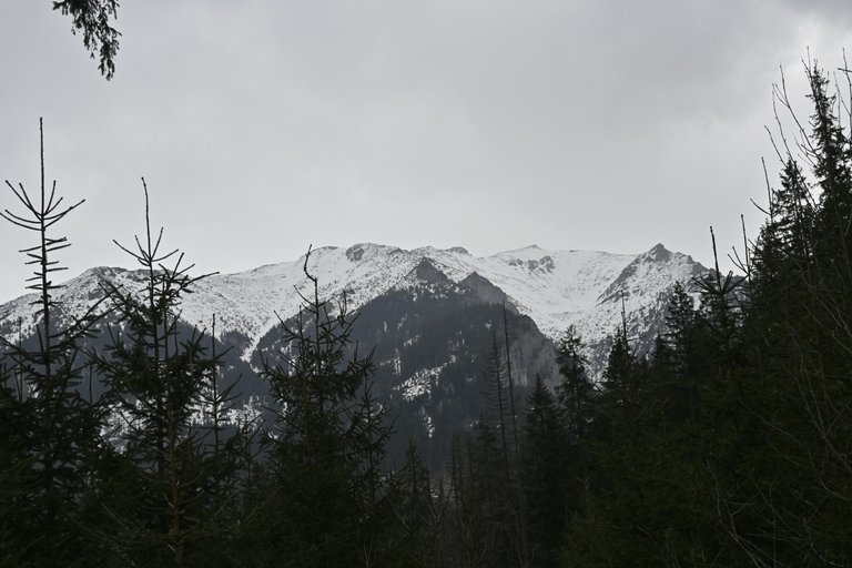
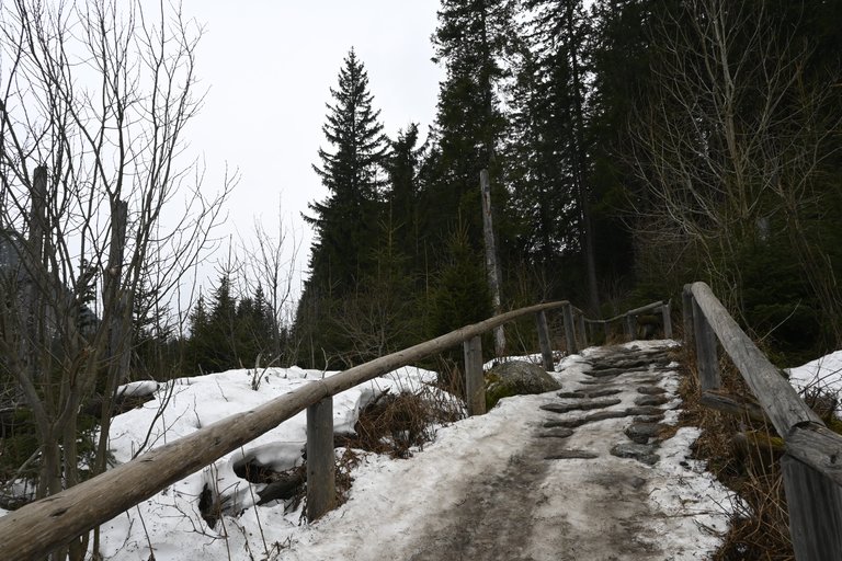
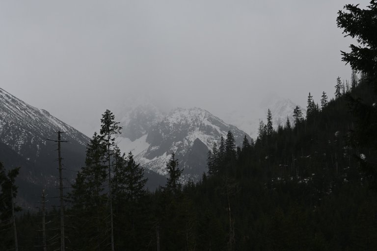
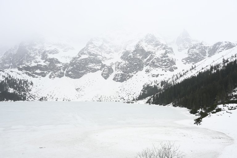
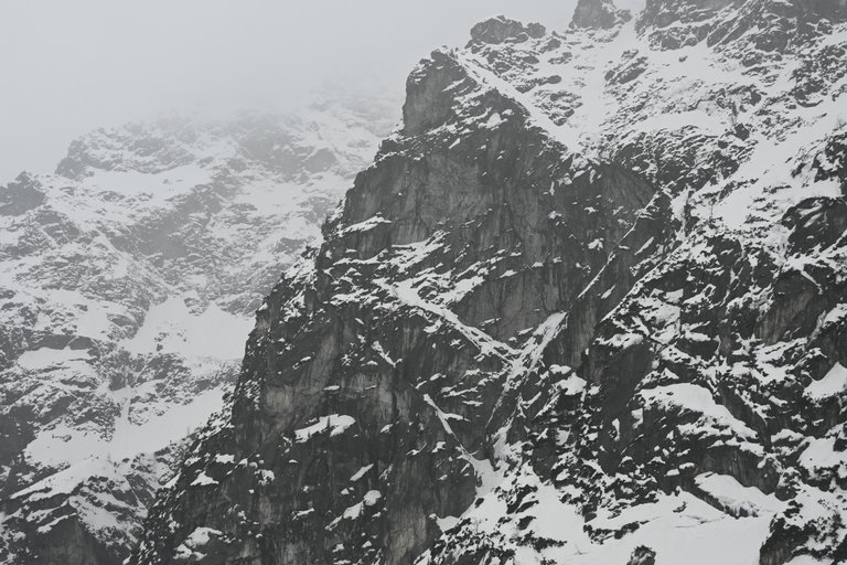
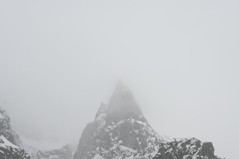
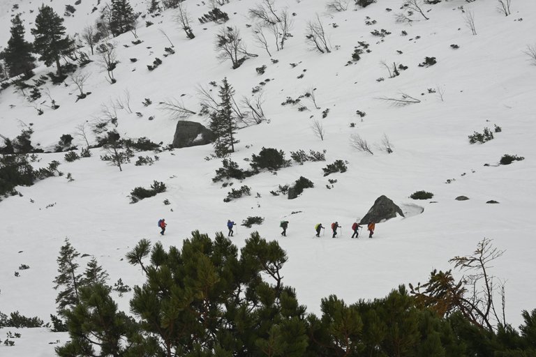
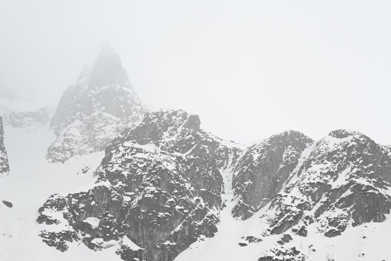
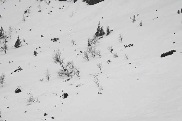
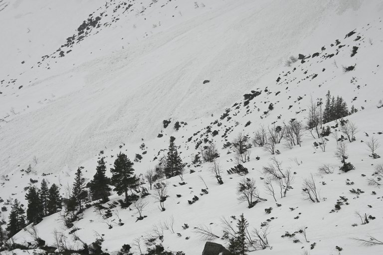
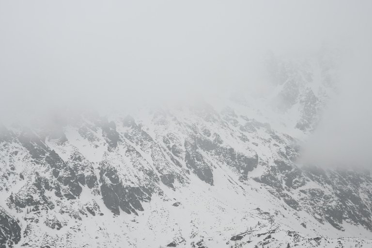
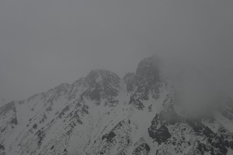
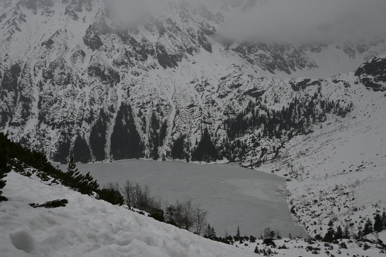
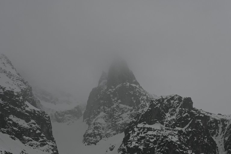
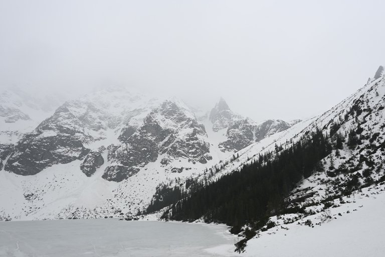
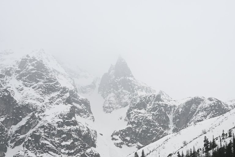
The next day, after a quick breakfast, we left our cozy mountain shelter and set off along the asphalt road to Morskie Oko. The asphalt road was covered with snow only approximately at the height of Włosienica, and from this point the truly winter landscape began. About 500 meters after Włosienica, on the right side, we saw the front of a really large avalanche, about 30 meters from the trail. I may sound like a beetroot boy, but I will say that I have never seen such a large avalanche in my life, and I have seen a lot of them. And it was this sight that influenced our further actions that day. Around 9:00 we reached the PTTK shelter at Morskie Oko, but the weather slowly started to deteriorate, it started to rain lightly, so we decided to hide inside for some time. Inside the shelter it was great. A dozen or so people who spent the night at Morskie Oko ate their breakfasts in peace and quiet and slowly got ready to go to the mountains. We also had a light snack, but unfortunately during our 30-minute break the weather only worsened. Seeing the current conditions in the mountains, remembering the recent announcement about the third degree of avalanche danger and seeing this huge avalanche less than an hour ago, we decided that going to Szpiglasowa Przełęcz, i.e. what we had timidly planned the previous evening, had become completely unrealistic. There were three options. Plan one: We stay in the warm shelter for a while and return to the parking lot, and then we go for a short walk to a peak like Gęsia Szyja, 1,489 m above sea level. or Sarnia Skała 1377 m above sea level Plan two: we go to Czarny Staw Pod Rysami, 1,583 m above sea level. The third plan is the most ambitious - we go to the Valley behind Mnichem, 1788 m above sea level. and we chose him. We set off briskly and walked about 2 kilometers up, then reached the height where the mountain pine plant area begins. It was so annoying because due to the high snow, the proper route of the trail was completely invisible and we were walking blindly, so almost every second step we took ended with us sinking at least knee-deep, and sometimes waist-deep into the void between the branches of mountain pine trees. Struggling with each step, we reached a huge boulder, took off our backpacks, took one last series of photos of the Monk and I ordered a retreat. Because the sum of unfavorable factors has exceeded the critical level. The worst thing was that after reaching the Shelter at Morskie Oko, the place changed beyond recognition. The quiet, peaceful shelter that we saw just two hours ago has become crowded and noisy, thanks to hundreds of tourists trying to take shelter here from the rain. A hundred tourists were just the beginning of a great wave of tourists that was heading towards Morskie Oko and we passed them while returning, soaked, to the parking lot.
[PL]
Kolejnego dnia po szybkim śniadaniu opuściliśmy nasze przytulne górskie schronisko i ruszyliśmy po asfaltowej drodze do Morskiego Oka. Asfaltowa droga pokryła się śniegiem dopiero mniej więcej na wysokości Włosienicy i od tego mniej więcej miejsca zaczął się prawdziwie zimowy krajobraz. Jakieś 500 metrów za Włosienicą po prawej stronie zobaczyliśmy w odległości około 30 metrów od szlaku czoło naprawdę dużej lawiny. Zabrzmię może tak ten chłopiec od buraków, ale powiem, że tak dużej lawiny jeszcze nigdy w życiu nie widziałem, a dużo ich już widziałem. I właśnie ten oto widok zaważył nad naszymi dalszymi działaniami tego dnia. Około 9:00 dotarliśmy do Schroniska PTTK przy Morskim Oku, ale za pogoda zaczęła się pomału psuć, to znaczy zaczynał padać lekki deszcz postanowiliśmy schować się na jakiś czas w środku. Wewnątrz schroniska było ekstra. Kilkanaście osób, które nocowały pod Morskim Okiem w spokoju bez pośpiechu jadło swoje śniadania i powoli szykowali się do swoich wyjść w góry. My tez lekko się posililiśmy, ale niestety w trakcie naszej 30 minutowej przerwy pogoda tylko się pogorszyła. Widząc aktualne warunki w górach, mając w pamięci niedawny komunikat o 3 stopniu zagrożenia lawinowego i widząc niespełna przed godziną tą świeżą ogromną lawinę uznaliśmy, że wyjście na Szpiglasową Przełęcz czyli to co nieśmiało planowaliśmy jeszcze poprzedniego wieczoru stało się kompletnie nierealne. Opcje były trzy. Plan pierwszy: Siedzimy sobie jeszcze chwile w ciepłym schronisku i wracamy na parking i potem ewentualnie pójdziemy na jakiś mały spacer na szczyt typu Gęsia Szyja 1489 m n.p.m. czy Sarnia Skała 1377 m n.p.m. Plan drugi: idziemy nad Czarny Staw Pod Rysami 1583 m n.p.m. Plan trzeci najbardziej ambitny idziemy do Doliny za Mnichem 1788 m n.p.m. i właśnie jego wybraliśmy. Ruszyliśmy dziarsko i przeszliśmy około 2 kilometry w górę, po czym doszliśmy do wysokości gdzie zaczyna się roślinna partia kosodrzewiny. Było to o tyle upierdliwe, że z powodu wysokiego śniegu właściwa trasa szlaku była kompletnie niewidoczna i szliśmy trochę na oślep, przez co niemal co drugi nasz krok kończył się zapadnięciem co najmniej po kolano, a niekiedy po pas w pustkę pomiędzy gałęzie kosodrzewiny. Męcząc się z każdym krokiem doszliśmy go ogromnego głazu, zdjęliśmy plecaki, zrobiliśmy ostatnią serie zdjęć Mnicha i zaordynowałem odwrót. Gdyż suma niekorzystanych czynników przekroczyła poziom krytyczny. Najgorsze okazało się to, że po dojściu do Schroniska nad Morskim Okiem tamto miejsce zmieniło się nie do poznania. Ciche, spokojne schronisko jakie jeszcze dwie godziny temu mieliśmy okazję oglądać stało się tłoczne i głośne, a to za sprawą setki turystów próbujących schronić się tutaj przed deszczem. Setka turystów, to tylko początek z wielkiej fali turystów, która zmierzała w kierunku Morskiego Oka a my mijaliśmy ich wracając przemoczeni na parking.
What beautiful photos you shared make me really want to return to the mountains😍
Congratulations, your post has been added to Pinmapple! 🎉🥳🍍
Did you know you have your own profile map?
And every post has their own map too!
Want to have your post on the map too?
Congratulations @olusiu! You received the biggest smile and some love from TravelFeed! Keep up the amazing blog. 😍 Your post was also chosen as top pick of the day and is now featured on the TravelFeed front page.
Thanks for using TravelFeed!
@for91days (TravelFeed team)
PS: Did you know that we recently launched the truvvl app? With truvvl, you can create travel stories on the go from your phone and swipe through nearby stories from other TravelFeed users. It is available on the Apple App Store and Google Play.
Hiya, @ybanezkim26 here, just swinging by to let you know that this post made it into our Honorable Mentions in Travel Digest #2147.
Your post has been manually curated by the @pinmapple team. If you like what we're doing, please drop by to check out all the rest of today's great posts and consider supporting other authors like yourself and us so we can keep the project going!
Become part of our travel community:
Congratulations @olusiu! You received a personal badge!
Participate in the next Power Up Day and try to power-up more HIVE to get a bigger Power-Bee.
May the Hive Power be with you!
You can view your badges on your board and compare yourself to others in the Ranking
Check out our last posts:
Hello olusiu!
It's nice to let you know that your article will take 14th place.
Your post is among 15 Best articles voted 7 days ago by the @hive-lu | King Lucoin Curator by szejq
You receive 🎖 0.3 unique LUBEST tokens as a reward. You can support Lu world and your curator, then he and you will receive 10x more of the winning token. There is a buyout offer waiting for him on the stock exchange. All you need to do is reblog Daily Report 230 with your winnings.
Buy Lu on the Hive-Engine exchange | World of Lu created by szejq
STOPor to resume write a wordSTART