[ENG]
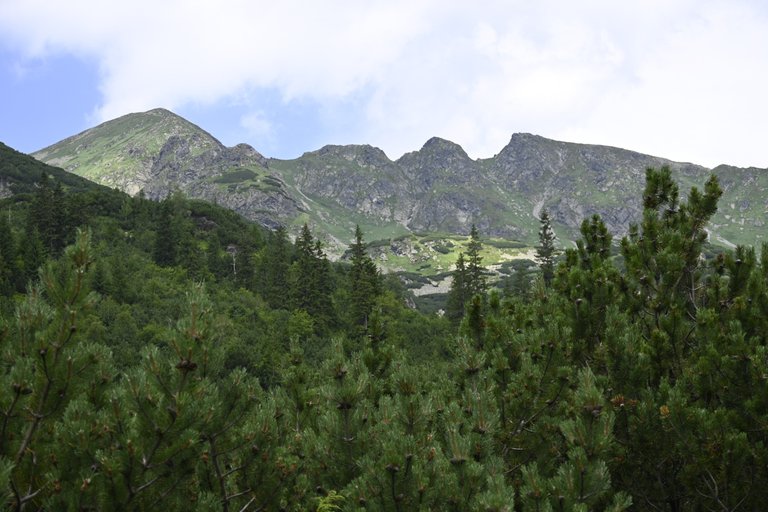
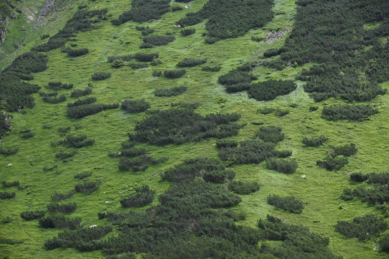
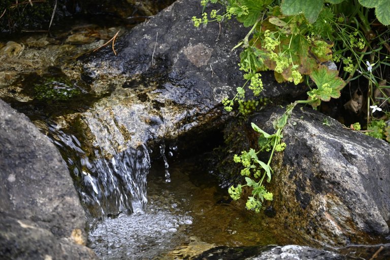
We haven't been to the Tatra Mountains for a long time, but since it's the holidays, we have to follow certain rules, so we have to avoid the Polish part of the Tatra Mountains and the only direction we can take is the Slovak Tatra Mountains. In the Polish part of the Tatra Mountains, hundreds of thousands of tourists hit the trails every weekend during the summer holidays. In the Slovak part of the High Tatras, not hundreds of thousands, but tens of thousands go on the trails, while in the Slovak part of the Western Tatras, only hundreds of tourists go on the trails, so if we are going somewhere during the peak tourist season, it's only there. Our exact destination was Żarska Dolina, which should take about 3 hours to reach. Unfortunately, when we set off for Slovakia on Saturday morning, no one expected that after reaching Zuberec it would turn out that there was a race there and some roads in the area were closed, which meant we had to take a significant detour and the total time to get to the parking lot at the entrance to Żarska Dolina increased to 4 hours. This was the first problem because it meant that we had to start our hike after 10 a.m., which meant that we were exposed to unpleasant, burning sun rays from the very beginning. The first stage led us along the blue trail from the parking lot to the Żarska Chata shelter where we were to sleep that day. Less than 5 kilometers and almost 400 meters of ascent was a good warm-up, especially since 80% of the trail led us through a shaded forest. After reaching the shelter, we drank a large Kofola and ate a second breakfast of roasted cheese with fries. Here I must point out that the cook did not do a great job and in general it was the worst fried cheese we have ever eaten in the Czech Republic or Slovakia, and the real scandal was that there was no garlic soup on the buffet menu! We also managed to leave one of ours in the shelter, which made further mountain climbing more enjoyable. It was already well after 12 p.m. and we had almost 10 kilometers left to cover with a total ascent of 1,100 meters. The tourist map estimated the time needed to complete this route at almost 6 hours, so we had to end our pleasant rest in the shelter and quickly set off on the trail.
[PL]
Dawno już nie byliśmy w Tatrach, ale jako że akurat są wakacje to pewnych zasad trzeba się trzymać, więc trzeba szerokim łukiem omijać Polską część Tatr to kierunek może być tylko jeden Tatry Słowackie. W polskiej części Tatr w wakacje w każdy weekend na szlaki wychodzi setki tysięcy turystów. W Słowackiej części tatr Wysokich na szlaki wychodzą nie setki tysięcy, ale dziesiątki tysięcy, natomiast w Słowackiej części tatr Zachodnich na szlaki wychodzą zaledwie setki turystów, więc jeśli gdzieś w szczycie sezonu turystycznego mamy gdzieś jechać to tylko tam. Jako dokładny cel obraliśmy sobie Żarską Dolinę, do której czas dojazdu powinien wynosić około 3 godzin. Niestety Gdy w sobotę rano ruszaliśmy w na Słowację nikt nie spodziewał się, że po dojechaniu do Zuberca okaże się, że na miejscu jest jakiś wyścig i część dróg w rejonie jest pozamykana, przez co musieliśmy jechać znacznym objazdem i sumarycznie czas dojazdu na parking przy wejściu do Żarskiej Doliny wzrósł nam do 4 godzin. To był pierwszy problem bo oznaczało to, że naszą wędrówkę musimy rozpocząć po godzinie 10 przez co od samego początku narażeni byliśmy na nieprzyjemne palące promienie słoneczne. Pierwszy etap prowadził nas niebieskim szlakiem od parkingu do schroniska Żarska Chata w którym mieliśmy spać tego dnia. Niecałe 5 kilometrów i niemal 400 metrów podejścia to była dobra rozgrzewka zwłaszcza że w 80% szlak prowadził nas po zacienionym lesie. Po dotarciu do schroniska duszkiem wypiliśmy po dużej Kofoli i zjedliśmy drugie śniadanie w postaci wyprażanego sera z frytkami. Tutaj muszę zaznaczyć, że kucharz nie popisał się i generalnie był to najgorszy smażony ser jaki przyszło nam jeść kiedykolwiek w Czechach lub na Słowacji, a prawdziwym skandalem było to, że w bufetowym menu nie było zupy czosneczkowej! Udało się też w schronisku zostawić jeden z naszych dzięki czemu dalsza wspinaczka górska miała być przyjemniejsza. Było już grubo po 12 a nam zostało do przejścia niemal 10 kilometrów z łączną suma podejść 1100 metrów. Mapa turystyczna szacowała potrzebny czas na przejście tej trasy na niemal 6 godzin, więc trzeba było kończyć przyjemny odpoczynek w schronisku i rychło ruszać na szlak.
[ENG]
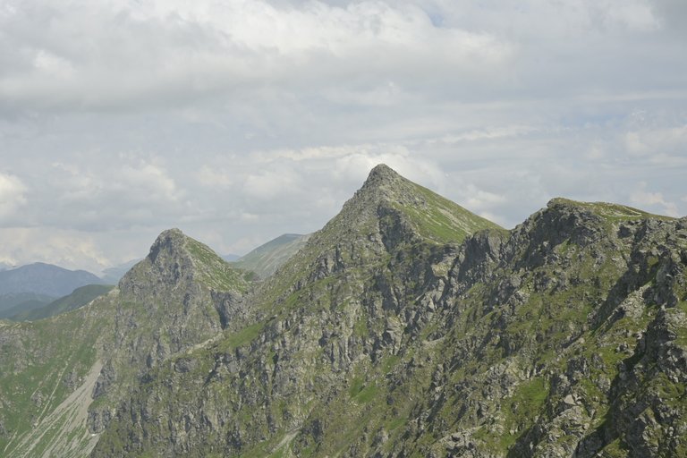
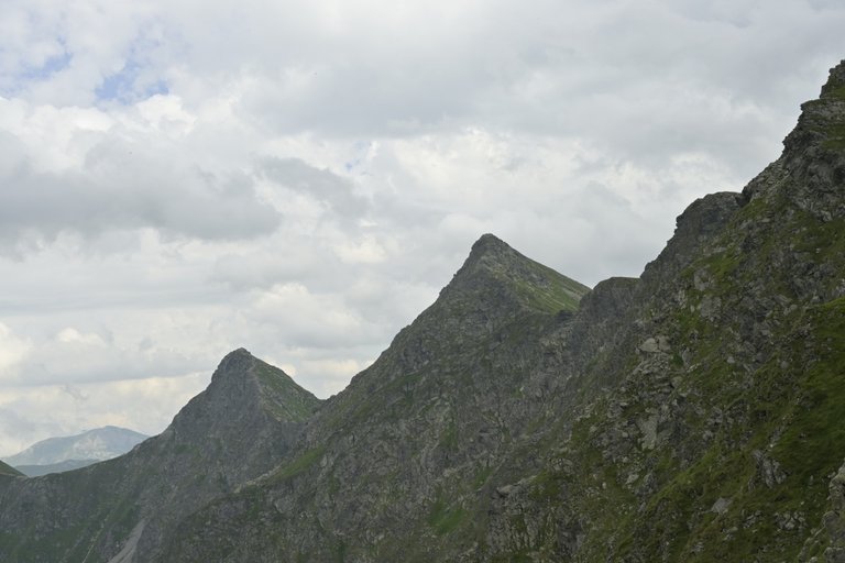
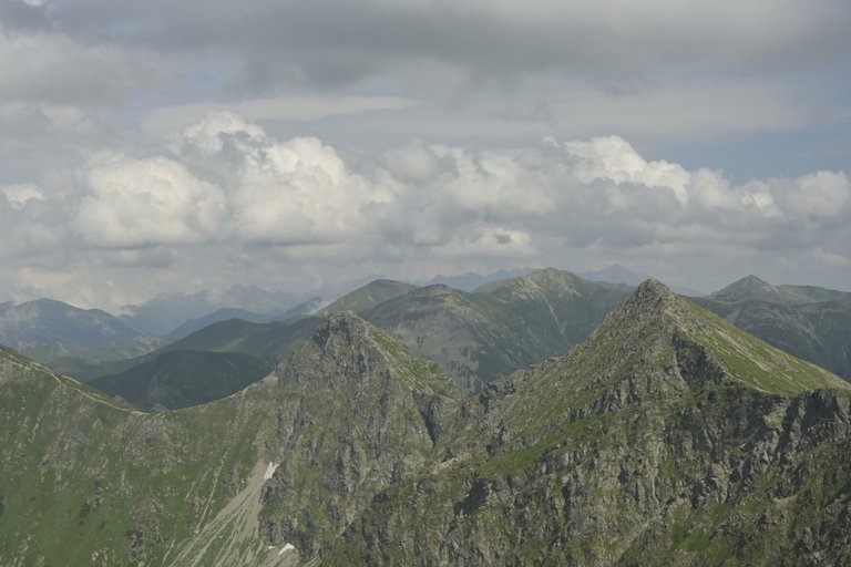
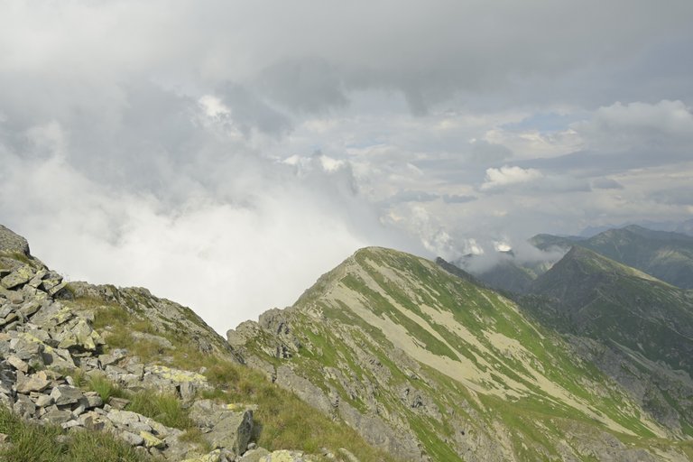
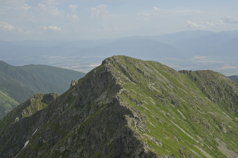
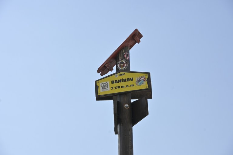
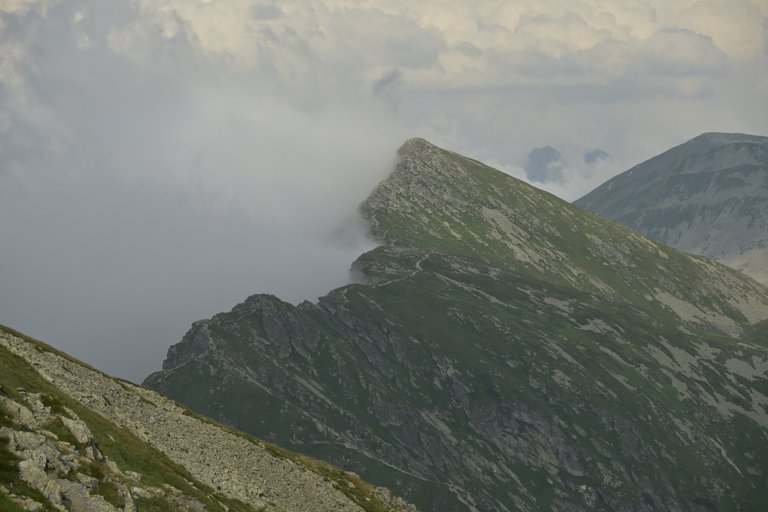
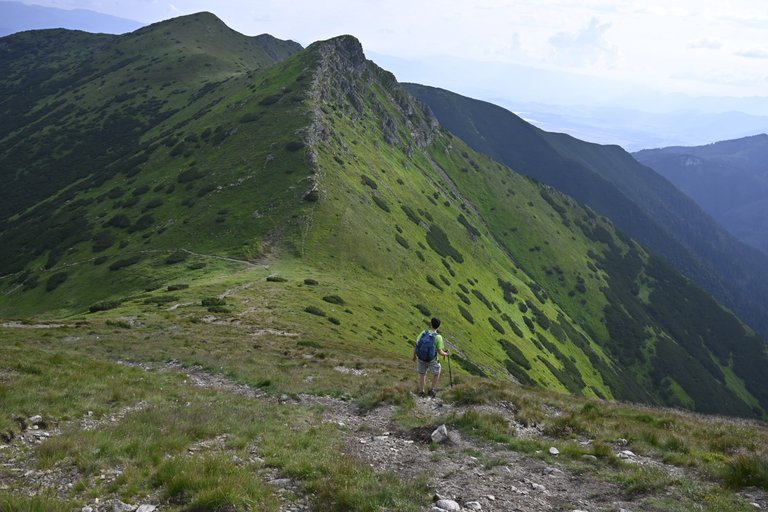
The first kilometers after leaving the shelter were still quite bearable, because approximately until we exceeded the altitude of 1,600 meters above sea level, there were trees growing along the trail from time to time, thanks to which we managed to walk in the shade and the hot weather was not so bothersome. Problems began only at the junction of the blue and green trails in a place called Pod Homôľkou. Then we still had 300 meters of ascent to Smutna Przełęcz, in full sun. We made it to the pass with a lot of effort and then the weather changed completely. The sun hid behind the clouds and the strong wind forced us to take our jackets out of our backpacks. And that was quite good, because now we were facing the worst part of the route, namely the crossing of Trzy Kopy. While still at the pass, we met two Polish tourists descending from Trzech Kopy, and we politely asked them: "how's it going, how's the trail?" The answer froze us a bit. They said that the route we were going on, from Banikowo, through Huba Kopa, to Trzech Kopa, was in their opinion the most difficult trail they had ever encountered in the Tatra Mountains. We went up with our hearts on our shoulders and it wasn't easy. Trzy Kopy are three separate rocks through which you have to slowly get through with the help of chains. From what I remember, the middle kick was the worst, and walking over the abyss on a narrow ledge secured only by a chain made my legs slightly weak. After Trzech Kopy, we had to climb Hruba Kopa and this was a big surprise, because it was just an ordinary peak like many others in the Western Tatras. Just an ordinary path leading up and then down. More problems began on the approach to the summit of Banikov. Here, unlike Trzech Kop, there were no trail markings at all. This was the worst, because when climbing this peak, it happened several times that I climbed somewhere and only after climbing a rock did I realize that the trail led to another place and I had to go back. It was only a moment from Banikowo and we reached the last peak we were supposed to climb that day, Prislop. The way back to the shelter was an arduous descent along the green trail 900 meters down. After returning, we ordered a large kofoli again and went for a well-deserved rest, because the next day was also going to be hard.
[PL]
Pierwsze kilometry po wyjściu z schroniska były jeszcze całkiem znośne, bo mniej więcej do momentu kiedy przekroczyliśmy wysokość 1600 metrów nad poziomem morza co jakiś czas zdarzały się drzewa rosnące wzdłuż szlaku, dzięki czemu udawało się iść cieniem i upalna pogoda nie była aż tak bardzo doskwierająca. Problemy zaczęły się dopiero na rozejściu szlaków niebieskiego i zielonego w miejscu zwanym Pod Homôľkou. Wówczas mieliśmy jeszcze 300 metrów podejścia na Smutną Przełęcz i to w pełnym słońcu. Dużym wysiłkiem wyleźliśmy na ta przełęcz i wówczas pogoda kompletnie się odmieniła. Słońce schował się za chmury, a mocny wiatr sprawił, że musieliśmy z plecaków wyciągnąć kurtki. I to całkiem dobrze, bo właśnie teraz czekał nas najgorszy fragment trasy, a mianowicie przejście przez Trzy Kopy. Jeszcze na przełęczy spotkaliśmy schodzących z Trzech Kop dwóch polskich turystów, których zapytaliśmy grzecznościowo: „jak leci, jak tam szlak”. Odpowiedź trochę nas zmroziła. Powiedzieli, że trasa na którą właśnie się wybieraliśmy z Banikowa, przez Huba Kopa, aż do Trzech Kop ich zdaniem była najtrudniejszym szlakiem jaki kiedykolwiek spotkali w Tatrach. Z duszą na ramieniu ruszyliśmy w górę i faktycznie nie było łatwo. Trzy Kopy to trzy oddzielne skały, przez które z pomocą łańcuchów trzeba się powoli przedostać. Z tego co pamiętam to najgorsza była środkowa kopa, a przejście nad przepaścią po wąskiej półce zabezpieczonej wyłącznie łańcuchem sprawiało, że nogi lekko miękły. Po Trzech Kopach czekało nas wejście na Hrubą Kopę i tutaj duże zaskoczenie, bo to był zwykły najzwyklejszy szczyt jakich wiele w Tatrach Zachodnich. Ot zwykła ścieżka prowadząca w górę, a później w dół. Kolejne kłopoty zaczęły się na podejściu na szczyt Banikow. Tutaj w przeciwieństwie do Trzech Kop nie było wcale żadnego oznakowania szlaku. To była najgorsze, bo wchodząc na ten szczyt kilkukrotnie zdarzyło się, że wlazłem gdzieś i dopiero po wejściu na jakąś skałę orientowałem się, że szlak prowadzi w inne miejsce i musiałem się cofać. Z Banikowa już tylko chwila i weszliśmy na ostatni szczyt jaki mieliśmy zdobyć tego dnia czyli na Prislop. Droga powrotna do schroniska to było żmudne schodzenie po zielonym szlaku 900 metrów w dół. Po powrocie ponownie zamówiliśmy sobie po dużej kofoli i udaliśmy się na zasłużony odpoczynek, bo kolejny dzień tez miał być ciężki.

Too bad about the food at the refuge! There's nothing worse than expecting a delicious meal after a long hike and being disappointed. And the absence of the garlic soup is truly a miss for those who love local specialties, you'll see that next time it will be better!! Always keep going!!😋
Congratulations, your post has been added to the TravelFeed Map! 🎉🥳🌴
Did you know you have your own profile map?
And every post has their own map too!
Want to have your post on the map too?
- Go to TravelFeed Map
- Click the create pin button
- Drag the marker to where your post should be. Zoom in if needed or use the search bar (top right).
- Copy and paste the generated code in your post (any Hive frontend)
- Or login with Hive Keychain or Hivesigner and click "create post" to post to Hive directly from TravelFeed
- Congrats, your post is now on the map!
PS: You can import your previous Pinmapple posts to the TravelFeed map.Opt Out
Congratulations, your post has been added to WorldMapPin! 🎉
Did you know you have your own profile map?
And every post has their own map too!
Want to have your post on the map too?
Congratulations @olusiu! You received a bright smile from TravelFeed. Our eyes were beaming while reading your post. 😁
Thanks for using TravelFeed!
@for91days (TravelFeed team)
PS: Why not share your blog posts to your family and friends with the convenient sharing buttons on TravelFeed?
Hello olusiu!
It's nice to let you know that your article will take 13th place.
Your post is among 15 Best articles voted 7 days ago by the @hive-lu | King Lucoin Curator by szejq
You receive 🎖 0.8 unique LUBEST tokens as a reward. You can support Lu world and your curator, then he and you will receive 10x more of the winning token. There is a buyout offer waiting for him on the stock exchange. All you need to do is reblog Daily Report 362 with your winnings.
Buy Lu on the Hive-Engine exchange | World of Lu created by szejq
STOPor to resume write a wordSTART