I welcome all readers to the next part of travel notes on the long-distance European route E3. In today's episode, we will look deeper into the Malá Fatra mountain range in western Slovakia.
Vítám všechny čtenáře u dalšího dílu zápisků z cest po dálkové Evropské trase E3. V dnešním díle se podíváme hlouběji do pohoří Malé Fatry na západním Slovensku.
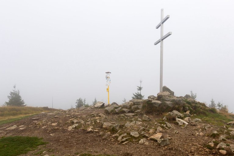
In the morning I had planned to get up at sunrise, but I woke up a little earlier because I thought my sleeping bag wasn't completely dry. Which turned out to be true. Because wet clouds from the valley were rolling onto the top of Minčol. So it was clear that nothing would come of the sunrise either. That's why I quickly packed up and set off further on the trail, saying that I would have breakfast later.
Ráno jsem měl v plánu vstávat na východ slunce, ale probudil jsem se o trochu dříve, protože mi přišlo že můj spacák není úplně suchý. Což se ukázalo jako skutečnost. Protože se na vrchol Minčol valily vlhké mraky z údolí. Takže bylo jasné, že z východ slunce taktéž nic nebude. Proto jsem se rychle zabalil a vyrazil dále na stezku, s tím že se nasnídám později.
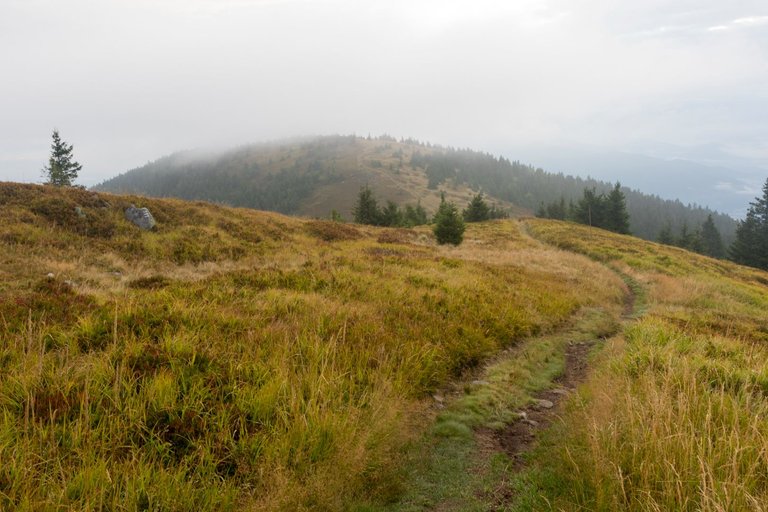
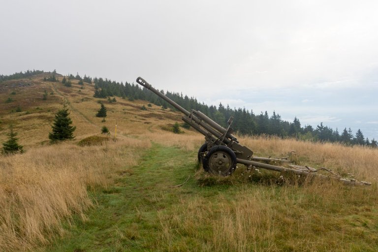
From the top, I started to descend to the mountain pass of name Okopy, where you can see a cannon from the Second World War as a reminder of the heavy fighting between the Germans and the Russians for the Fatra Mountains.
Z vrcholu jsem začal klesat do sedla Okopy, kde je k vidění dělo z druhé světové války jako připomínka těžkých bojů mezi Němci a Rusy o Fatranské pohoří.
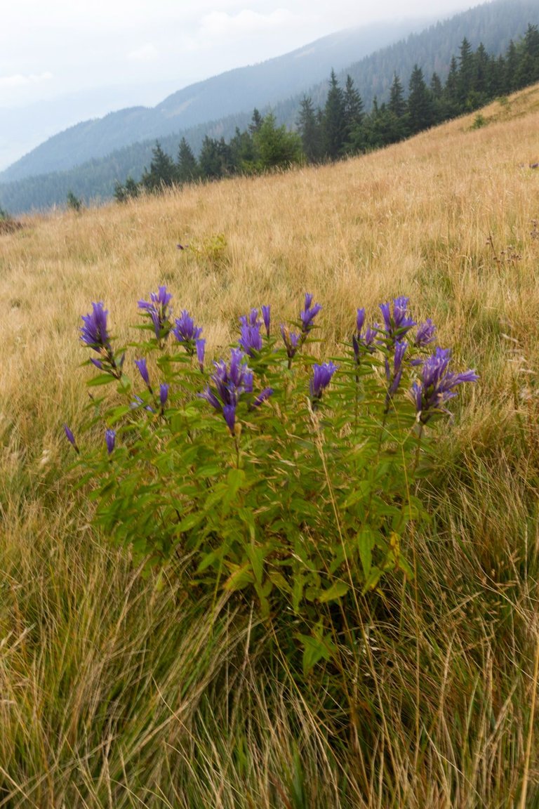
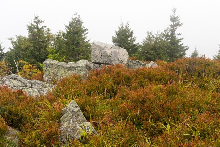
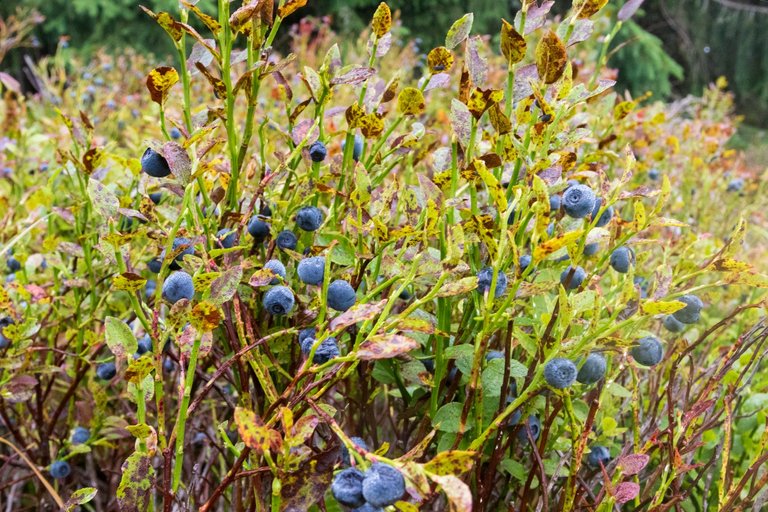
Many interesting plants grew on the way from the pass to other peaks. But I was most interested in the huge blueberries, which ended up replacing the planned breakfast.
Cestou ze sedla na další vrcholy rostlo mnoho zajímavých rostlin. Ale nejvíce mě zaujaly obrovské borůvky, které nakonec zastoupily plánovanou snídani.
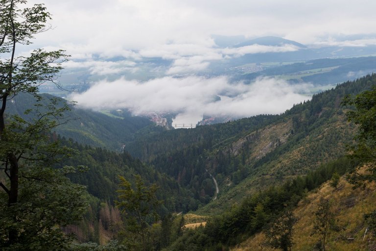
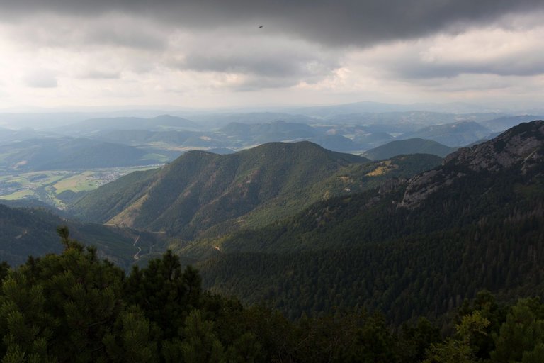
When I reached the mountain pass of Javorina, from where I started to descend back to the river Váh, which I crossed a few days ago. Panoramic views of the town of Strečno with the castle on the hill above the town opened up.
Když jsem došel do sedla Javorina odkud jsem začal klesat zpět k řece Váh, kterou jsem překonal několik dní zpět. otevřeli se předemnou výhledy na městečko Strečno s hradem na kopci nad městem.
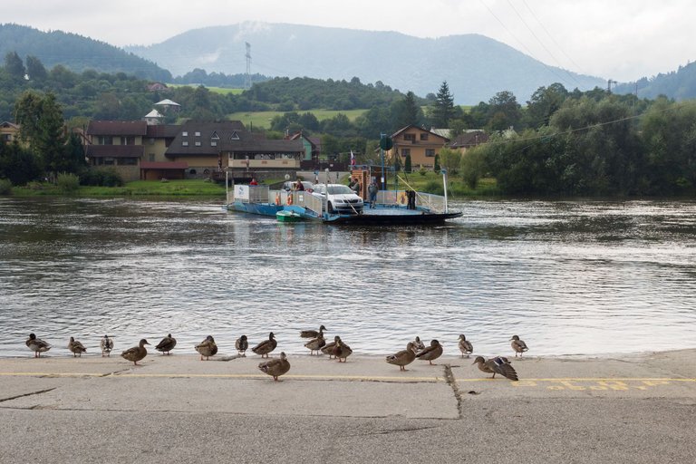
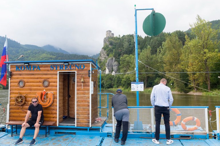
I had planned to visit the castle, but in some mysterious way I managed to miss right way. Probably because it wasn't marked from the hill and I didn't want to go back up the hill. So I headed to the local convenience store with a plan to cross the bridge to the other side of the river. But the bridge was closed so I had to use the ferry.
Měl jsem v plánu navštívit hrad, ale nějakým záhadným způsobem se mi podařilo přejít odbočku. Asi proto že nebyla z kopce značena a už se mi nechtělo vracet zpět do kopce. Tak jsem se vydal do místní samoobsluhy s plánem přejít přes most na druhou stranu řeky. Jenže most byl uzavřen a tak jsem musel použít přívoz.
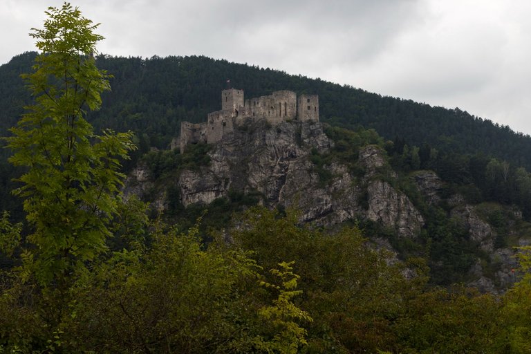
There was a better view of the castle from the other side of the river than from the side I came from.
Z druhé strany řeky byl lepší výhled na hrad, než ze strany odkud jsem přišel.
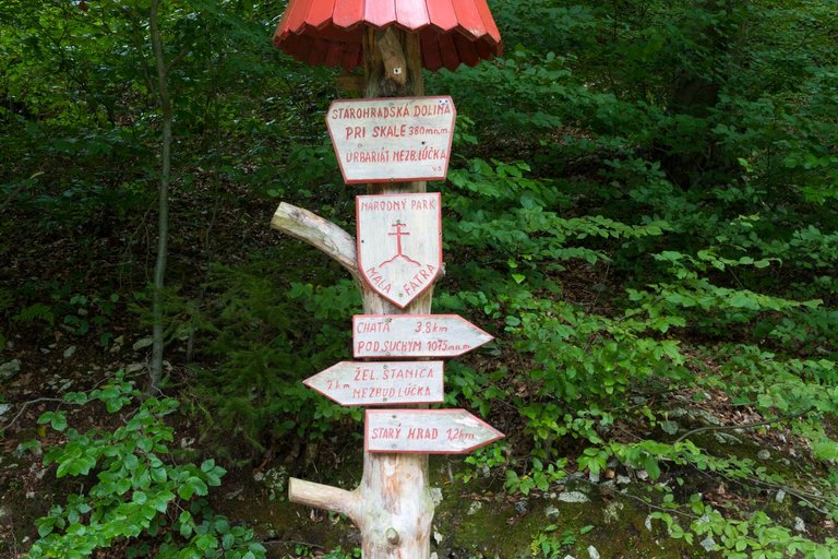
Not long after, I arrived at the border of the Malá Fatra National Park, where was also this interesting tourist sign.
Za nedlouho jsem dorazil na hranici Národního parku Malá Fatra, kde byla i tato zajímavé turistická cedule.
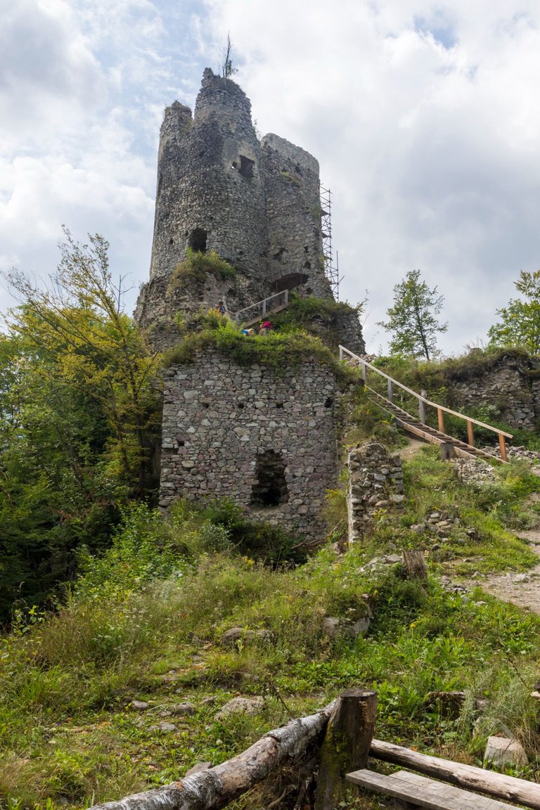
From the sign it started to be pretty much uphill. From the river to the Starý hrad (Old Castle), it was about a 100 meter elevation gain. But as I later found out, it was only a warm-up before what awaited me.
Od cedule to začalo být poměrně hodně do kopce. Od řeky k Starý hrad to bylo asi 100 metrů převýšení. Ale jak jsem později zjistil byla to pouze rozcvička předtím co mě čekalo.
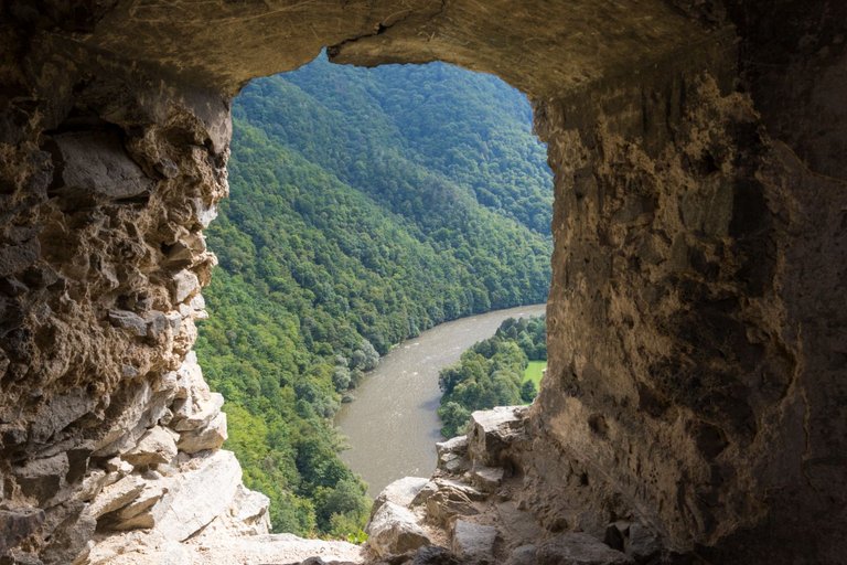
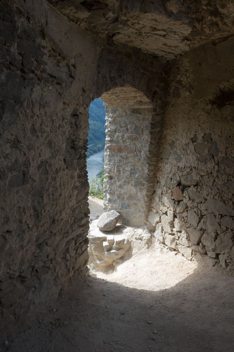

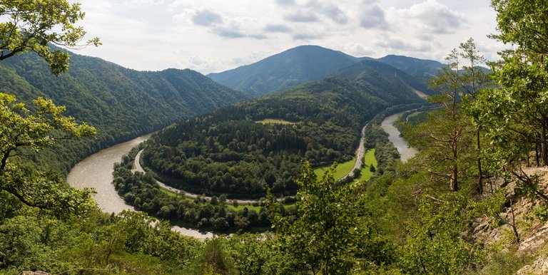
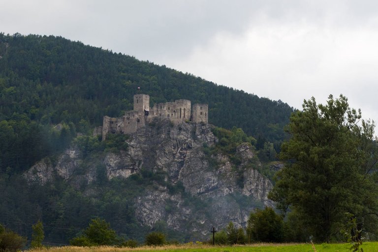
From the windows of the castle there were many views of the meander of the river Váh and from a nearby vantage point even of the entire arch that the river forms here.
Z oken hradu bylo mnoho výhledů na meandr řeky Váh a z nedaleké vyhlídky dokonce na celý oblouk, který zde řeka tvoří.
Then there was only a brutal climb with an elevation gain of 450 meters in less than 4 kilometers to the hut Chata pod Suchým. Here I had a pair of Radegast beers. And I continued to the Suchý peak (1468m), which was another 400 meters of elevation over 2 kilometers.
Pak už následovalo jen brutální stoupáni s převýšením 450 metrů na necelých 4 kilometrech k chatě pod Suchým. Zde jsem si dal na posilněnou dvojici piv značky Radegast. A pokračoval dále na vrchol Suchý (1468m) což bylo dalších 400 metrů převýšení na 2 kilometrech.
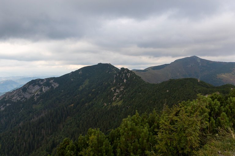
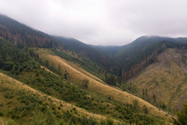
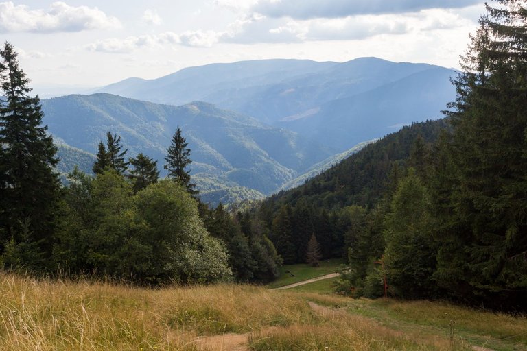
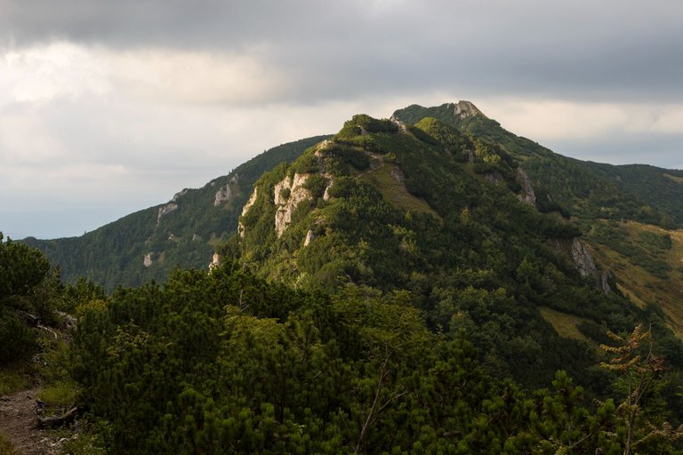
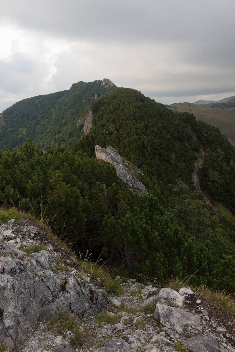
Here I just saw what actually awaits me next. A relatively uncompromising ridge path over several other peaks. The weather was still relatively good at the time, but gradually it started to deteriorate.
Zde jsem teprve uviděl co mě vlastně dále čeká. Poměrně nekompromisní hřebenová cesta přes několik dalších vrcholů. Počasí to dobou bylo ještě poměrně dobré, ale postupně se začalo kazit.
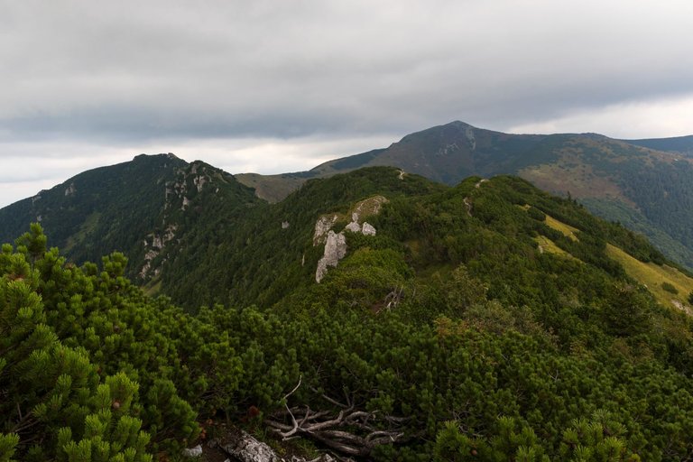
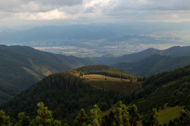
From a distance, the path looked passable, but the opposite was true, every summit climb took its physical toll, and the sunset was relentlessly approaching, and finding a place to sleep in this terrain was a real challenge.
Z dálky cesta vypadala schůdně, ale opak byl pravdou každé zdolání vrcholu si vybralo svojí fyzickou daň a západ slunce se nekompromisně blížil a najít místo na spaní v tomto terénu byla skutečně výzva.
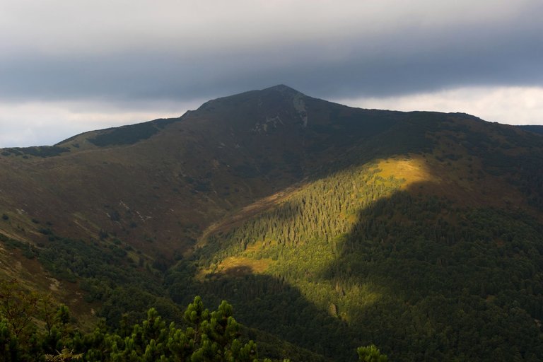
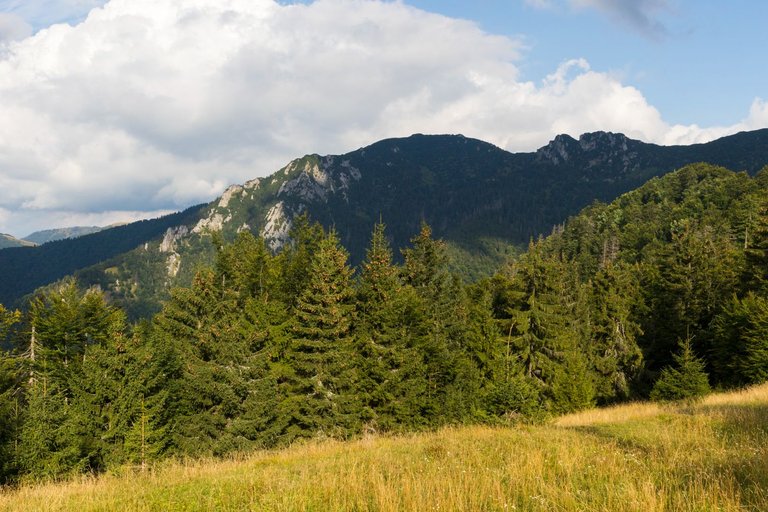
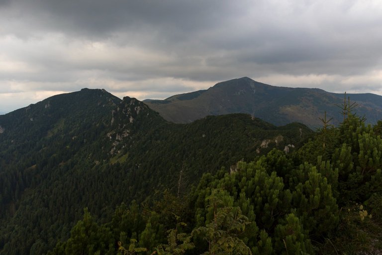
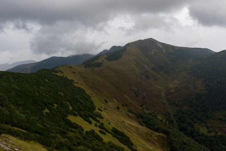
The clouds at the top of Malý Kriváň (1671m) did not look good at all, even though the sun occasionally shone through.
Mraky na vrcholem Malý Kriváň (1671m) nevypadaly vůbec dobře i když občas skrz prosvitlo slunce.
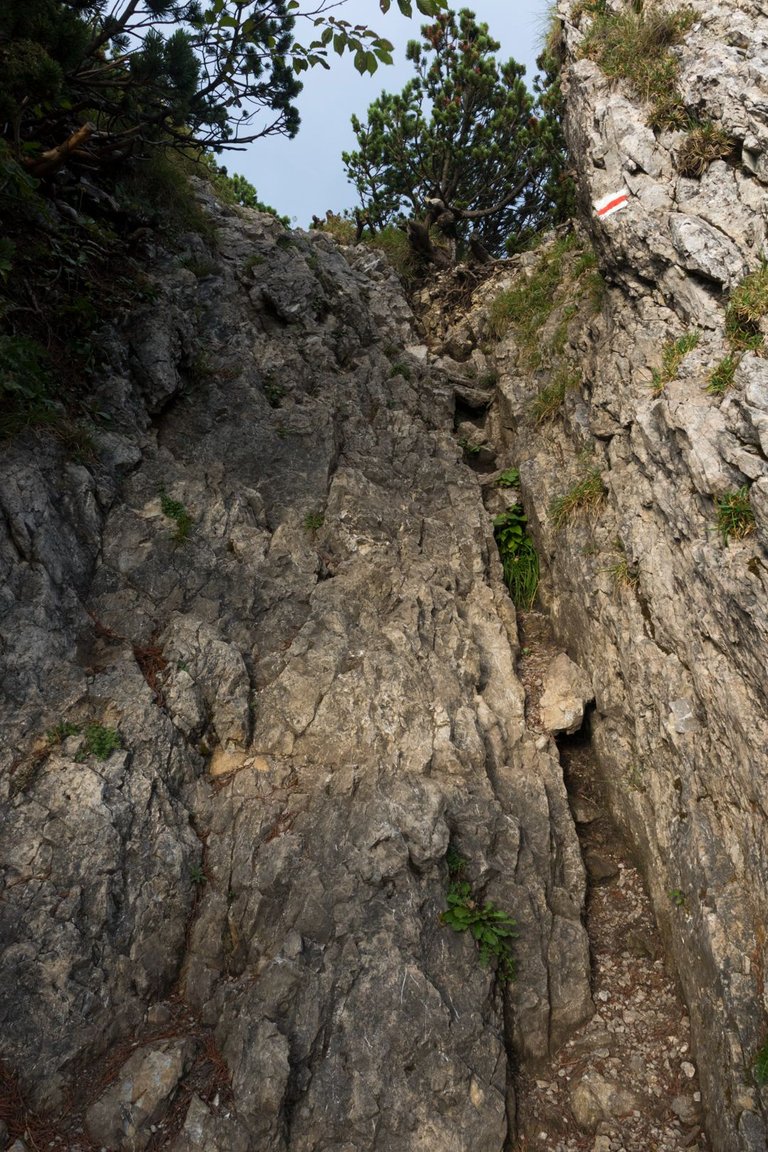
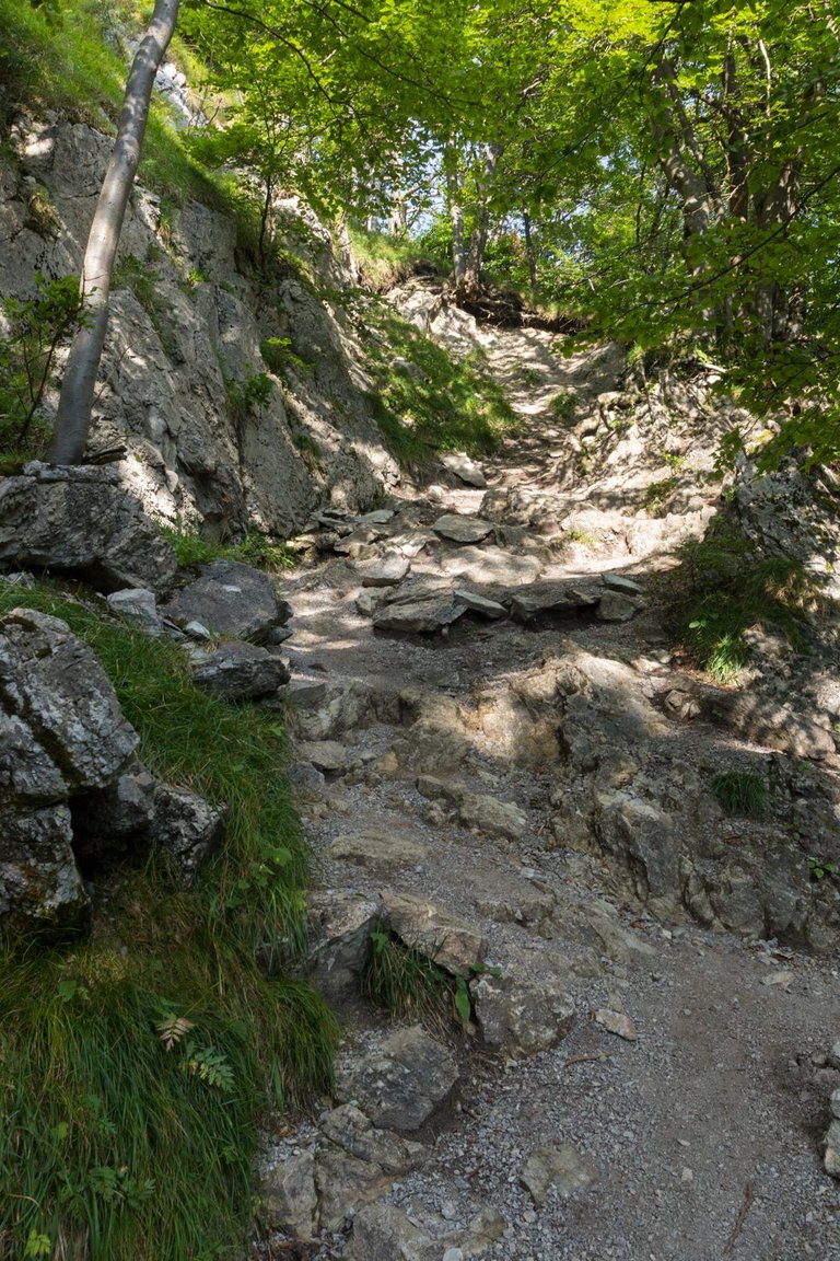
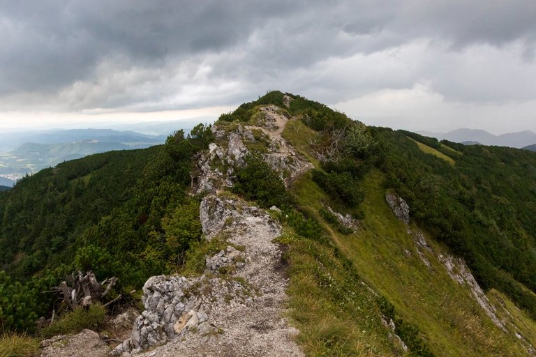
The terrain in this section of the trail was quite challenging in places and sometimes required some basic rock climbing.
Terén v tomto úseku stezky byl místy dost náročný a občas vyžadoval i nějaké to základní lezení po skále.
When I finally reached the end of the difficult ridge, I still had no win. Because a place to sleep had to be found. And that's what I was hoping for somewhere around Malý Kriváň.
Když jsem se konečně dostal na konec těžkého hřebenu, stále jsem neměl vyhráno. Protože bylo třeba najít místo na spaní. A v to jsem doufal někde v okolí Malého Kriváně.
But before I got to the place it was quite dark, a strong wind started blowing and mainly it started to rain lightly. Which made my options more and more complicated. So not only did I have to find a flat surface, I had to find a flat surface downwind in order for my shelter to survive strong gusts of wind. Which was finally achieved almost another 2 km further beyond the fork to the top. By this time it was pitch black, so I was glad to crawl into the shelter, lay down to sleeping bag and sleep.
Ale než jsem se na místo dostal byla již poměrně tma , začal foukat silný vítr a hlavně začalo jemně pršet. Což moje možnosti stále více komplikovalo. Takže nejenomže jsem musel najít rovnou plochu, musel jsem najít rovnou plochu v závětří, aby můj přístřešek přežil silné poryvy větru. Což se nakonec podařilo skoro o další 2 km dále za rozcestím na vrchol. Tou dobou byla již černočerná tma a tak jsem byl rád, že jsem zalezl do přístřešku a uložil se ke spánku.
| Total distance traveled | Conquered peaks | Total altitude |
|---|---|---|
| 1217.7 Km | 193 | 69120 m |
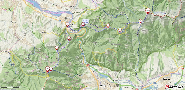
This day was one of the hardest I have ever experienced and by the end of the day it was a real fight for survival as I was severely hypothermic from the cold rain and wind. At a distance of 23 kilometers, I descended 1382 meters and climbed 1469 meters. Of that, 1,000 meters were only at 9 kilometers from the Váh river to Suchý peak.
Tento den byl jeden z nejnáročnějších co jsem kdy zažil a ke konci dne se jednalo o skutečný boj o přežití, protože jsem byl silně podchlazen od studené deště a větru. Na vzdálenosti 23 kilometrů jsem klesnul o 1382 metrů a vystoupal o 1469 metrů. Z toho 1000 metrů bylo jen na 9 kilometrech od řeky Váh na vrchol Suchý.
The landscape and the peaks looks challenging, i like all the photos. nice sharing
What a beautiful trekking with stunning landscapes and views!! Thanks a lot for sharing!!
When a person is worried and problems are going on in life, the best solution is to go to a place with such a beautiful natural view for a few days. There are many good effects on the mind of a person and it is very beneficial for a person to see such mountains and all other things.
Wow, walking through nature is wonderful. Top photographs 📸 Thanks for sharing ☺️
Oh, you are an adventurer. That's so cool. The views are beautiful and I love walking with you (through the screen) If I could I would enlist in that hike, no matter how high you have to climb.
How about this, does it help with the steep routes? lol.
A pleasure to read you and admire these wonderful photos.
Beers are great at hikes. Bacause they have lot of vitamins and natural sugar. Two are maximum what I drink, because if I take more. World start dizzing.
What a wonderful place with unique views. Seeing the wildness of the mountains to the rivers seems exciting to me, the castle is beautiful. An exceptional adventure, but I think a little dangerous. It should be done as a team to have help in case of problems. I've also wondered if there are large, dangerous animals there. Thanks for sharing and take care of your body from the cold and hard rocks. Greetings from the hive in Cuba.
The place was a bit dangerous, but I've been through enough, so I'm especially careful in dangerous situations so that nothing happens to me. Slovakia has the largest concentration of brown bears in Europe, wolves and lynxes also live here. But by this time bears are fed before winter and wolves and lynx avoid people.
Yes, the nature, the fresh air, the fairytale views all outline an amazing experience in the middle of nature, I'm a big lover of nature walks.
I love them too. Sometimes they are fairy tales and sometimes they can turn into horror in a moment. Especially in wild nature, which is usually mountains.
We have to be aware that when we walk in the woods or hike in the mountains we are not at home and yes, these places can become dangerous, they can take their toll, but we must always trust ourselves to respect nature and it will all be a wonderful experience, I am sure of that.
Congratulations, your post has been added to Pinmapple! 🎉🥳🍍
Did you know you have your own profile map?
And every post has their own map too!
Want to have your post on the map too?
Congratulations @softa! You have completed the following achievement on the Hive blockchain And have been rewarded with New badge(s)
Your next target is to reach 110000 upvotes.
You can view your badges on your board and compare yourself to others in the Ranking
If you no longer want to receive notifications, reply to this comment with the word
STOPCheck out our last posts:
Hiya, @livinguktaiwan here, just swinging by to let you know that this post made it into our Top 3 in Travel Digest #2047.
Your post has been manually curated by the @pinmapple team. If you like what we're doing, please drop by to check out all the rest of today's great posts and consider supporting other authors like yourself and us so we can keep the project going!
Become part of our travel community:
Congratulations @softa! Your post has been a top performer on the Hive blockchain and you have been rewarded with this rare badge
You can view your badges on your board and compare yourself to others in the Ranking
If you no longer want to receive notifications, reply to this comment with the word
STOPCheck out our last posts: