Sometime you’ve just got to do some research, find a reliable map, check the weather and set off on your hike.
This hike was kind of like that. No one that I mentioned it to was offering to do it with me and I was desperate to check it out. I had heard that the views were beautiful and I couldn’t think of a better thing to do on the weekend to celebrate my birthday.
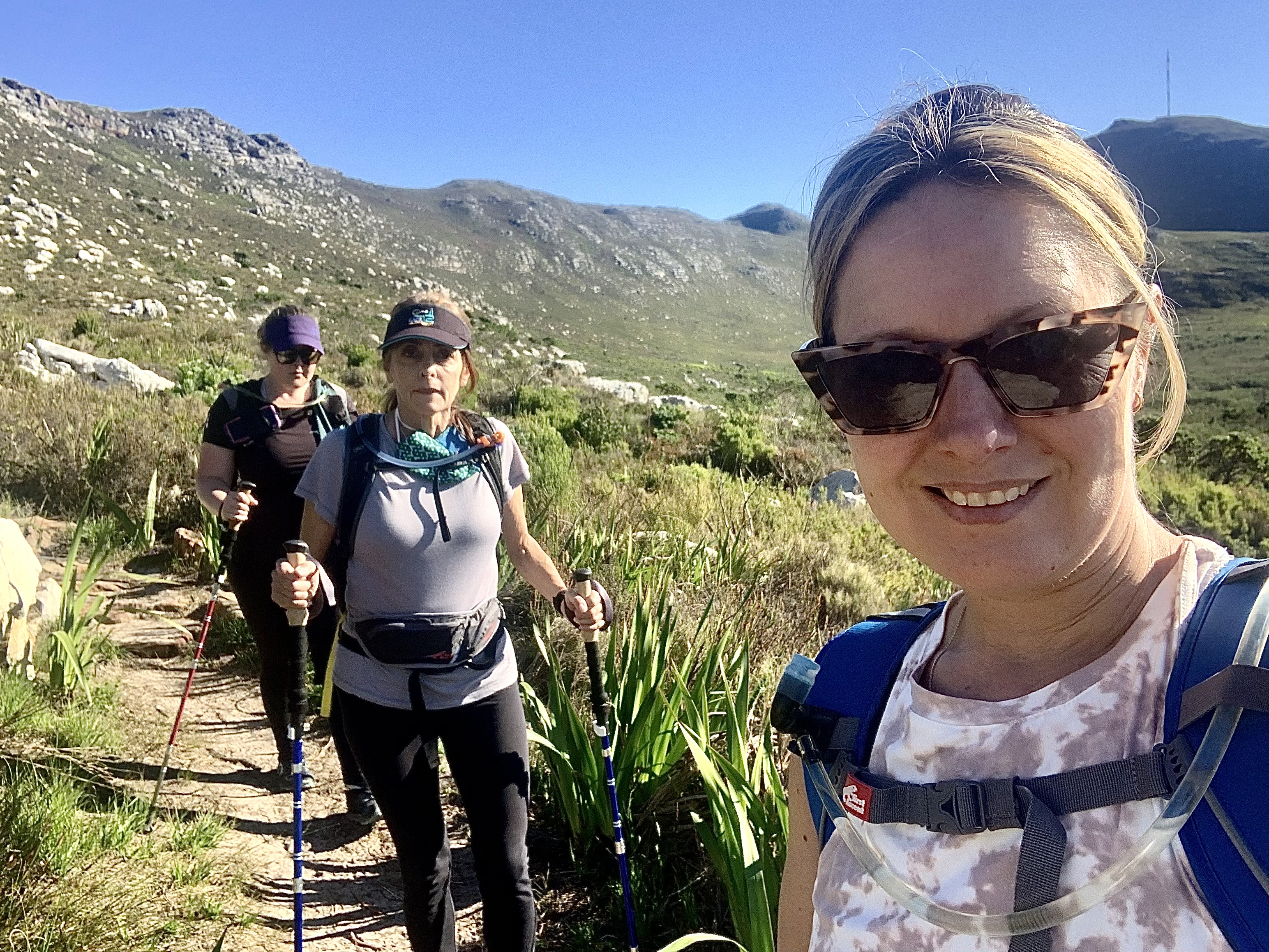
Luckily my sister is doing much better since her Multiple Sclerosis relapse in January - it’s taken some time. But she’s finally up to joining me on the mountain. My aunt is always keen to hike so she doesn’t take any convincing.
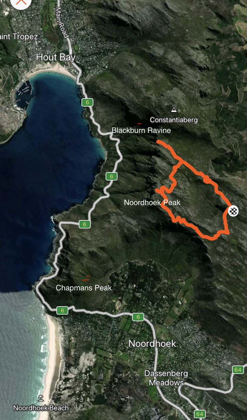
Noordhoek Peak is on the Silvermine Reserve which is a part of the larger Table Mountain Parks. I happen to live only a few kilometres down south from this area in Kommetjie and drive over this range often to get to the city further north. It’s always beautiful and always begging to be hiked. You can see Hout Bay to the west - my old stomping ground for more than a decade.
The main gate 1 opens at 8am in the winter months so we met there at opening time and drove the few kilometres up the first stretch to the Silvermine dam parking area. I’ll post the River hike later this week which starts lower down the river and and goes up river to the dam and then circles around through the fynbos back to the start.
Before starting I popped to the loo and what do you know??? They are “long drop” toilets. Who else knows what they are? You know, no plumbing just a loo with a hole down the bottom to a big hole in the ground 🕳. It’s no problem as long as you’re not afraid of creep crawly biting your butt. Anyway I survived the long drop and we got going.
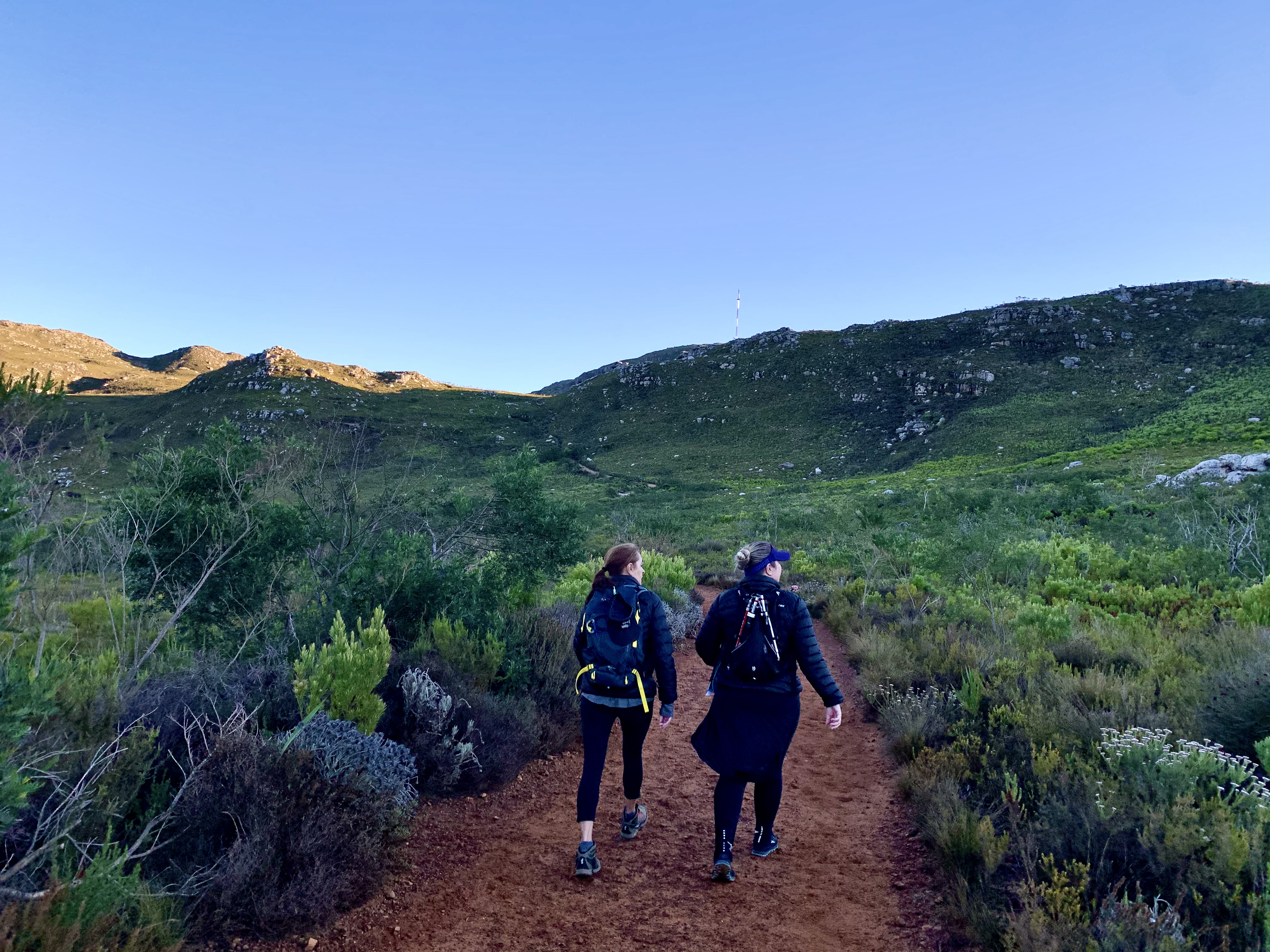
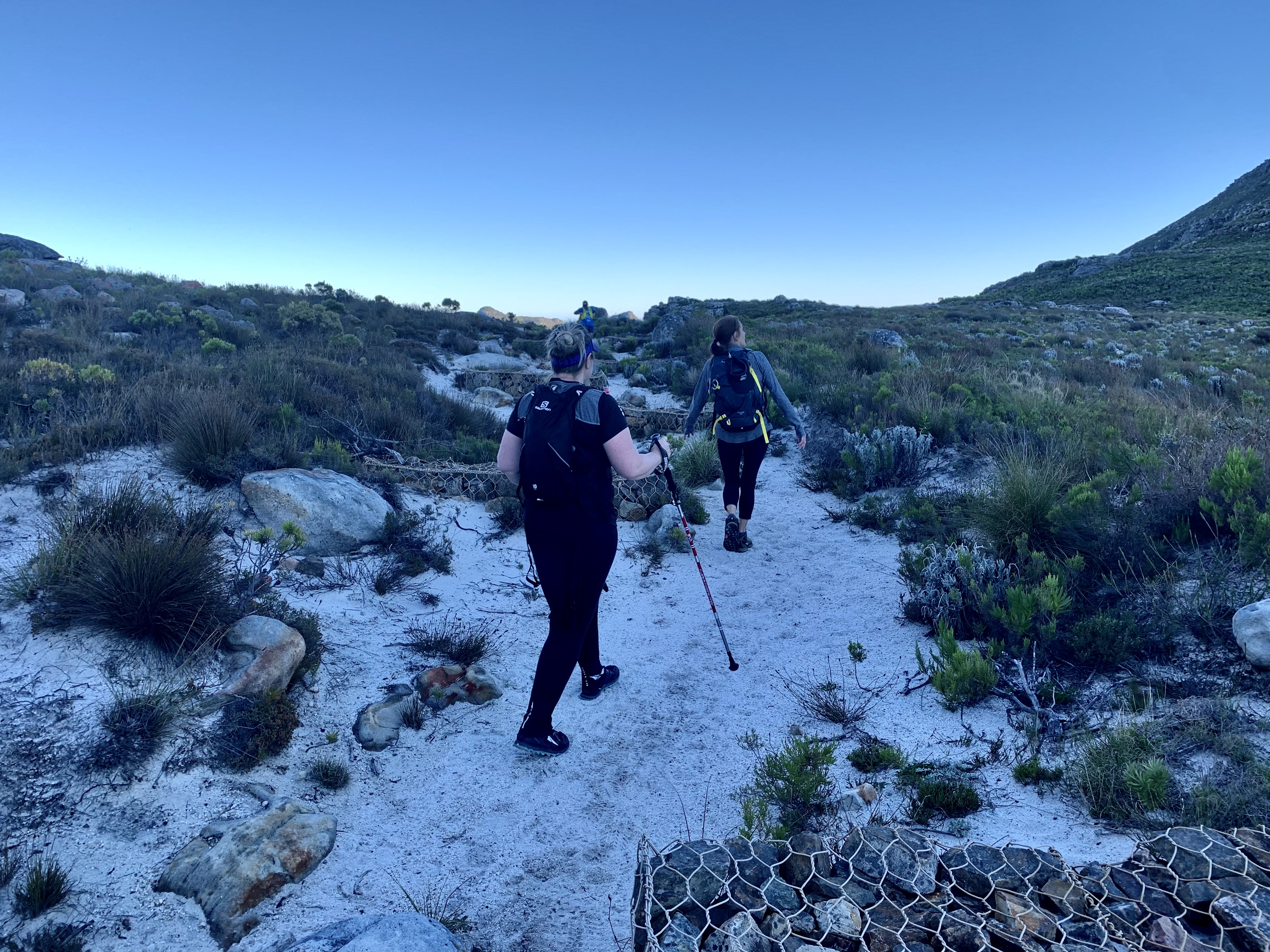
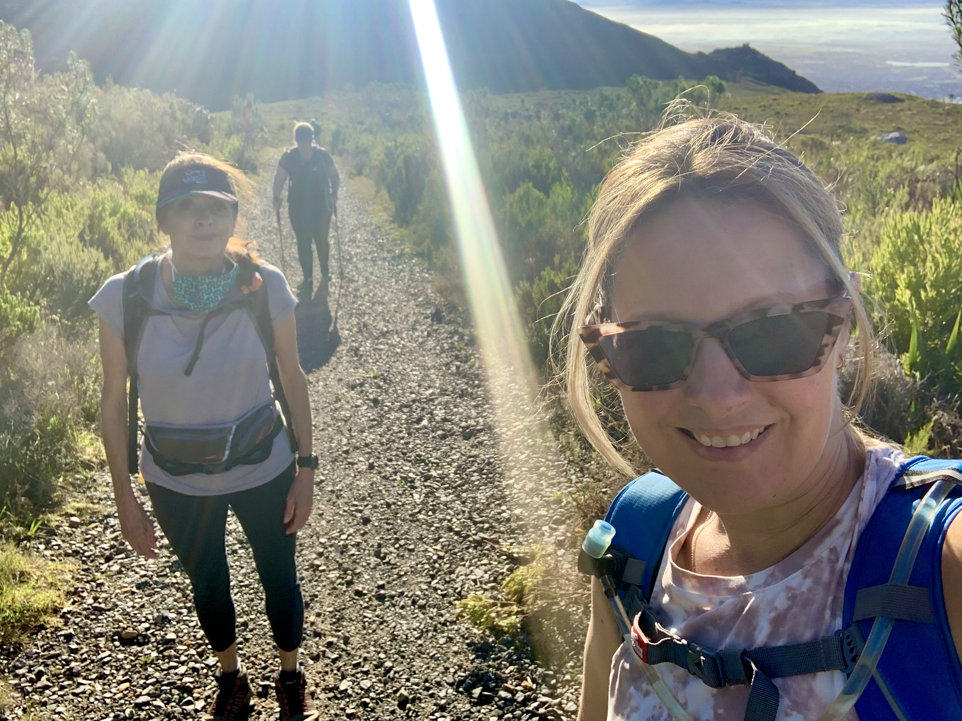
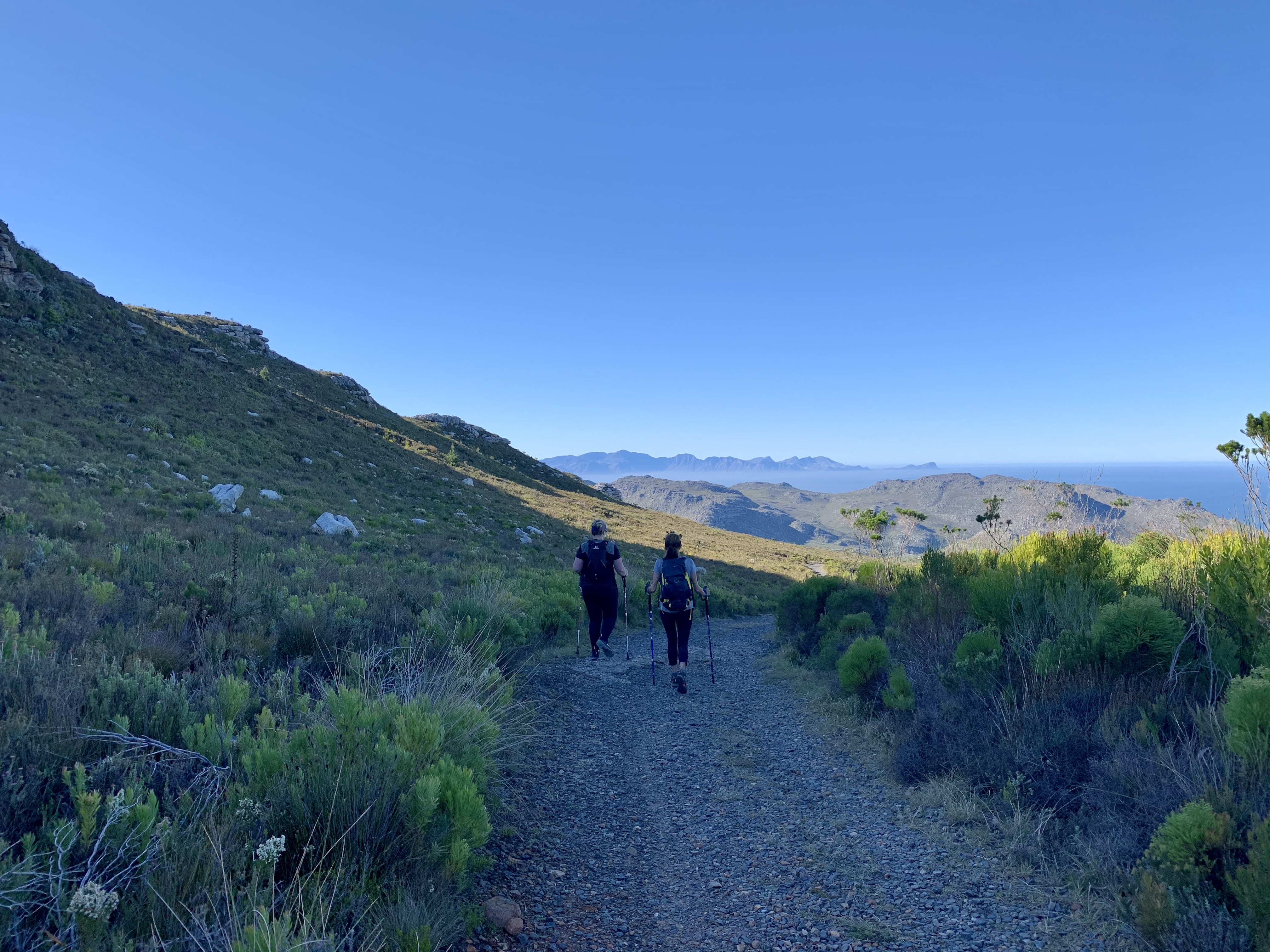
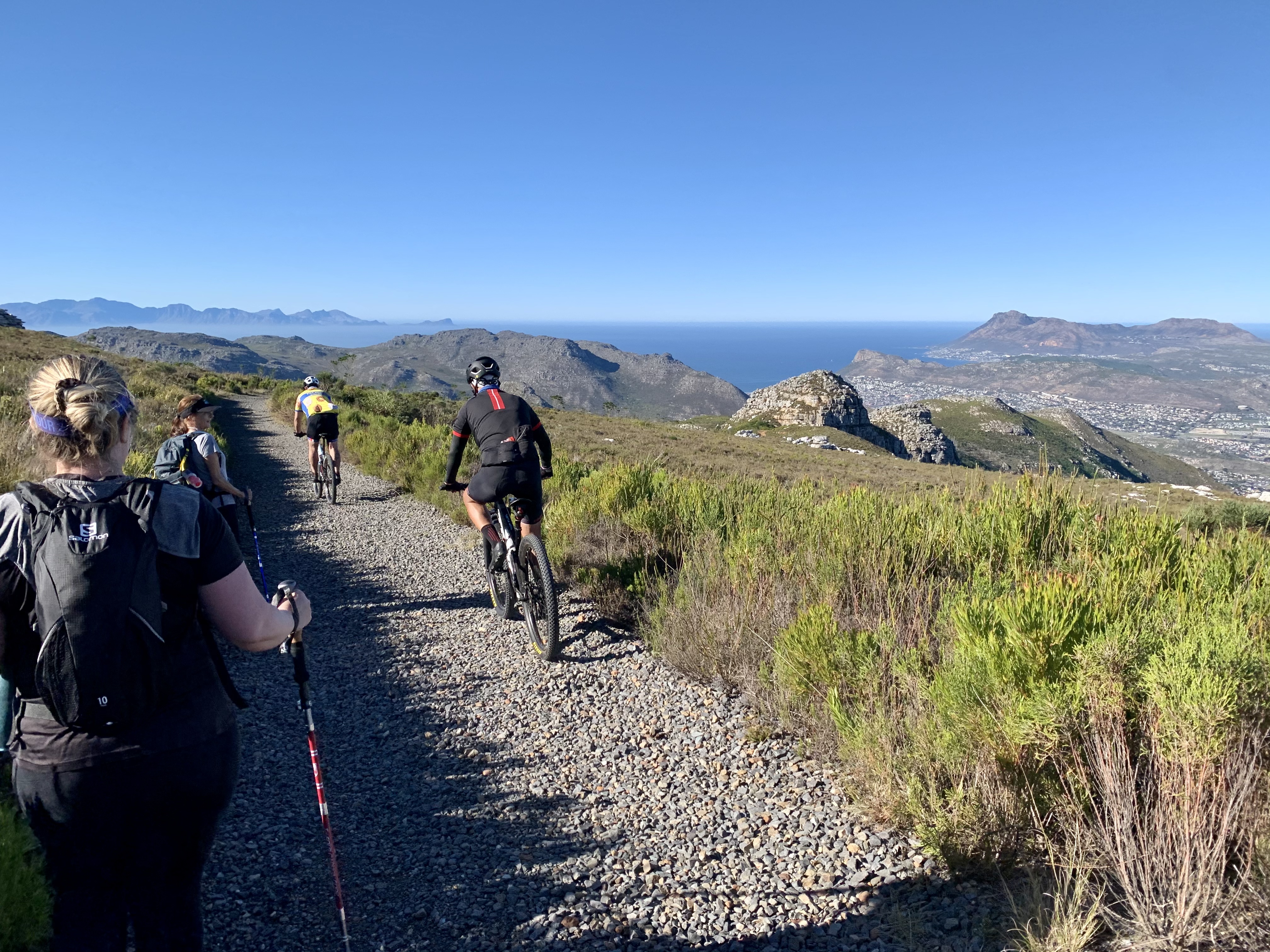
The first section of the walk was pretty easy. It was a reasonably wide trail that gradually made its way along the hill side of the dam. Every couple minutes we were passed by hyperactive trail runners that were racing to raise funds for the Volunteer Wildfire Services.
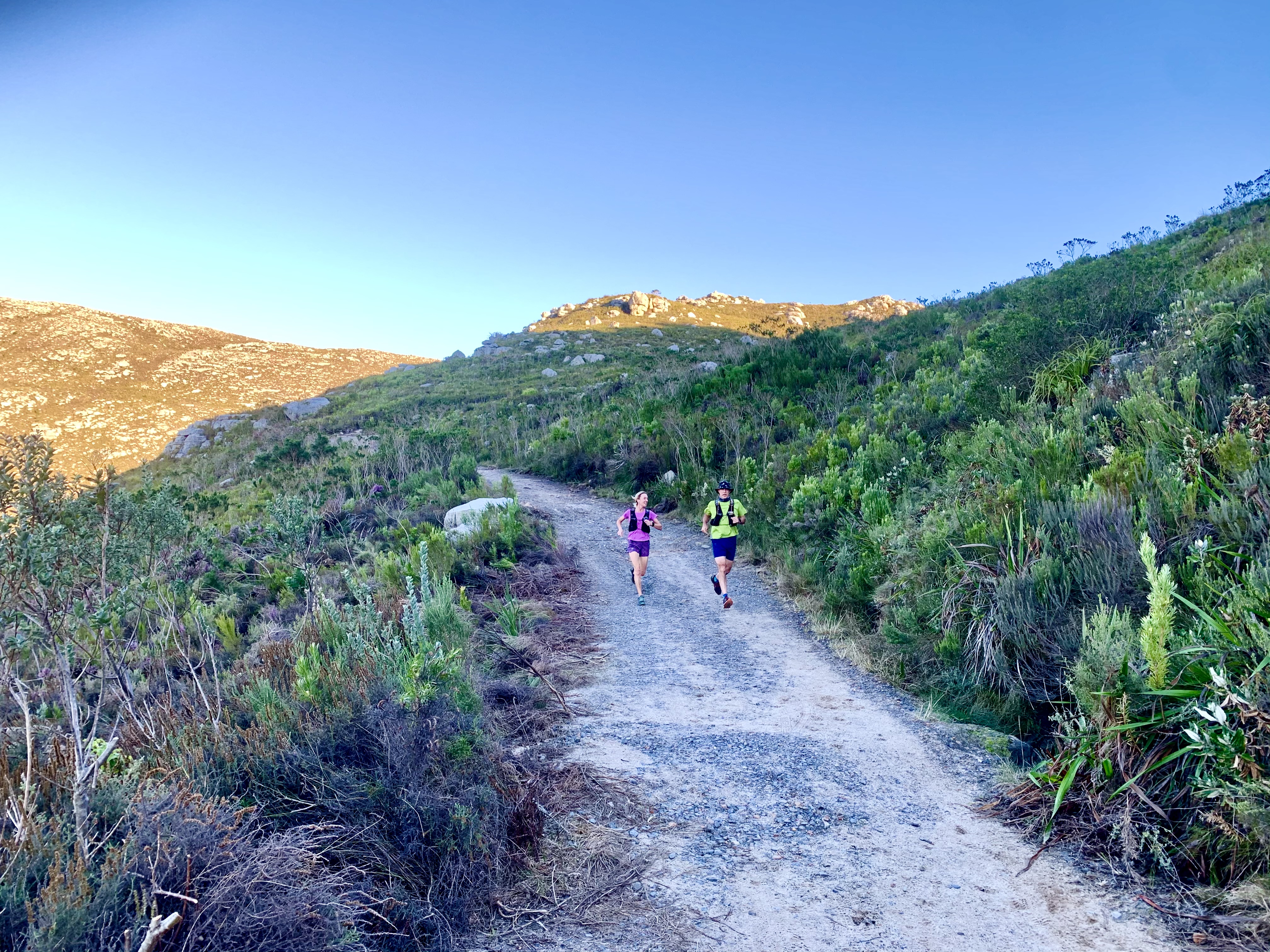
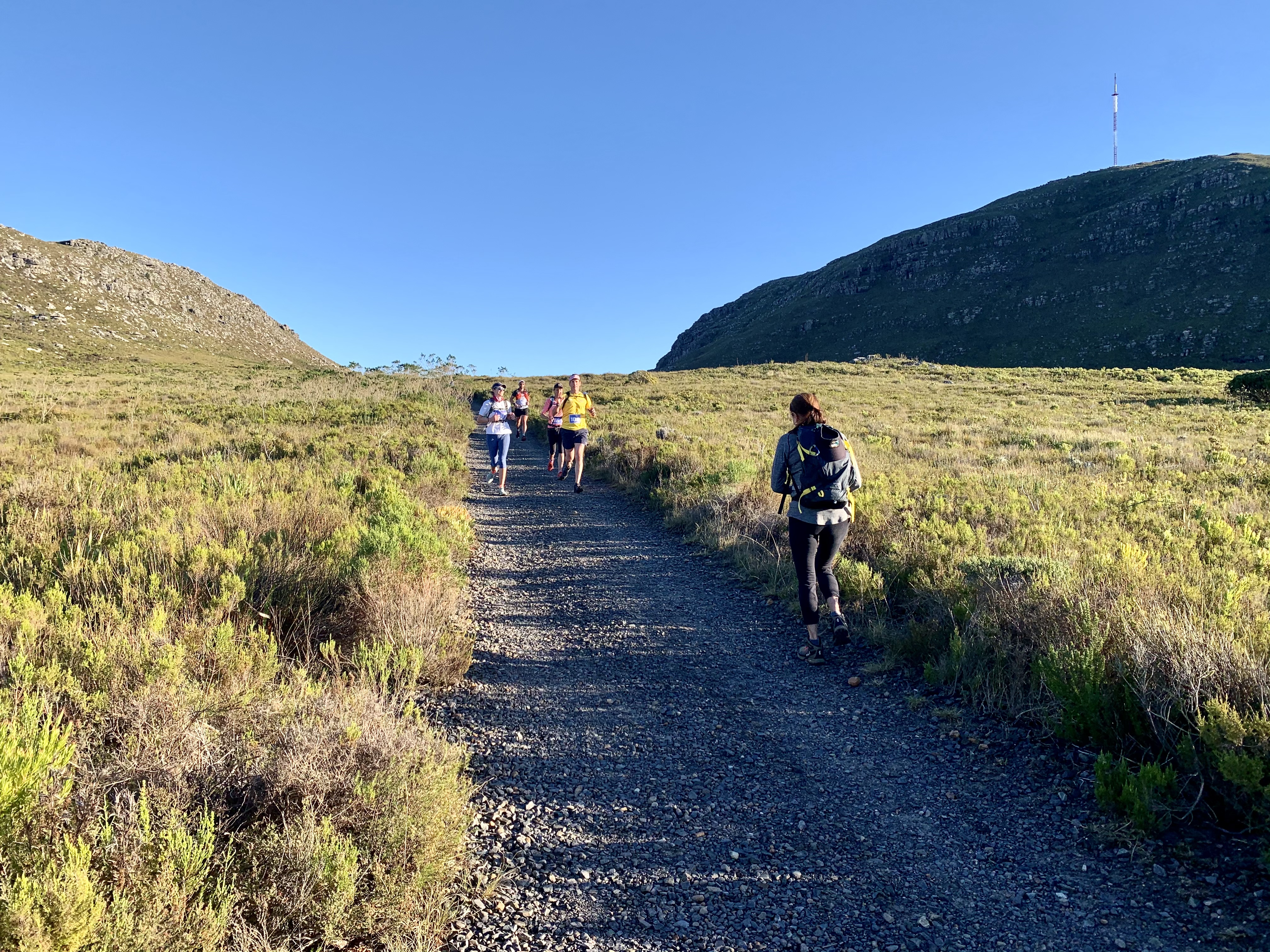
Turns out they were running 24 kilometres across the mountain range and we happened to pick a section of their route to hike. It was all good. We became self appointed Marshall’s as the route markers were tiny and we saw a couple runners heading in the wrong direction. The good citizens that we are we hollered at anyone that passed us to “keep right at the bottom of the hill.” Most were thankful while others probably thought we were nuts.
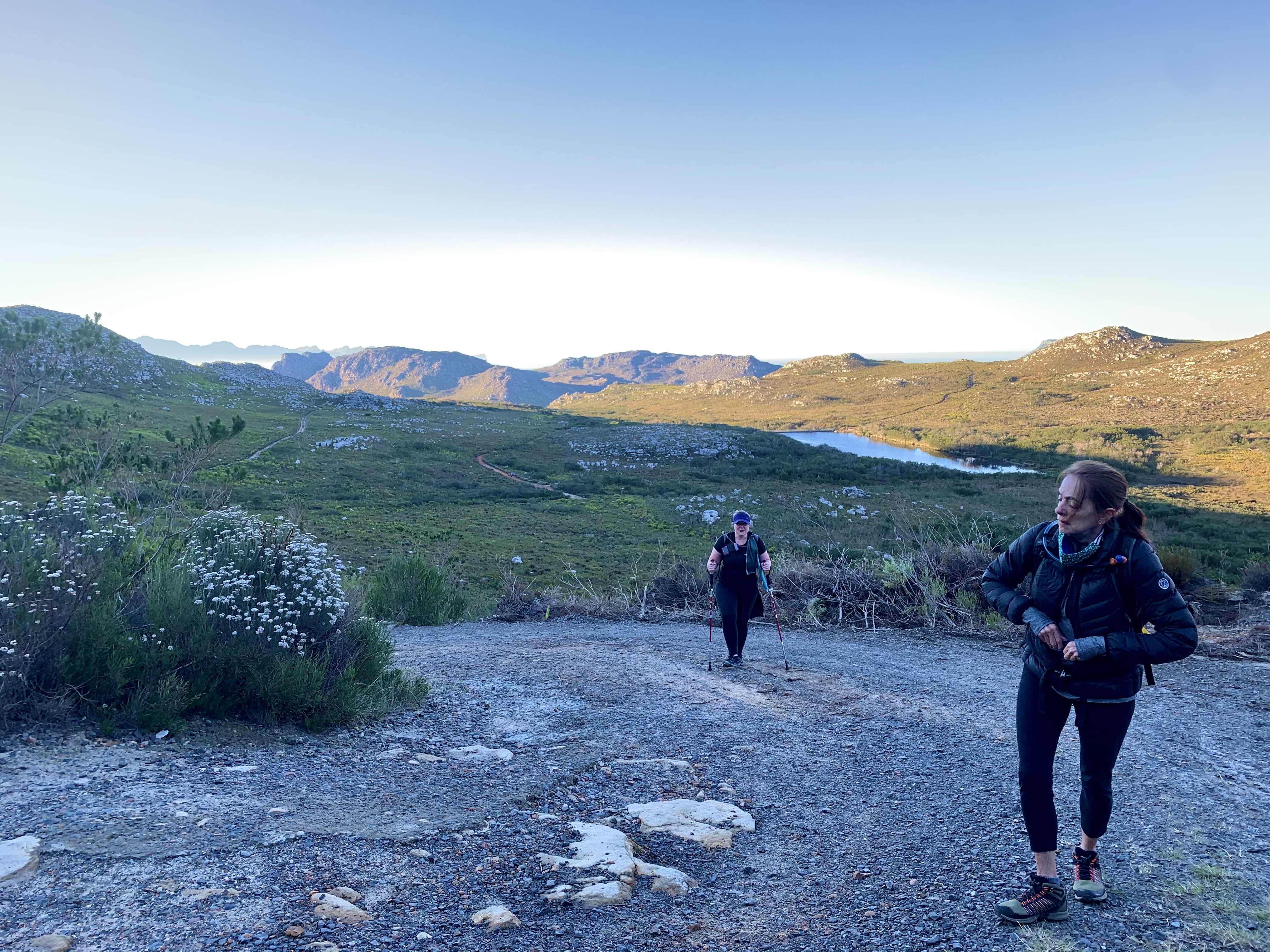
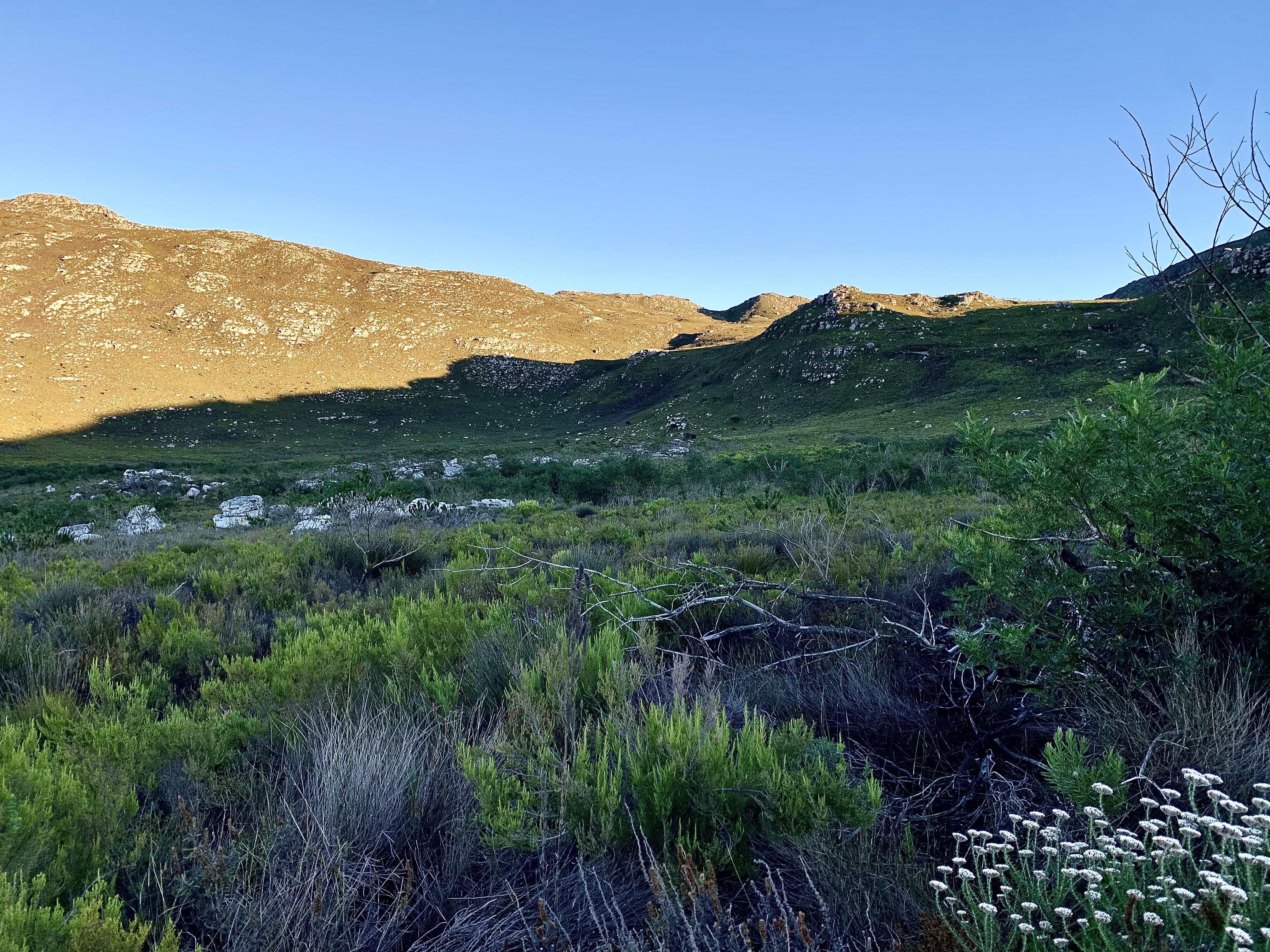
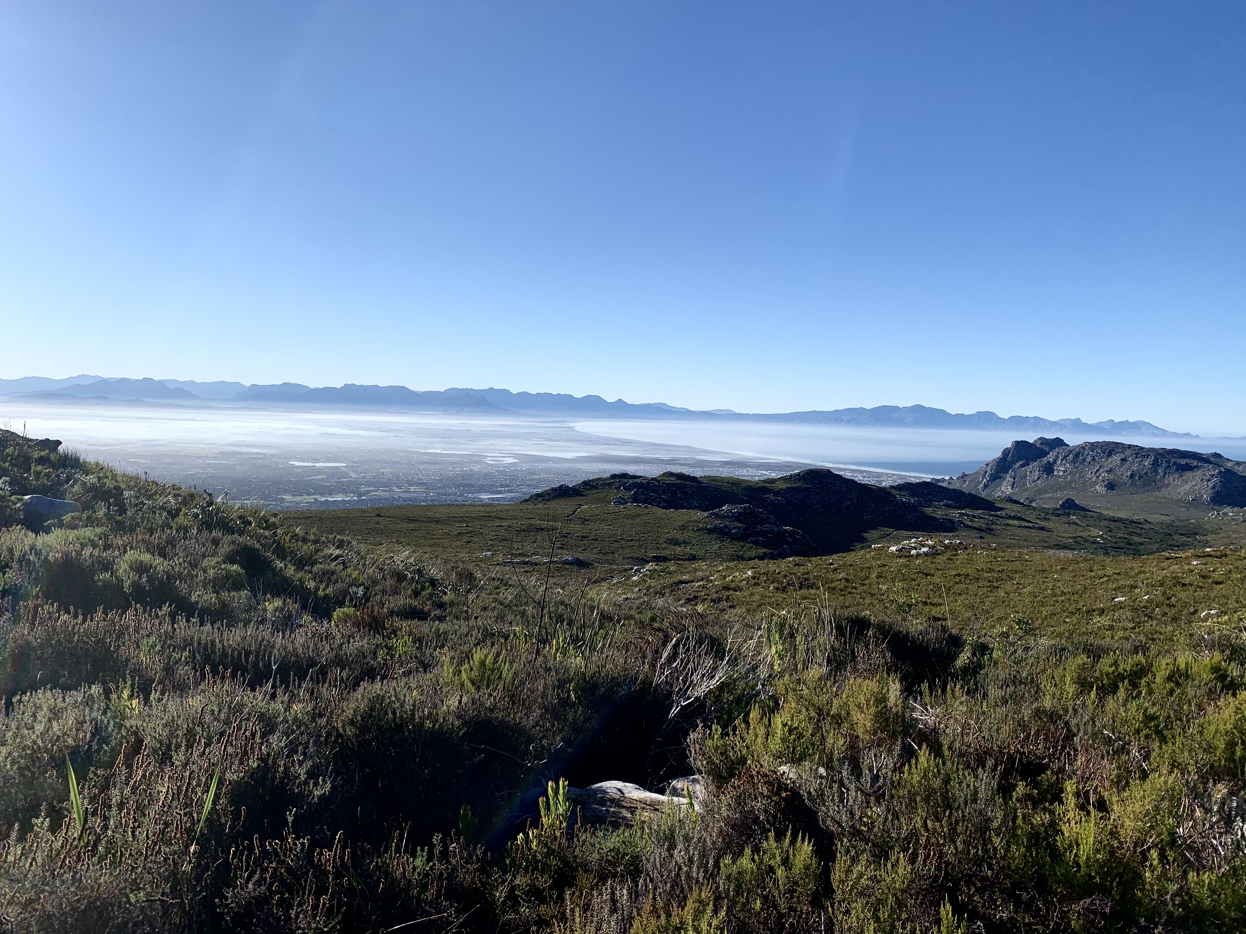
We made it up the first steep zig zag that had become jeep track and the views had begun to reveal themselves. The higher we walked the more beautiful it got.
We not only had the perfect weather but the temperature decided to warm up a little so we weren’t feeling like ice blocks.
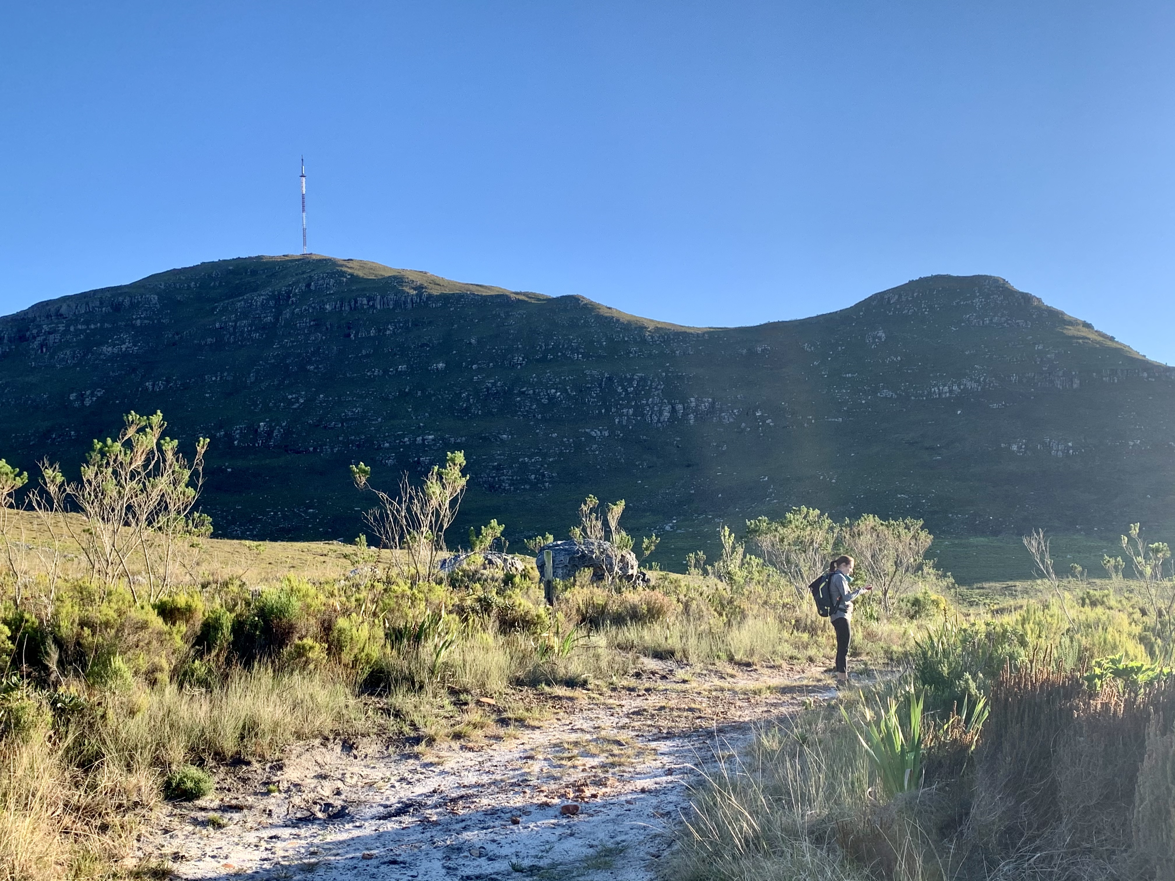


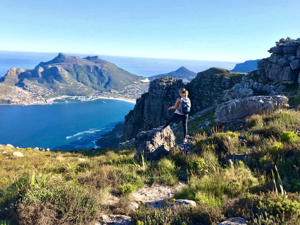
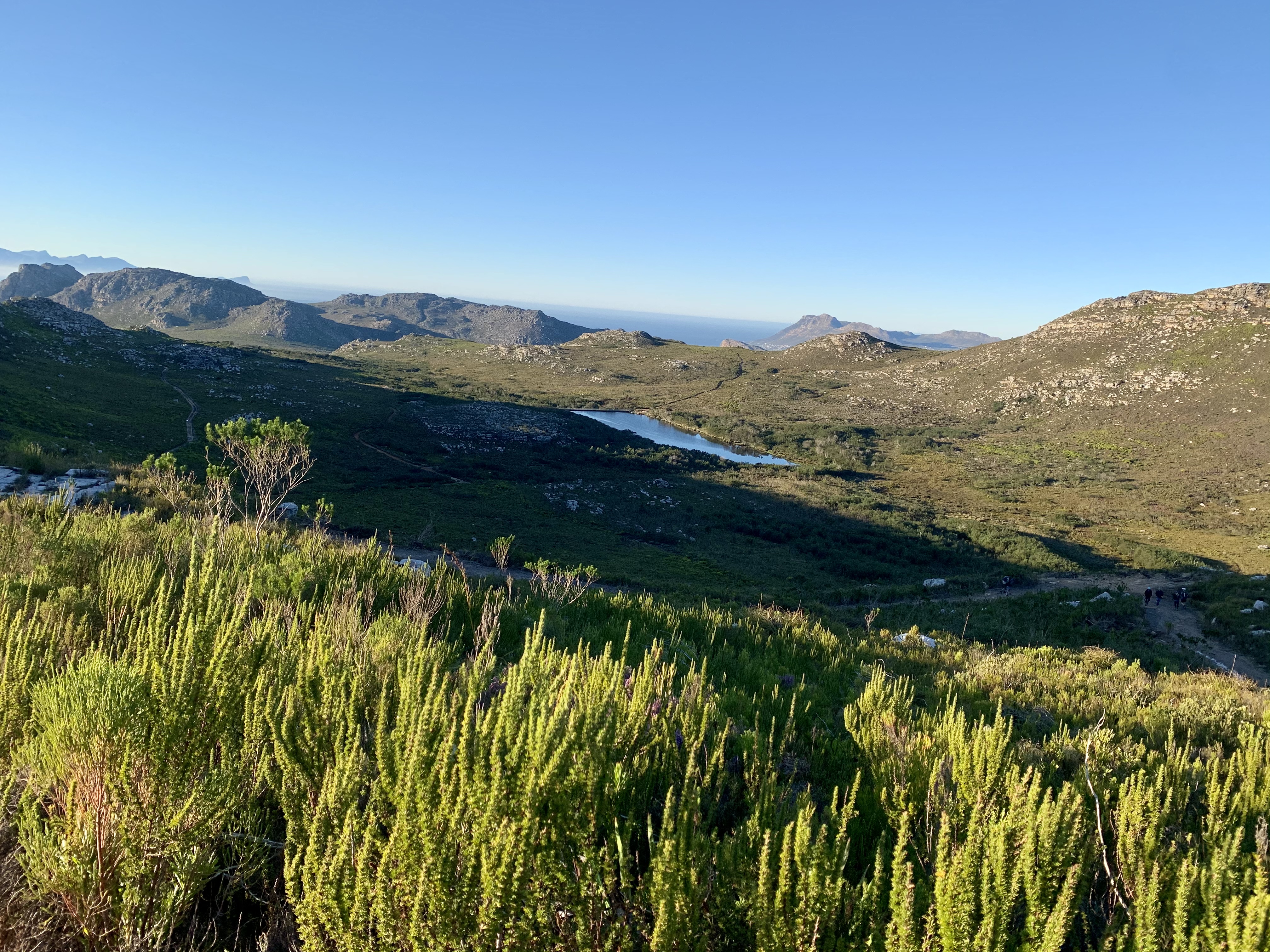
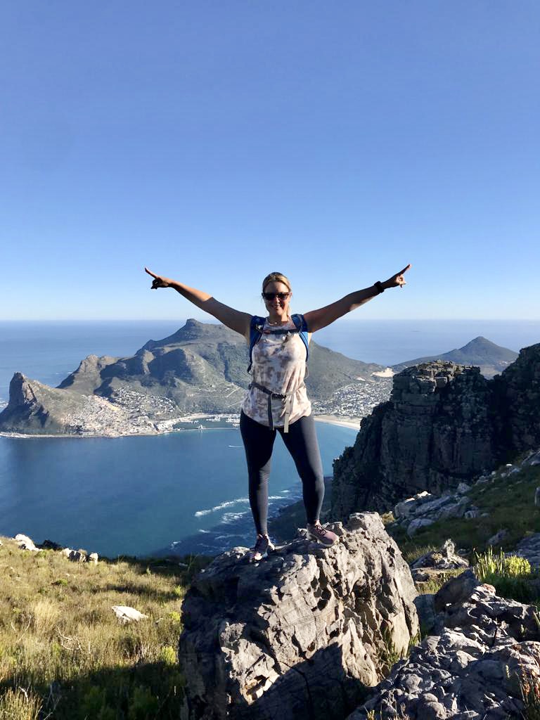
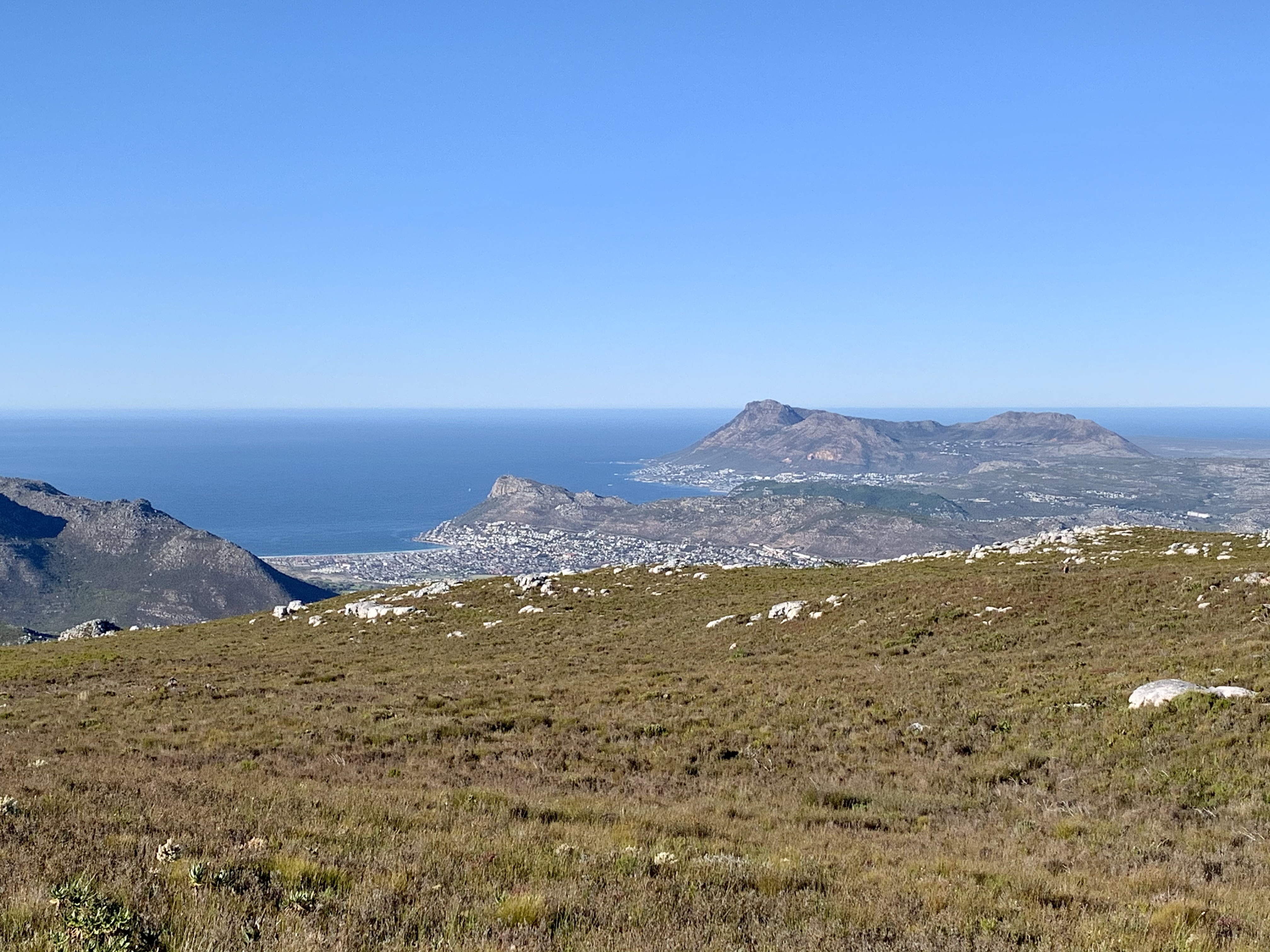
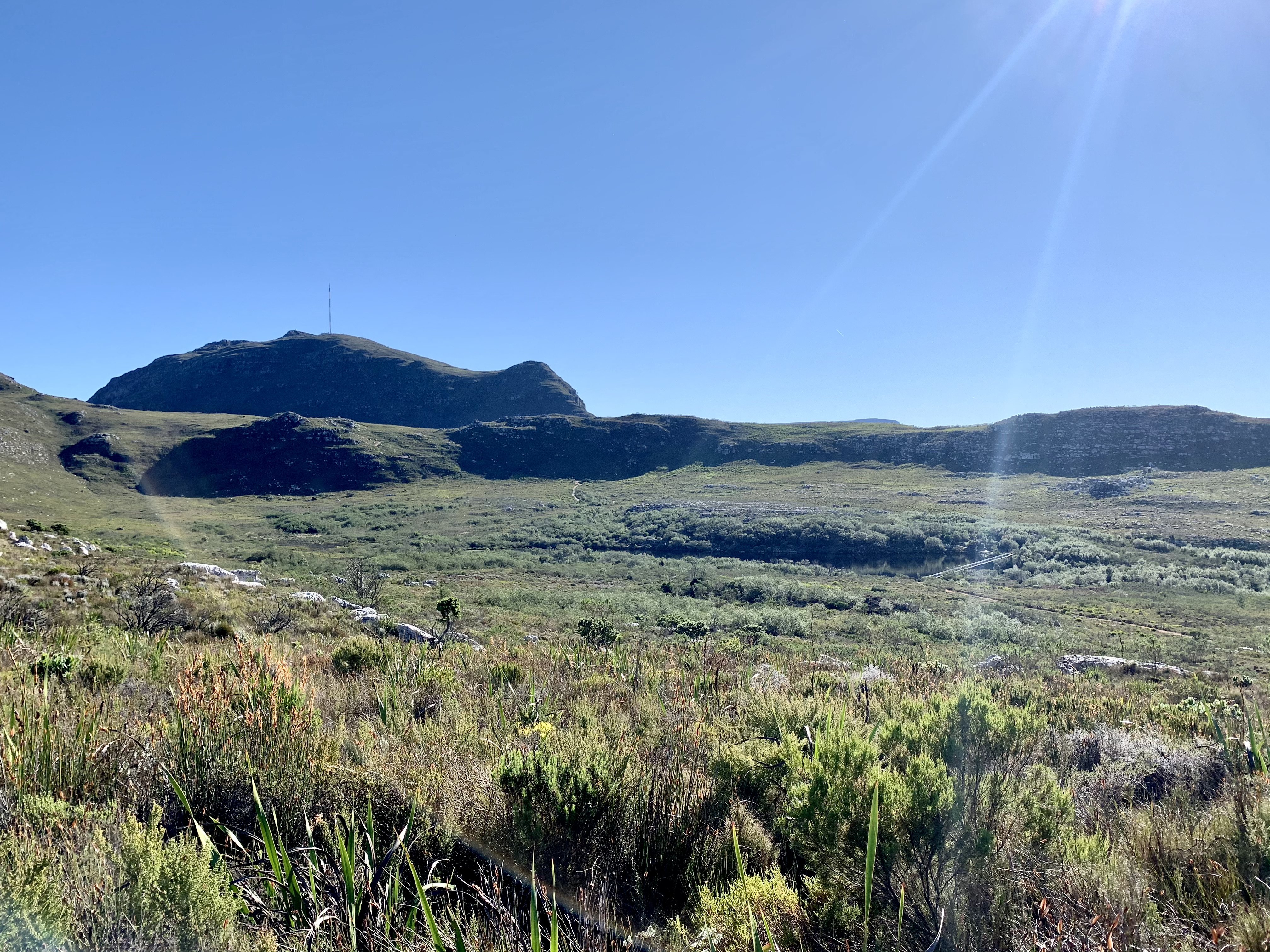
At the top of this section was a flattish walk towards the next hill to our left, but before attempting the hill we decided to head straight towards the Sentinal Look Out.

This takes you to the top of the Blackburn ravine down below and shows off the views of Hout Bay. Blackburn ravine can be tackled from Hout Bay by starting at the East Fort on Chapmans Peak Drive. It’s a constant uphill climb and must have been a killer for all the trail runners that kept coming towards us. They had started at the Hout Bay harbour on the far side of Hout Bay Beach down below.
Happy with our photos we headed back along this little detour and joined back with the jeep track at the bend and started our next ascent. By now we were walking in the full sunshine and it started to get hot.

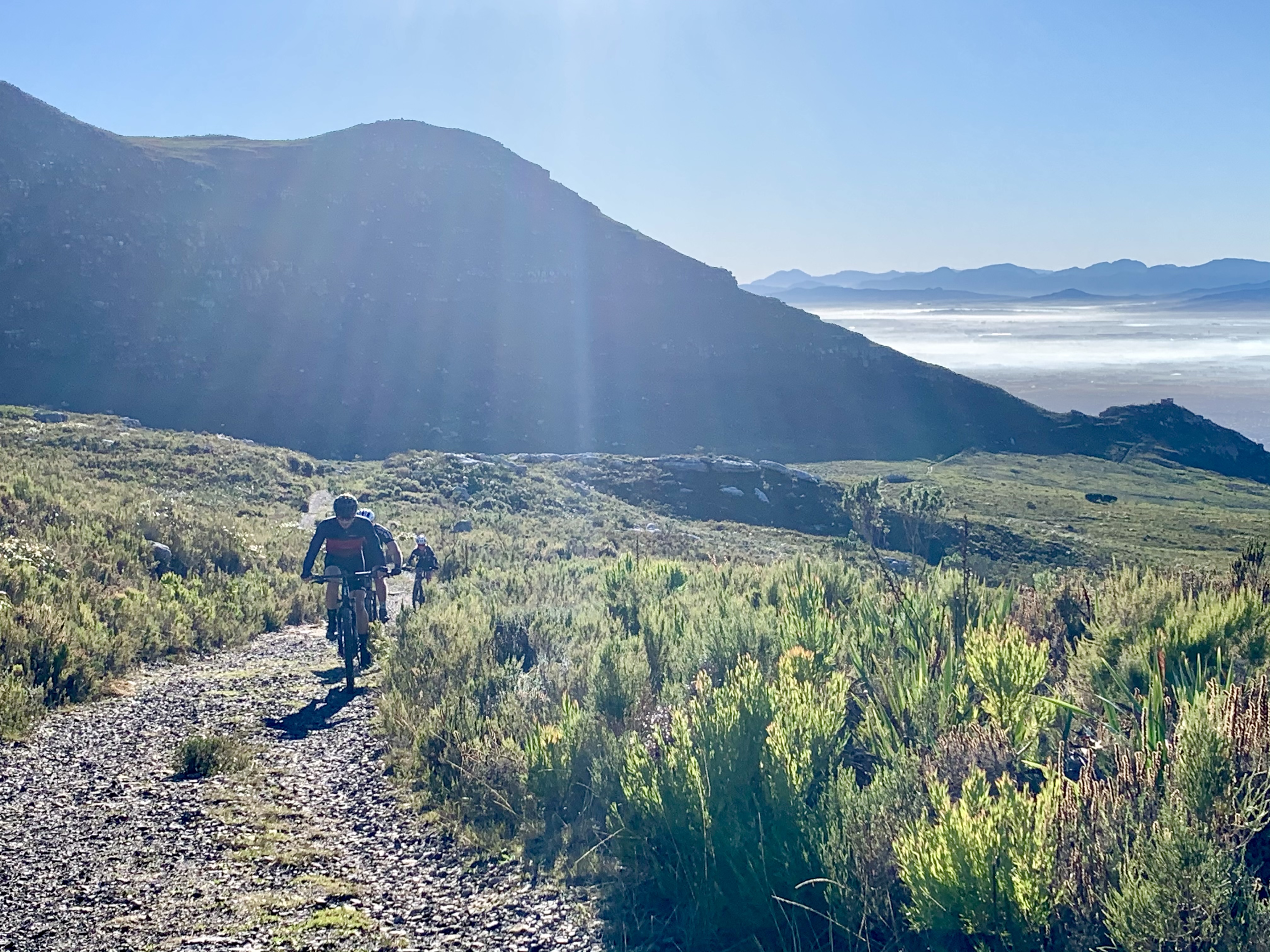
The mountain bikers must love this route and I can see why. It’s a pretty well maintained part of the mountain with good paths and tracks. There’s a special parking area just for mountain bikers that leads directly to the jeep track and away from the pedestrians on the smaller paths. The bikes seems quite happy to pass us as we walked up the hill. I’m quite happy not to sit on a bike seat!

Jade struggled a bit with the heat just as we reached the top. But the timing was perfect as we found a little outcrop with shade just for her to hide in for our break so she had some time to recuperate.

The Eagles Nest Lookout was a main rest-stop and half way mark of the hike. Snacks, water and staring non-stop at the views ahead was all that we could do.
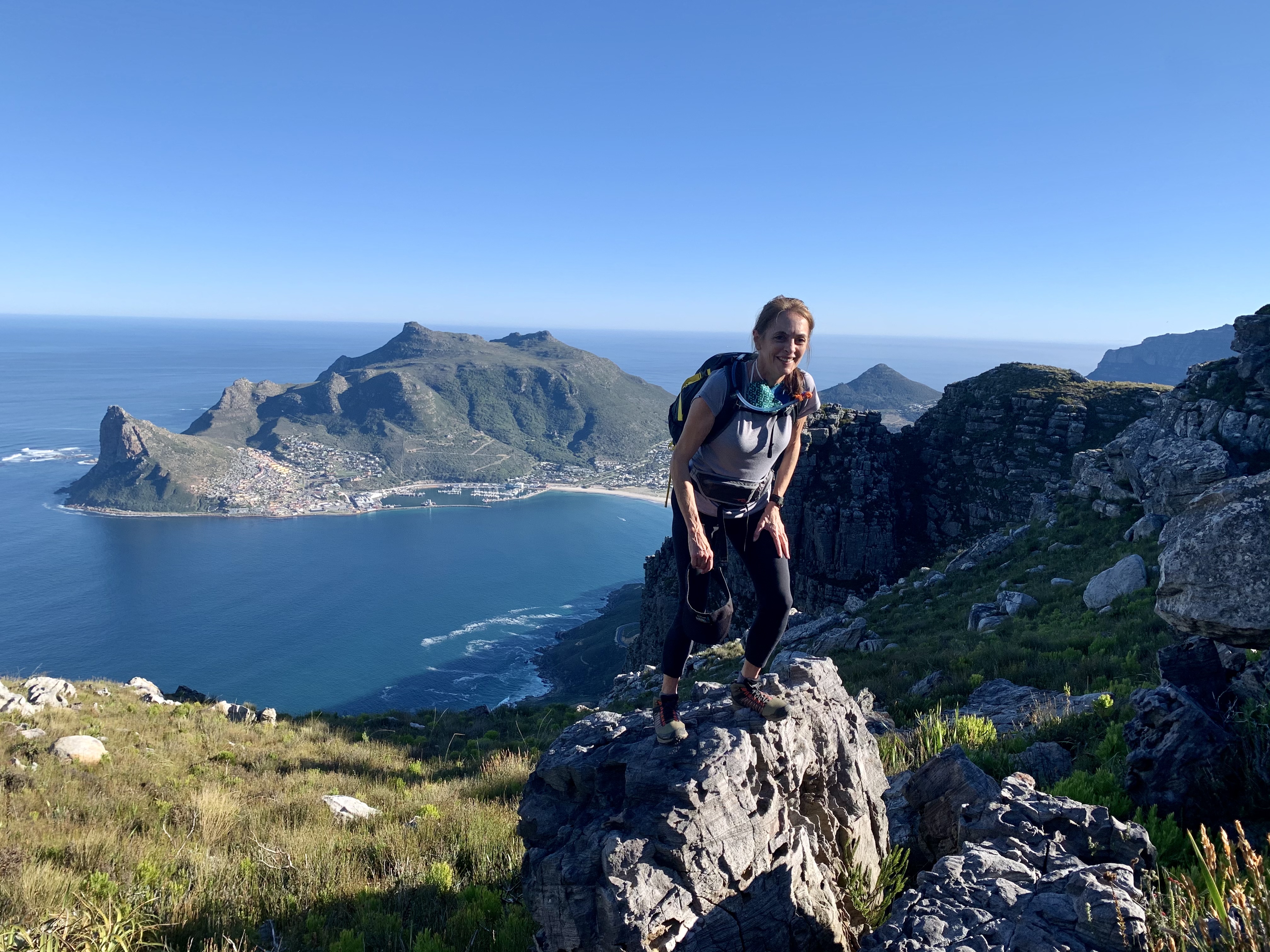
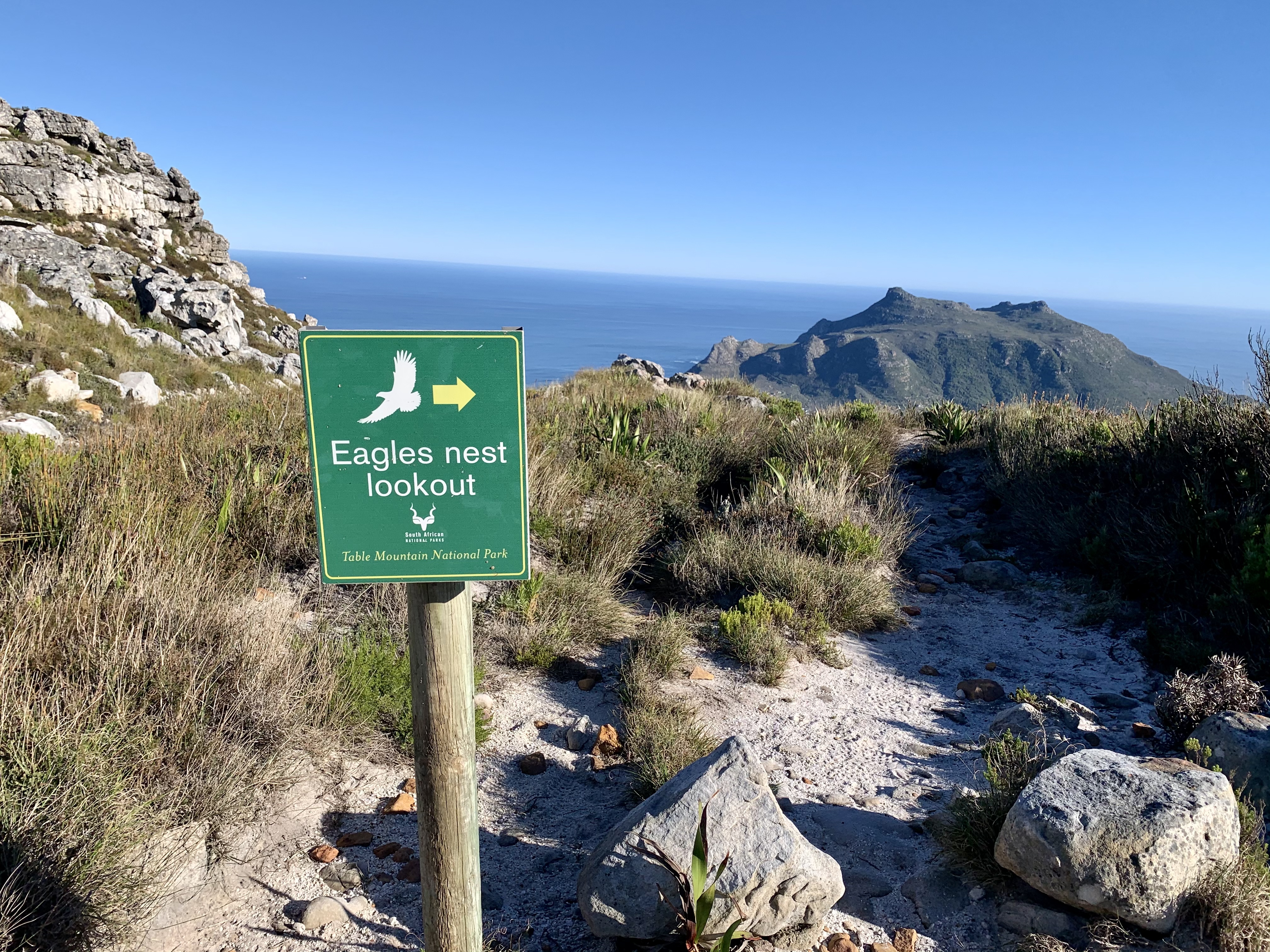
My aunt is actually afraid of heights but also hates missing out so she copied me and climbed onto this rock for a photo. I want to be like her in 20 years, still enjoying life, being brave and taking hold of every opportunity.

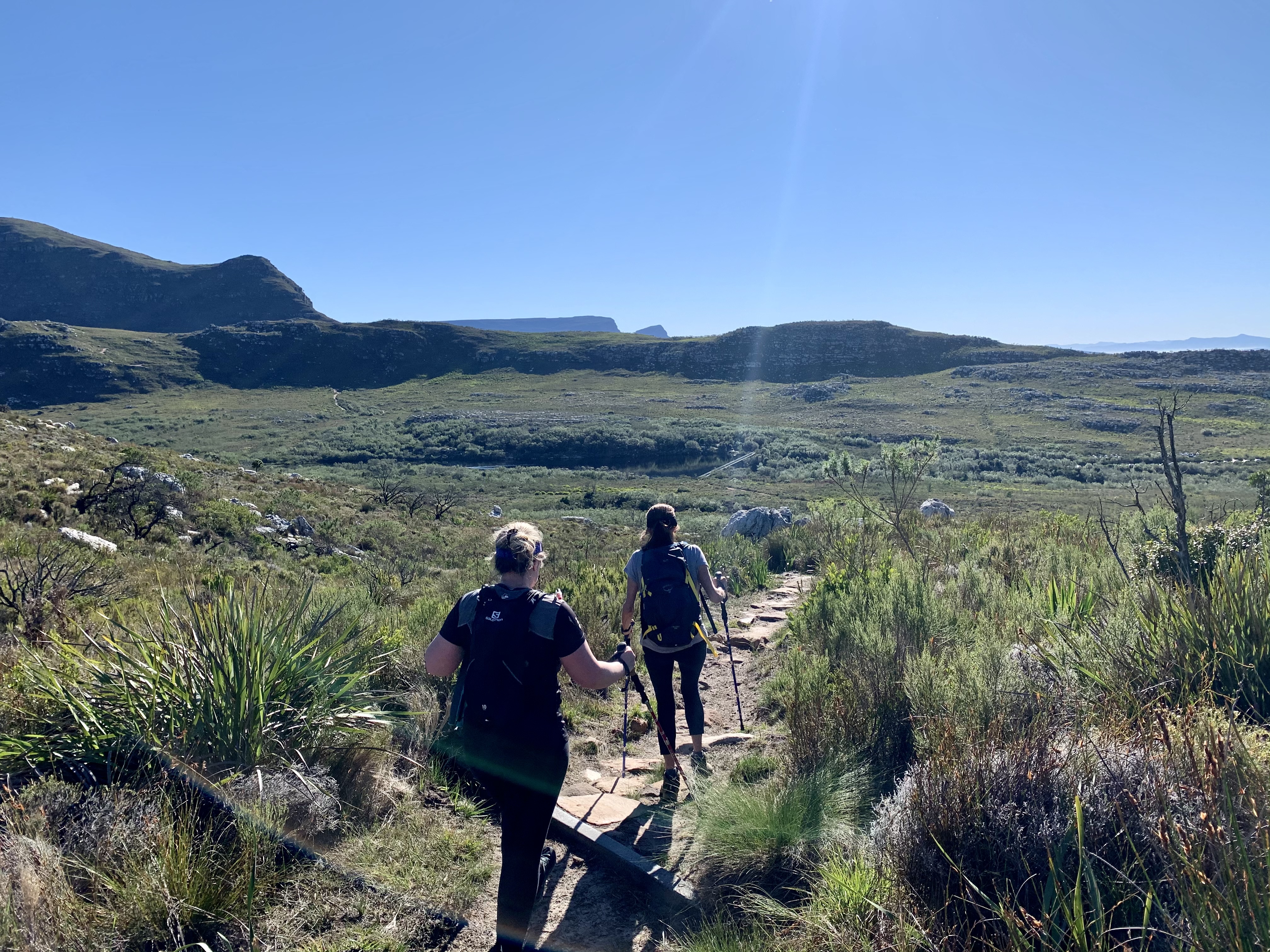
Now that we had enjoyed a little sustenance and rested we felt ready for the rest of the downhill part of this circular trail. These circular trails are my favourite because I get bored walking back the same way I’ve come.
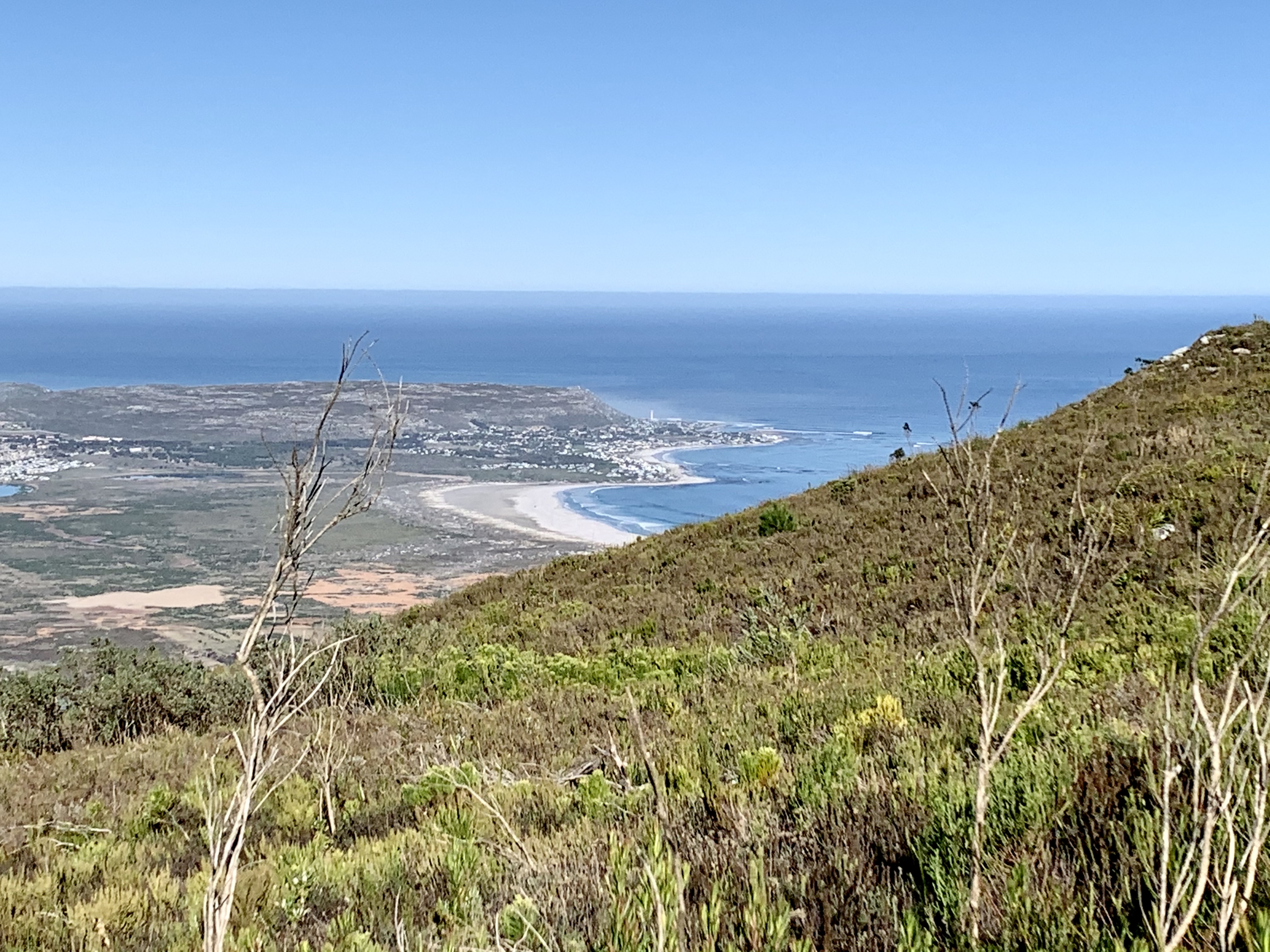
The way down was on the jeep track for most of the way. We got gorgeous views of the Noordhoek region with our home in Kommetjie in the distance.
We passed other hikers walking the route in the opposite direction and we were very grateful to have done it in the anti-clockwise direction. Coming up this hill would have been soul destroying because it’s pretty relentless. We seemed to to be doing it in the same direction as the bikes as they kept catching up to us from behind.
Three quarters of the way down we turned left onto a single track that was a shortcut back towards the dam. By now our legs were getting a bit tired and we still had a big family lunch to attend in the afternoon.
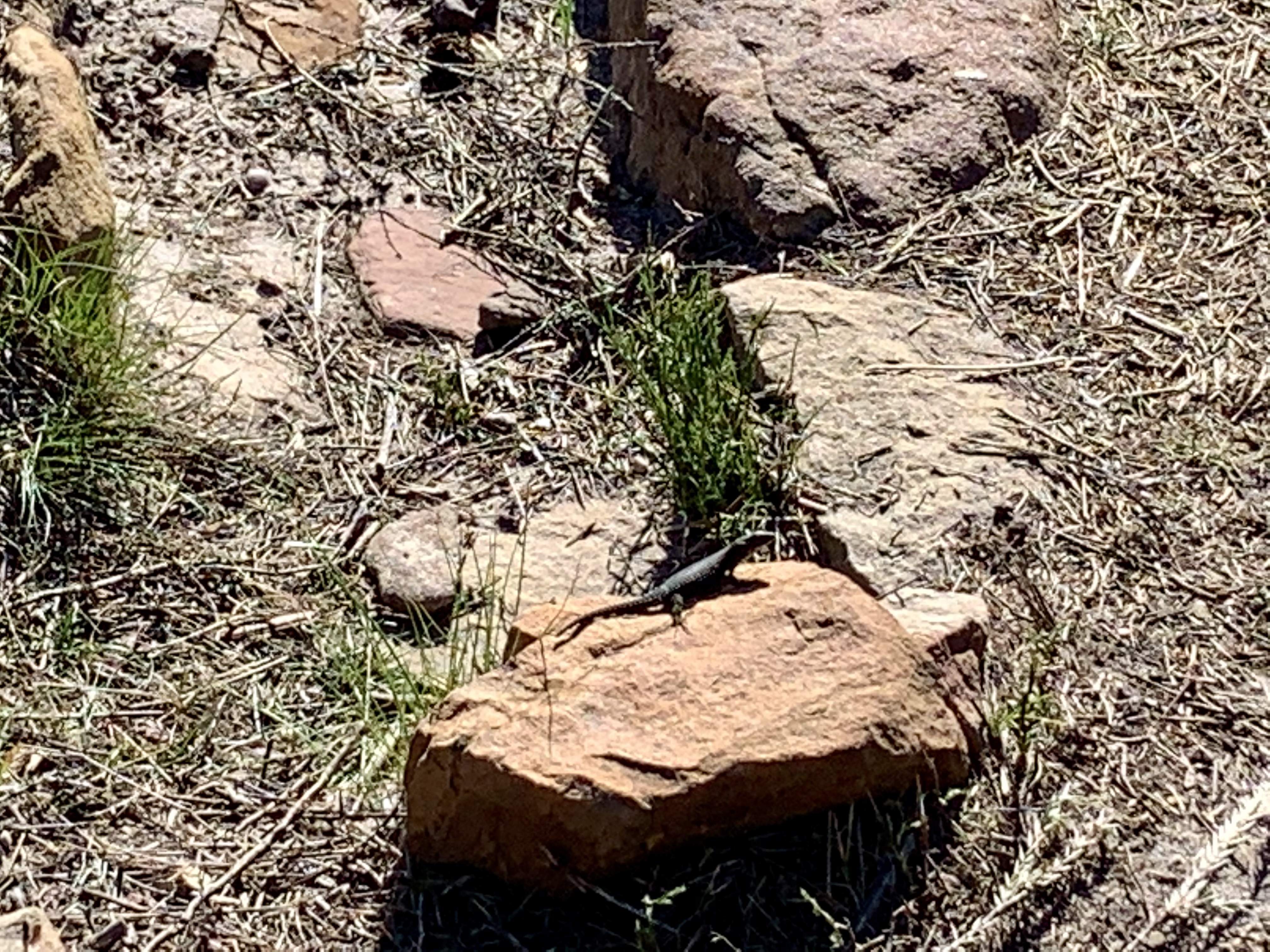
We kept spotting tiny black lizards sunning themselves on the path in the mid morning sunshine.
My legs weren’t used to the steps after dealing with a relatively smooth jeep track for 90% of the route.
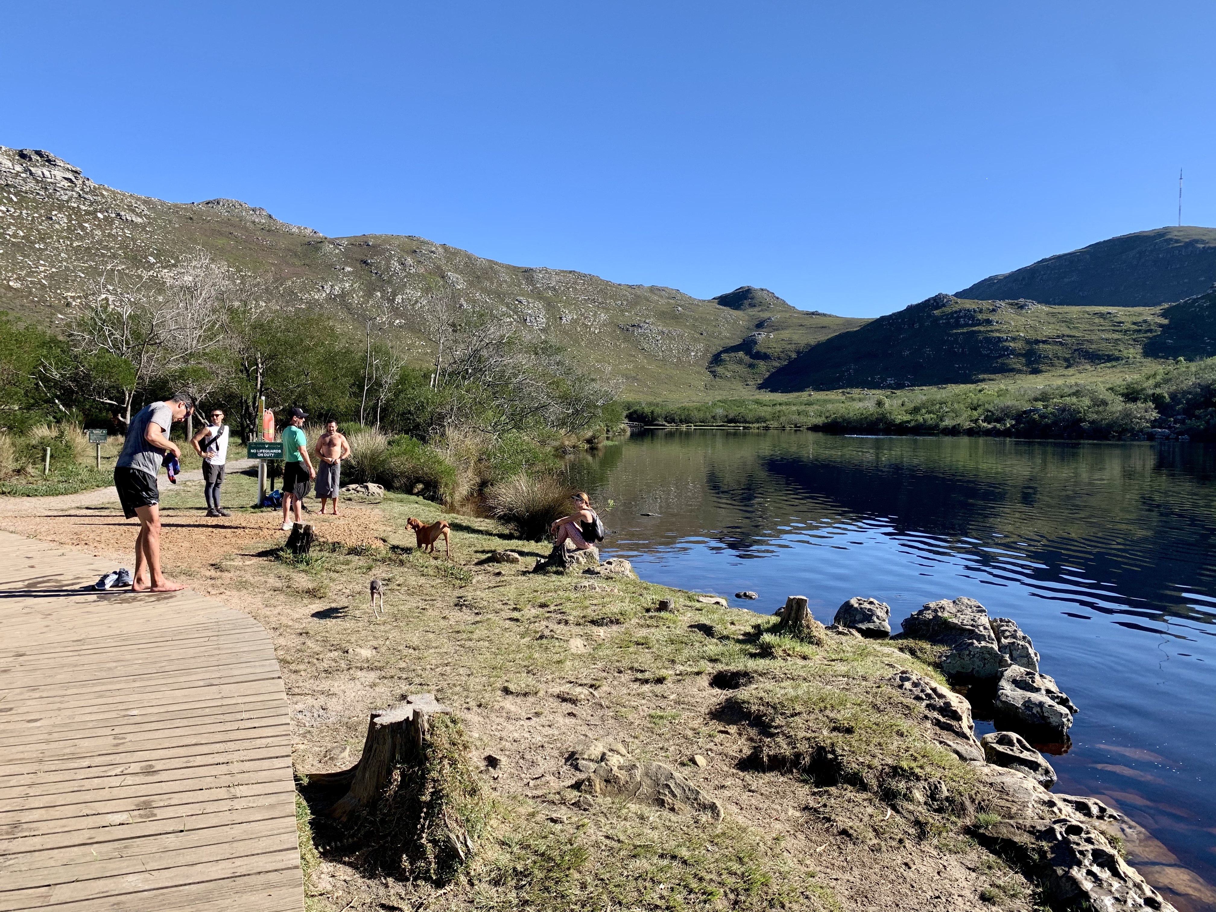
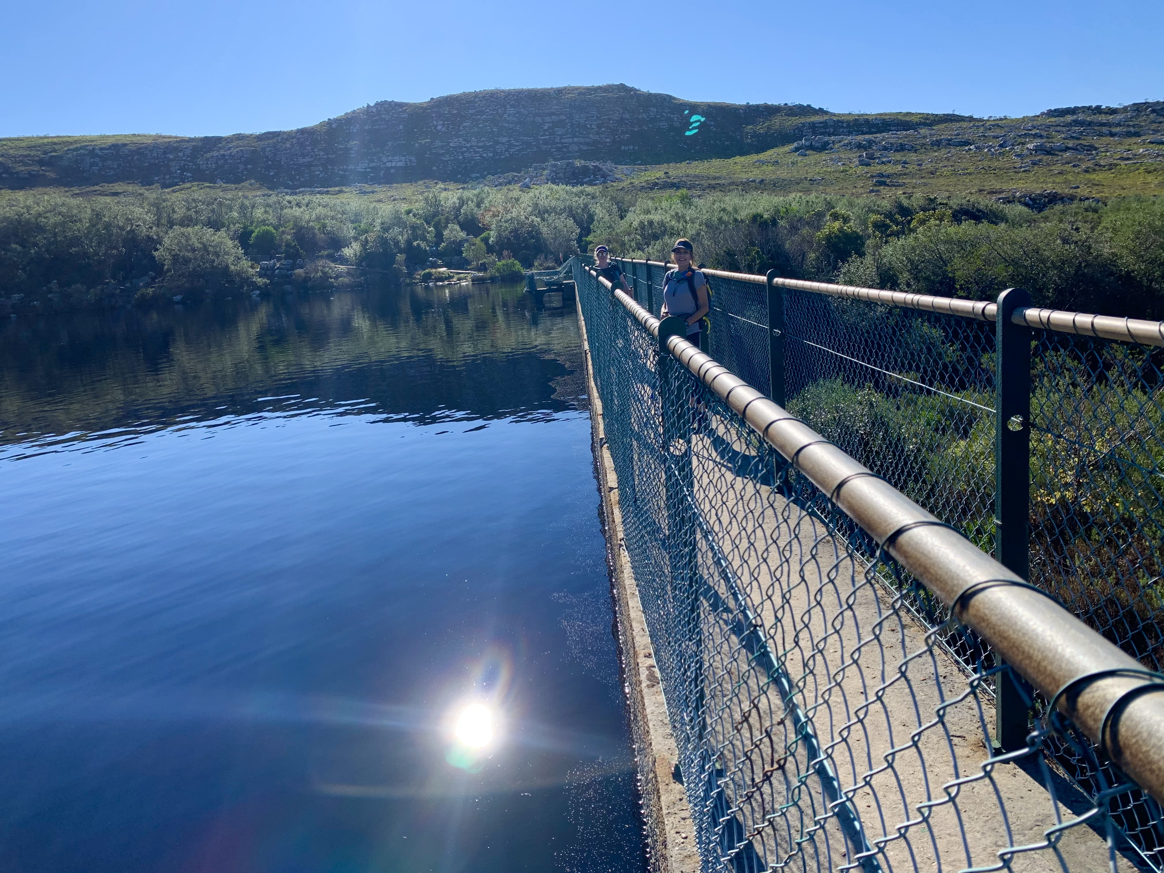
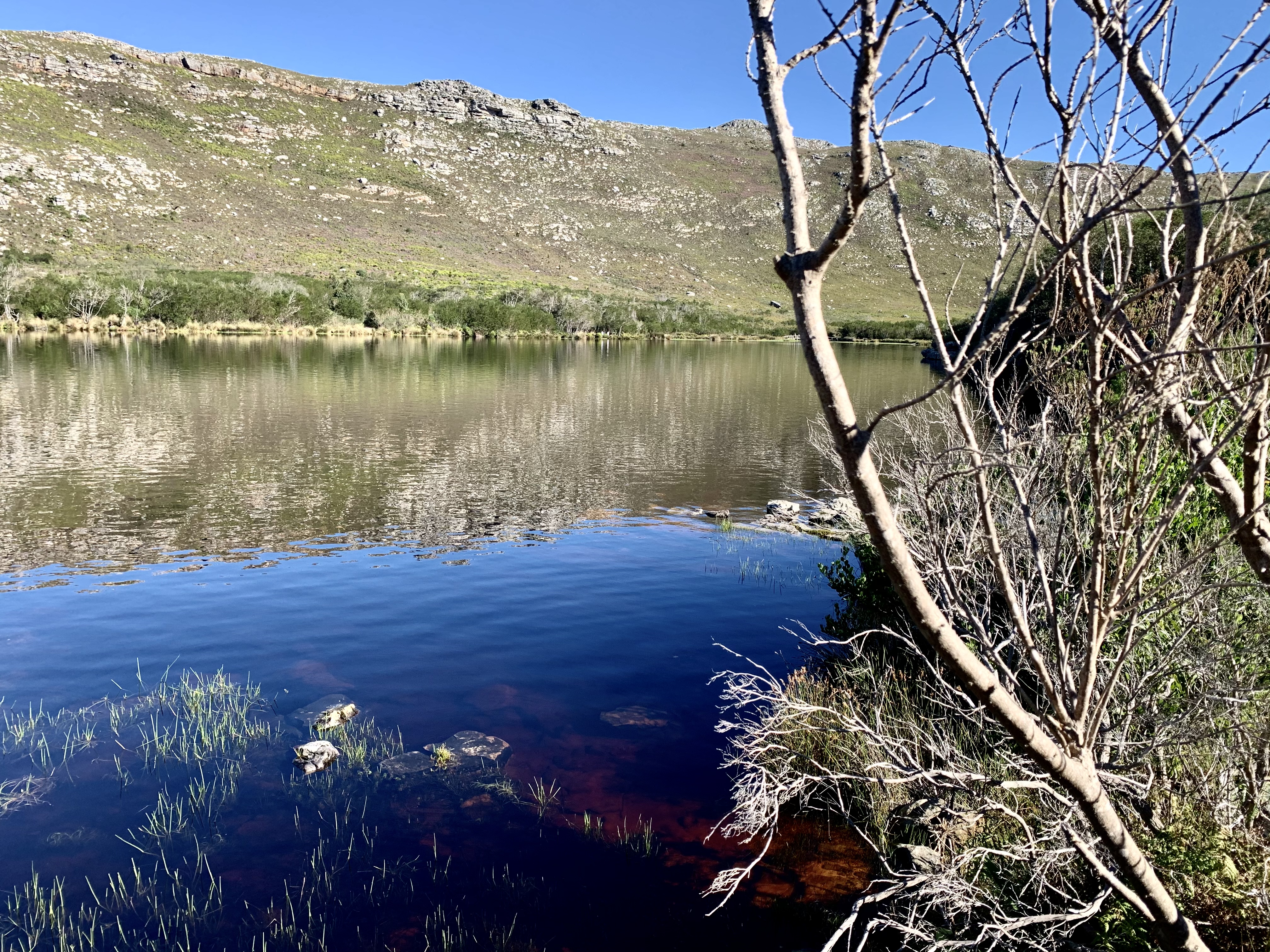
And then with in only a few minutes we were at the dam wall. The cold water looked inviting with groups sitting along its edge and even a few people swimming.
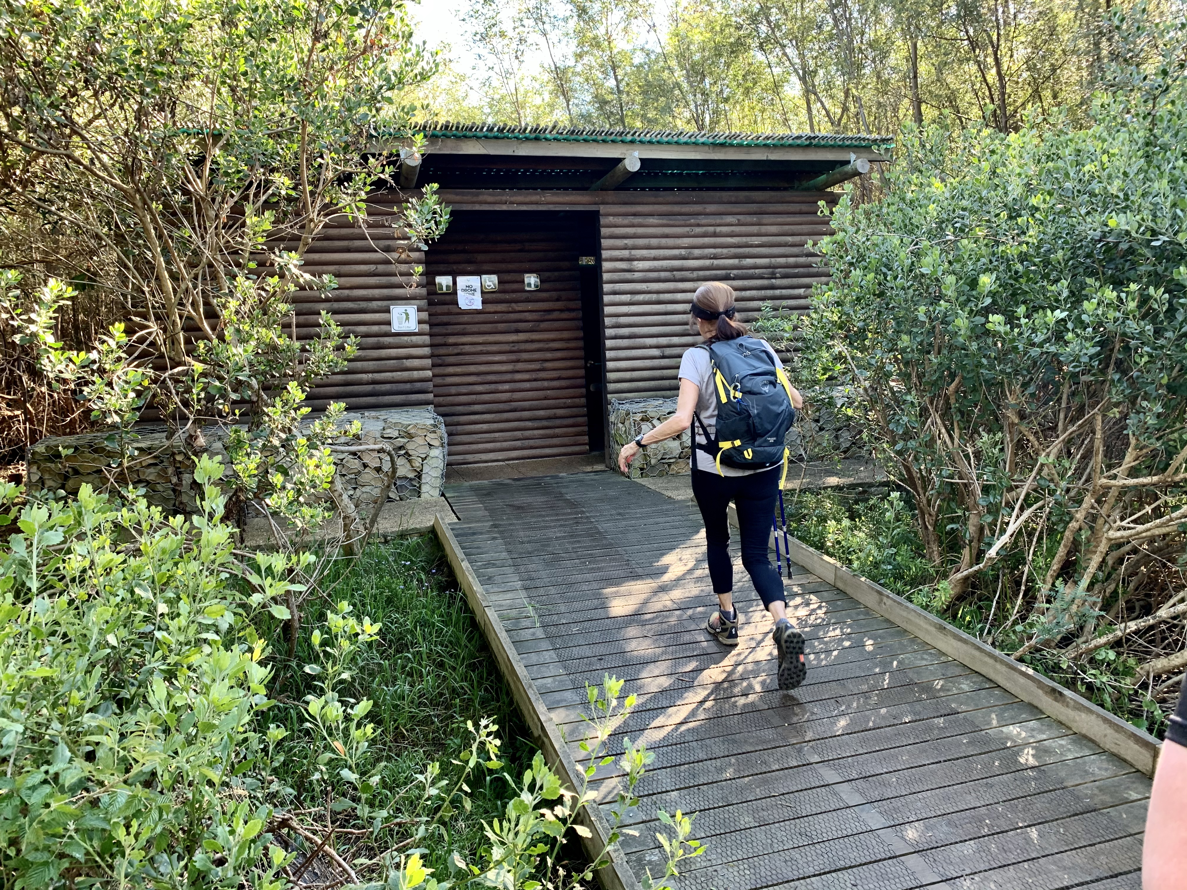
We headed along the dam wall to the other side and found our path back to the carpark and the long drop loo’s. This time my aunt got a chance to try them out.

We were quite impressed with ourselves by the end of the hike. Here’s a map of the area we covered.
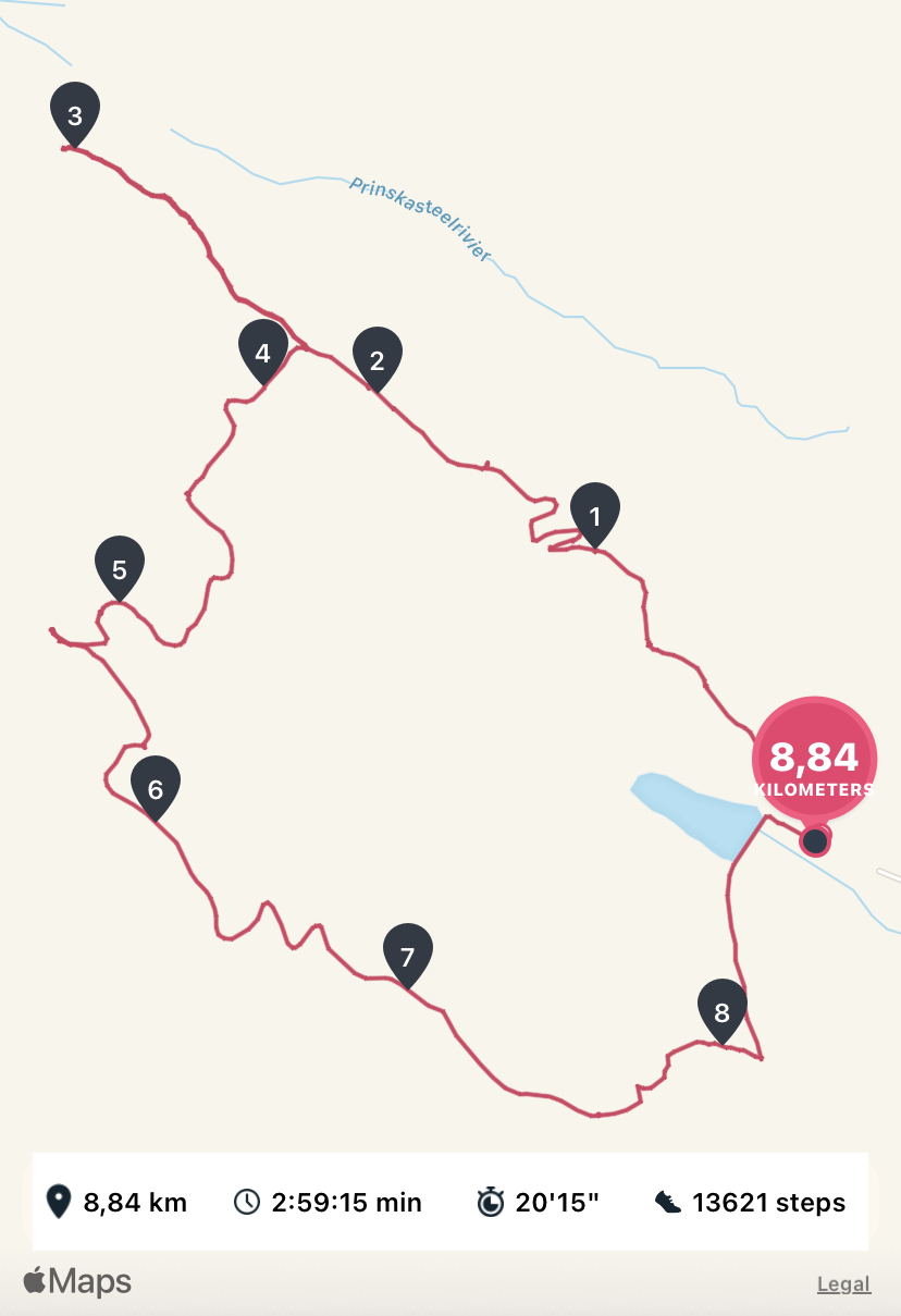
In total, with our detour to the Sentinal Look out, we covered 8.84 kilometres in just under 3 hours. It was slow going at some points but we also had to stand aside for trail runners to pass quite often on the first third of the hike and it includes a decent break at our main rest stop.
I’m keen to do this one again and maybe once I’m fitter I could do it as a trail run (one day.... in the future...)
The three of us plus my uncle are planning our next section of the Camino de Santiago for next April 2022. Here’s hoping us Saffers will be able to travel by then.
Until then the local hiking will be plentiful! We have so many routes to explore and the weather is going to be getting wetter.
Hope you enjoyed the hike!

Cool! Thank you!! @ackhoo
Congratulations, your post has been added to Pinmapple! 🎉🥳🍍
Did you know you have your own profile map?
And every post has their own map too!
Want to have your post on the map too?
I loved the scenery along the hike, there's so much variation. If I did the hike, I'm sure it would have taken me way more than 3 hours as I'm always stopping to take photos.
Oh I did too! My sister is still quite a bit slower due to her MS so our time was quite slow. I’m sure you would do just fine. It’s so beautiful though.
Hiya, @LivingUKTaiwan here, just swinging by to let you know that this post made it into our Top 3 in Daily Travel Digest #1225.
Your post has been manually curated by the @pinmapple team. If you like what we're doing, please drop by to check out all the rest of today's great posts and consider supporting other authors like yourself and us so we can keep the project going!
Become part of our travel community:
Wow this place is insane, The place looks magnificent makes hiking the trail totally worth it!! 😍
It was so worth it! I’m keen to do this hike again really soon.
Wow what a lovely post 🌸
After seeing it I can imagine how great adventure you had 💥
All the photographs are just stunning 👍🏻
Thankyou for sharing 🙏
I'm also a guy from Mountains, Himalayas and have a keen interest in Hiking , Skiing , Mountain Biking.
You can check my blogs and I hope you'll like them.
Have a good day :)
Great! I’ll check out your blog! I do hiking and a little trail running at the moment but anything outdoors is awesome! We are lucky to be close to the mountains here. We just don’t get any snow. That would be amazing!!!
It really is. I can’t wait to do it again.