MAYOTTE - 11 PHOTOS
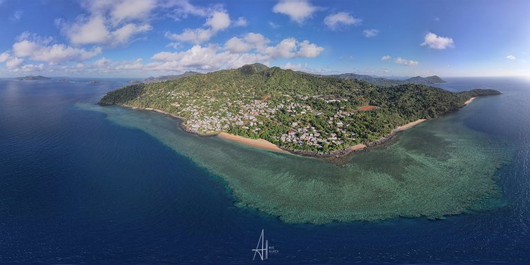


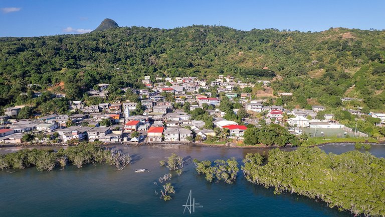
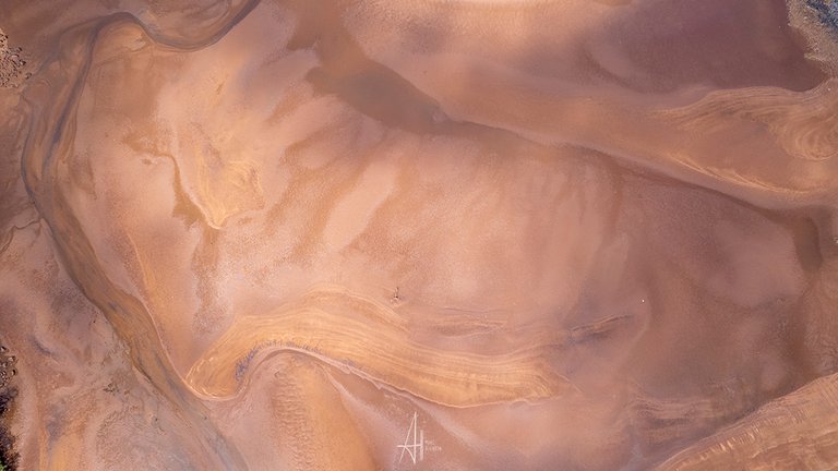
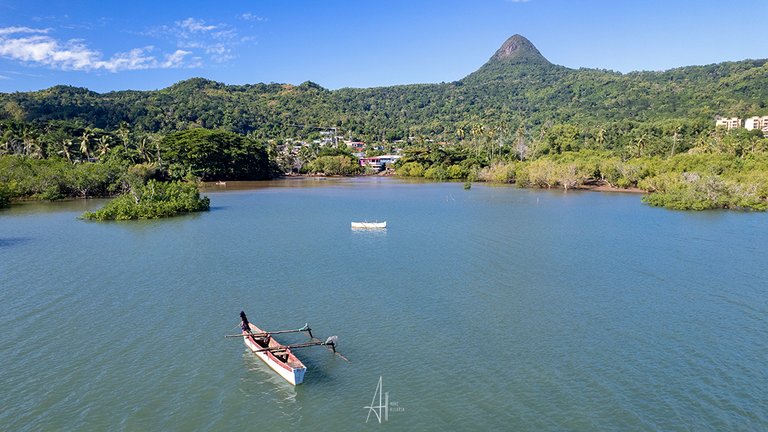
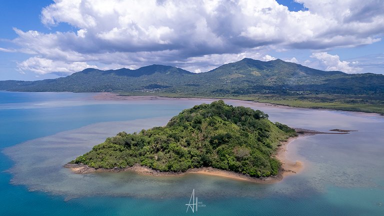
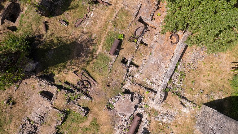
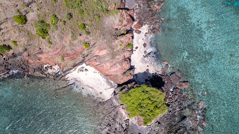
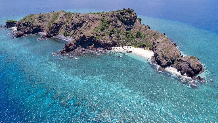
| Ceux qui s'y interessent savant certainement que Mayotte (je précise pour les non français, île Française de l'Océan Indien) a connu le passage d'un cyclone dévastateur il y a de cela 2 mois environ. Actuellement, beaucoup de paysages sont à l'état de ruine et necessiteront de nombreuses années pour retrouver ce qu'ils étaient avant le passage de ce déluge. Pour ma part, je me rends chaque année sur cette île afin d'enrichir ma photothèque dont se servent de nombreux médias locaux pour illustrer l'île. De nombreuses vues du ciel font partie de ce travail régulier. Je préfère montrer aujourd'hui ce à quoi l'île ressemblait avant le passage du cyclone. Photo 1 : Panoramique du village de M'Tsangadoua - Nord de l'ile Photo 2 : Ilot de Bandrele - Est de l'île Photo 3 : Villa de Kani Be - Sud de l'île Photo 4 : Paysage de vase de la mangrove de Tsingoni - Ouest de l'île Photo 5 : Pointe de N'Gouja - Sud de l'île Photo 6 : Village de Tsimkoura et pirogue traditionnelle - Sud de l'île Photo 7 : Zone de culture de Tsararano - entre Est de l'île Photo 8 : Ilot de Caroni - Sud de l'île Photo 9 : Vestiges sucriers de Hajangoua : Est de l'île Photo 10 : Ilot de Choisil - Nord de l'ile Photo 11 : Ilot Choisil - Nord de l'île |
Those who are interested certainly know that Mayotte (I specify for the non-French, French island of the Indian Ocean) has experienced the passage of a devastating cyclone about 2 months ago. Currently, many landscapes are in a state of ruin and will take many years to return to what they were before the flood. For my part, I go to this island every year in order to enrich my photo library which is used by many local media to illustrate the island. Many views from the sky are part of this regular work. I prefer to show today what the island looked like before the cyclone. Photo 1: Panoramic view of M'Tsangadoua village - North of the island Photo 2: Bandrele Island - East of the island Photo 3: Villa de Kani Be - South of the island Photo 4: Tsingoni mangrove landscape - West of the island Photo 5: Pointe de N'Gouja - South of the island Photo 6: Tsimkoura village and traditional canoe - South of the island Photo 7: Tsararano growing area - between the east of the island Photo 8: Caroni Island - South of the island Photo 9: Sugar remains of Hajangoua: East of the island Photo 10: Ilot de Choisil - North of the island Photo 11: Ilot Choisi - North of the island |


How to follow me ?
On Instagram here
On my website
On Facebook here
Traduction
Note ! Text original is in french, english version. is only a reverso traduction
MY NFT
My NFT by following this link
My NFT
!PIZZA
Your post has been manually reviewed for curation by the Principality of Bastion.
Check the Trail of posts we voted
Principality of Bastion - Our Leit Motiv? Let's Grow Together.
Principality's site | Minava NFT Market | Discord | Our Twitch Channel
You may TRAIL this account if you like the curation we do, or join our discord to know more about what we do.

$PIZZA slices delivered:
@itharagaian(3/10) tipped @marc-allaria
Interesting photos and perspectives! I enjoyed watching them.
Crazy cool shots. Im expecting this is on the end of the world almost in distance right?
Would love to sail there one day...
My congrats
My congrats