As I said in my previous post of this series, I had to turn back and head to the starting point before the upcoming storm (that it was not foreseen in the weather forecast of the day) reached me, as a precaution.
YouTube Short reacting live to the upcoming storm:
Even though I was relatively close to the final point of the route but I do like to follow my own advices: never mess around with mountain, it's more dangerous and unpredictable than what it seems.
YouTube Short imagining the dry riverbed on a pouring rainy day:
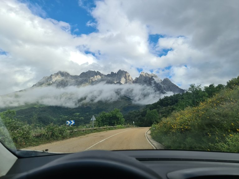
As I told you in the previous post and, although this route is absolutely beautiful, it's more dangerous than it seems, so it's advisable to take it easy and go well equipped, check the weather forecast before leaving home (important, always, before doing any route) and have the smartphone ready to call 112 in case of emergency.
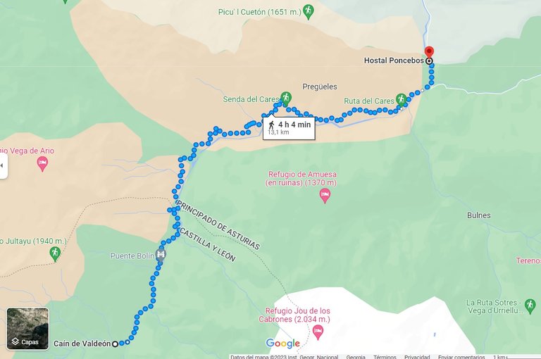
They also recommend you not to run the route but I did great part of it running (as you can see in my previous posts' YouTube Shorts) so it took me almost 4 hours total to complete the 4/6 of the route (around three hours and a forty-five minuts for 17 kilometers).
YouTube Short admiring the icy blue water of the river:
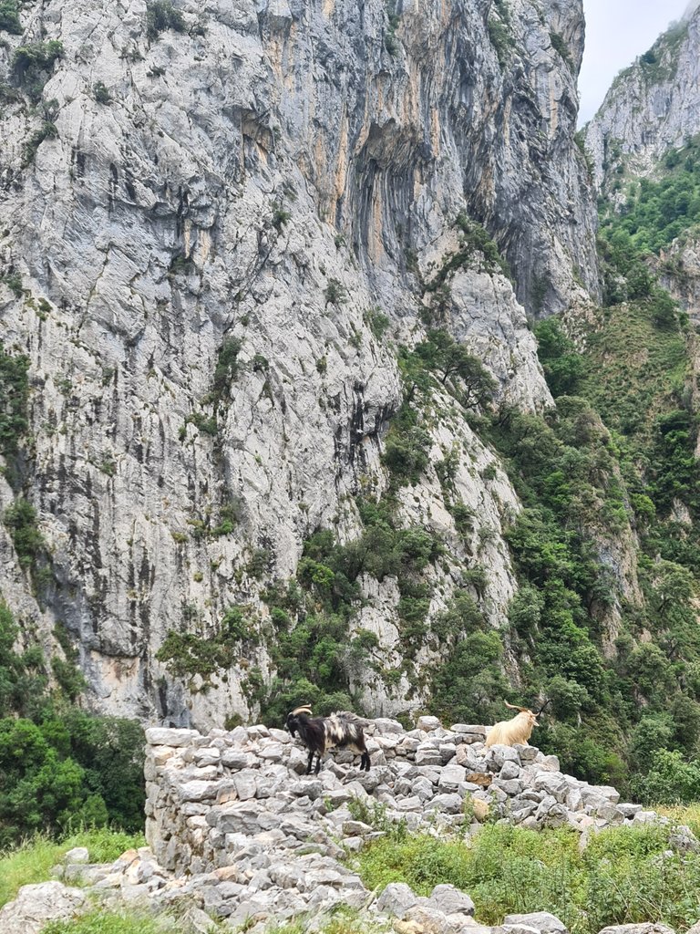
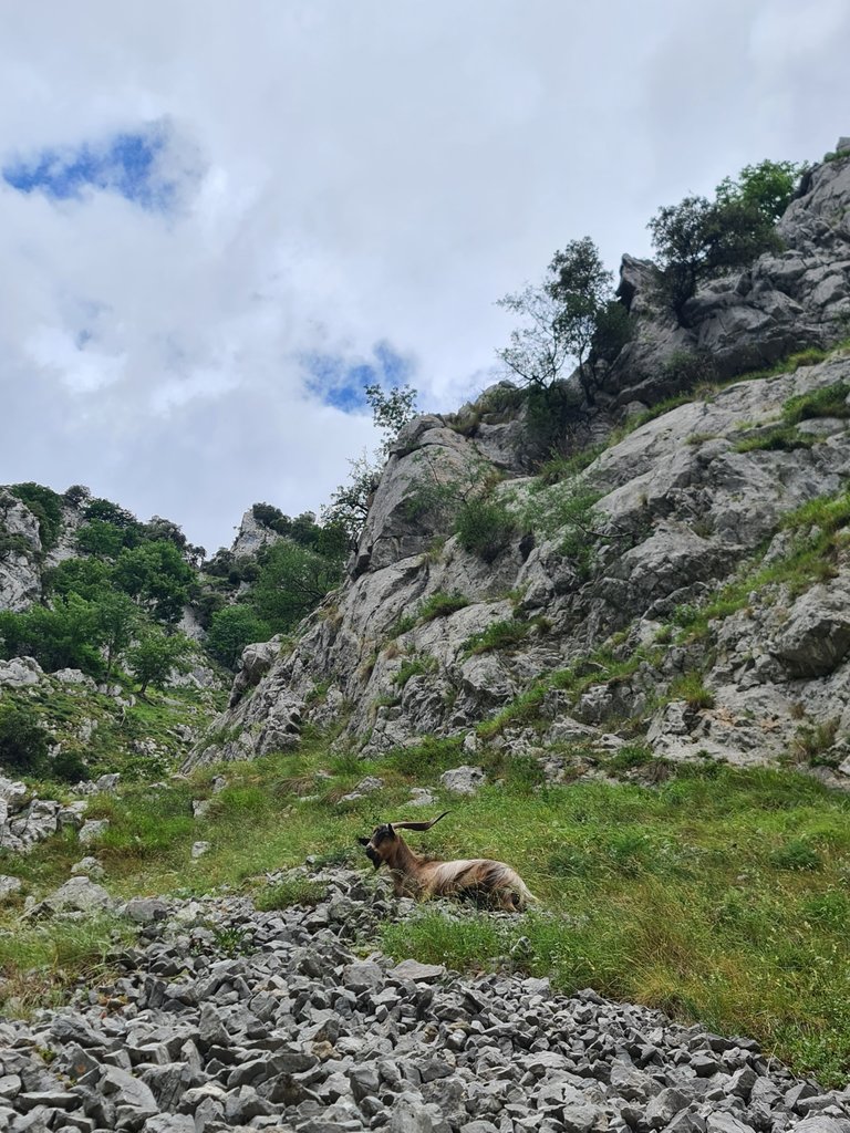
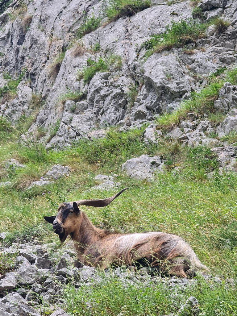
YouTube Short of a male chamois approaching too much to my position:
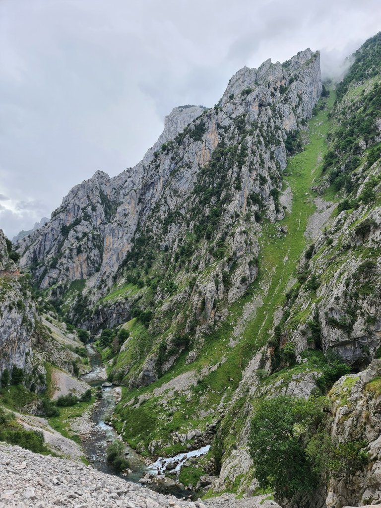
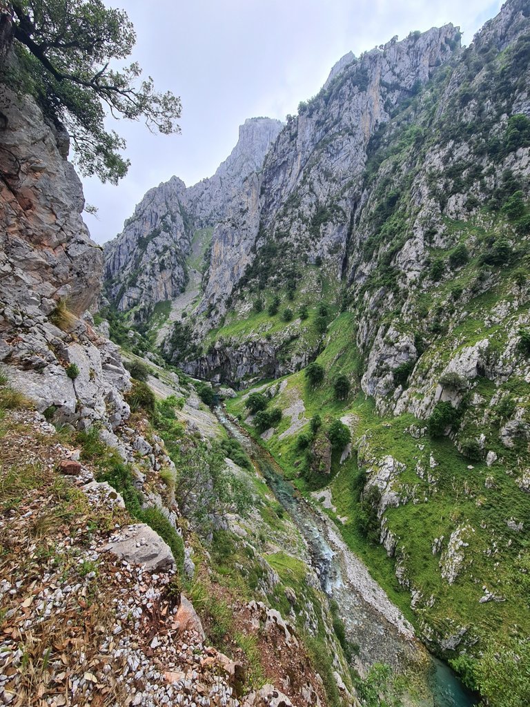
The average altitude of the path through which the route runs is around 600 meters, but you will be amazed by the heights of the abysses/chassms and also of the peaks that surround you, making you feel as small as an ant.
I will tell you more about this route and my experience in the last episode of this series!
Photographs taken with my Samsung Galaxy S20 Ultra 5G camera.
YouTube shorts recorded with my Samsung Galaxy S20 Ultra 5G camera
Sources on which I relied to give some accurate info about Picos de Europa National park and Cares hiking route: (1), (2)
Congratulations, your post has been added to Pinmapple! 🎉🥳🍍
Did you know you have your own profile map?
And every post has their own map too!
Want to have your post on the map too?
Congratulations @dresden.theone! Your post brought a smile to the TravelFeed team so we have sent you a smiley. Keep up the good job. 🙂
Thanks for using TravelFeed!
@invisusmundi (TravelFeed team)
PS: Why not share your blog posts to your family and friends with the convenient sharing buttons on TravelFeed.io?