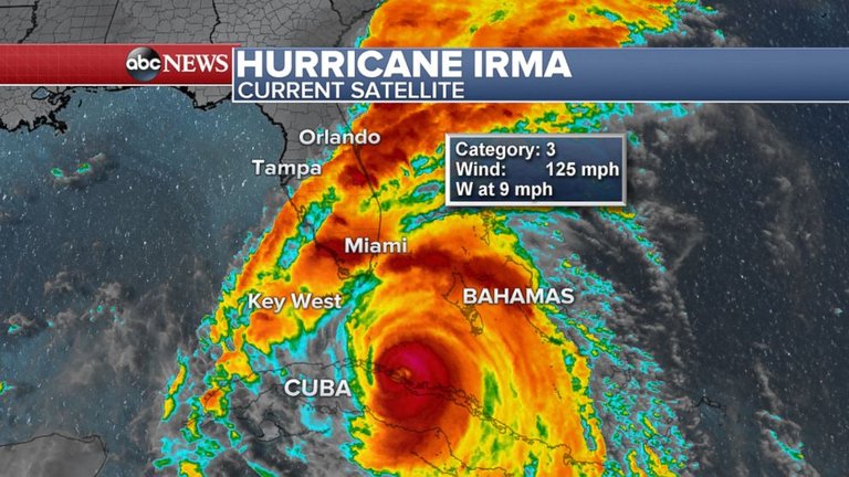
Hurricane Irma, the most powerful Atlantic storm in a decade, hit Cuba overnight as a rare Category 5 storm before being downgraded to a Category 3 Saturday morning. It is expected to strengthen again as it heads toward Florida.
As of about 3 p.m. Saturday, Irma was 140 miles southeast of Key West with winds of 125 mph. It was moving west at 9 mph and is expected to turn north and head up the western coast of Florida, making landfall on Sunday.
"This is a life-threatening situation," Florida Gov. Rick Scott said Saturday. "Our state has never seen anything like it."
The governor stressed the dangers of what he called a "deadly, deadly, deadly storm surge."
ABC News meteorologists are forecasting storm surges of 10 feet in Tampa and Sarasota, and 10 to 15 feet from Fort Myers to Naples. Somewhat lower storm surges of 3 to 6 feet may occur from Miami to Key Largo.
Winds were already picking up in Florida early Saturday, with gusts between 40 and 60 mph.
Hurricane-force winds with gusts over 115 mph are possible in the Keys by daybreak Sunday.
A few tornadoes are possible and a tornado watch was issued Saturday for southern Florida.
Florida's governor said 25,000 power outages were reported as of Saturday morning.
The state's residents should anticipate days-long power outages, FEMA said.
Ahead of Irma's arrival in the Sunshine State, the last flights departed Friday night from Miami International Airport and Fort Lauderdale-Hollywood International Airport. Miami's airport officially remains open, while Fort Lauderdale's airport is closed for Saturday and Sunday.
Many ATM machines across southwest Florida were out of cash by late Friday night after people stocked up in case Hurricane Irma causes power outages that make debit and credit card transactions impossible, The Associated Press reported.
Really wish we had underground hyperloops for this reason. Much easier to evacuate quickly. ONE DAY!