Hello Friends of Steemit.
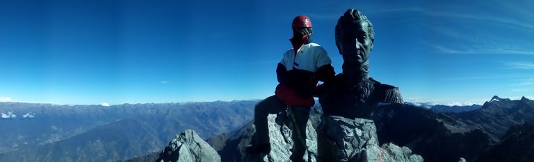
In this Post you will see a series of panoramic photos, taken towards the peak of Bolívar, in my first high mountain and summit in the highest point of Venezuela, at 4978 meters above sea level, located in the Sierra Nevada National Park, Mérida-Venezuela, in the third week of the month of December of last year (2017). Travel that without a doubt the best that has been done so far, for the singular spirituality, lived emotions, unique experiences, for all that the mountain teaches you, that you can only know by living it. A dream come true.
In this Post you will see a series of panoramic photos, taken towards the peak of Bolívar, in my first high mountain and summit in the highest point of Venezuela, at 4978 meters above sea level, located in the Sierra Nevada National Park, Mérida-Venezuela, in the third week of the month of December of last year (2017). Travel that without a doubt the best that has been done so far, for the singular spirituality, lived emotions, unique experiences, for all that the mountain teaches you, that you can only know by living it. A dream come true.
If you like this article, please RESTEEM, COMMENT & UPVOTE.
.JPG)
Source: Author. Canon EOS DIGITAL REBEL XTi. Foto: 1/160 seg f/9 35 mm. ISO 100 B. 2788 x 1360.
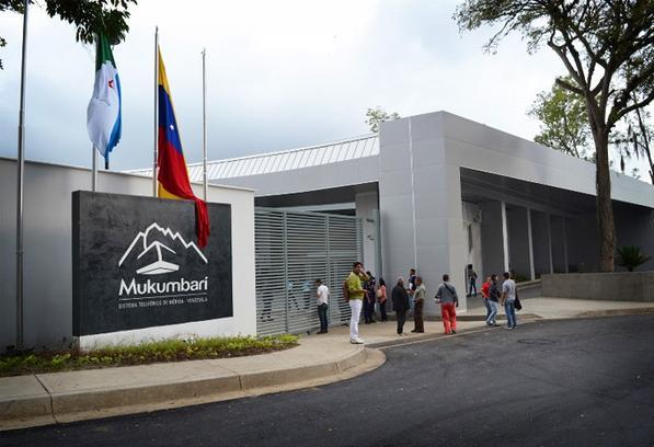
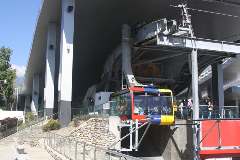
Mukumbarí is a cable car system in Venezuela. It is located in the Venezuelan city of Merida at an altitude of 1,640 meters (5,380 feet), up to Espejo Peak, at 4,765 meters (15,633 feet), within the Sierra Nevada National Park in the Venezuelan Andes. It is the longest cable car and the second longest in the world for only 500 meters, but it is in the first place because it is the only one that combined such height and length. The Cable Car of Mérida has a trajectory of 12.5 kilometers, reaching a height of 4,765 meters, which makes it a marvel of engineering unique in its type and with more than 50 years of history.
Fuente
Source: Author. Canon EOS 1000D. Foto: 1/100 seg, f/7,1, 28 mm. ISO 200 B
Source: Author. Canon EOS 1000D. Foto: 1/100 seg f/7,1 28 mm. ISO 200 B
First stretch
- Barinitas Station (1,577 m) *
- La Montaña Station (2,436 m) *
*From the Chama River Canyon, moving from the top and after the top. The Meseta de Mérida with its neighboring towns - Tabay, La Parroquia and Ejido. *
Second section
- La Montaña Station (2,436 m) *
- La Aguada Station (3,452 m) *
- Cloudy rain forest altiandina to the high moors, where El Toro Peak (4,756 m) emerges. The Sierra Nevada National Park and, to the north, you can see the Sierra de la Culata National Park, in the heart of the Venezuelan Andes. *
Third section
- La Aguada Station (3,452 m) *
- Loma Redonda Station (4,045 m) *
- The páramos. Here you can see more than 86 species of frailejón, an exclusive plant of the Andes mountain range. To the front we see the North flank of Pico Bolívar and, below, there is a path that leads to Los Nevados village, on the other side of the mountains. *
Fourth section
- Loma Redonda Station (4,045 m) *
- Pico Espejo Station (4.760 m) *
- Already at the top of Pico Espejo, the last cable car station. It appears around 20 to 40% less oxygen in reference to sea level. *

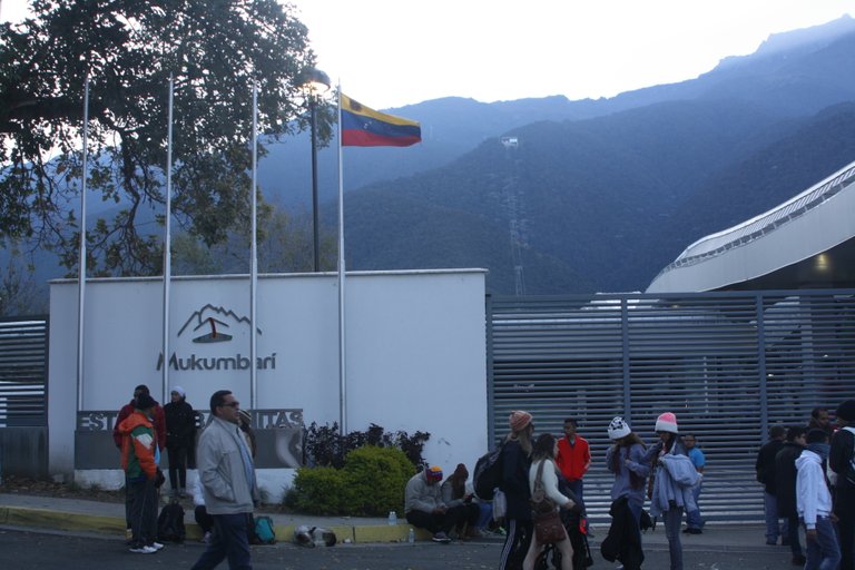
... 7:45 am, with our backpacks and climbing equipment hanging on the counted, and the backpacks to their full capacity, we were in the Plaza de las Heroínas waiting for the opening of the Mukumbarí cable car system, being the longest and the second highest in the world ... while the sun's rays caressed the mountain tops detailing all its relief, every minute that passed from the sunrise after the mountain range, it rose imposing, with its challenging and at the same time charming and subtle look beauty ... waiting for your rise ...
Source: Author. Canon EOS 1000D. Foto: 1/320 seg, f/13, 28 mm. ISO 200 B. 3888 x 1707
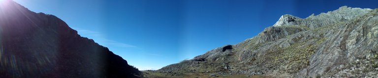
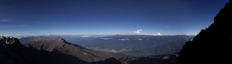
Pico Espejo / Peak Mirror
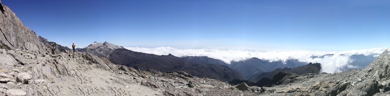
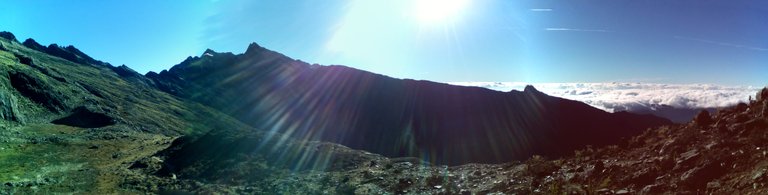
Source: Author. Canon EOS 1000D. Fotos 4: 1/320 seg f/11 28 mm. ISO 200 B. 17751 x 4401
Camp Albornoz
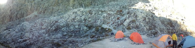
Source: Author. Sendtel Flare. Foto: 1/125 seg f/2,2 3,5 mm. ISO 116 B. 2192 x 544
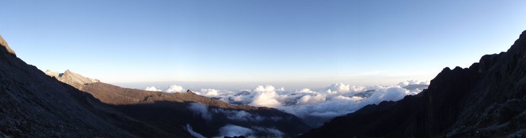
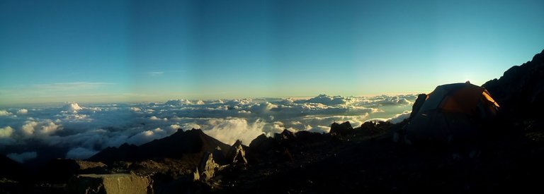
High altitude sunrise, from Base Camp Albornoz
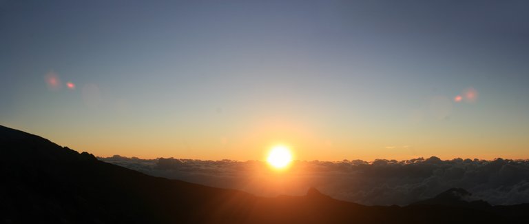
Source: Author. Canon EOS DIGITAL REBEL XTi. Fotos 2: 1/160 seg f/9 35 mm. ISO 100 B. 7270 x 3075.
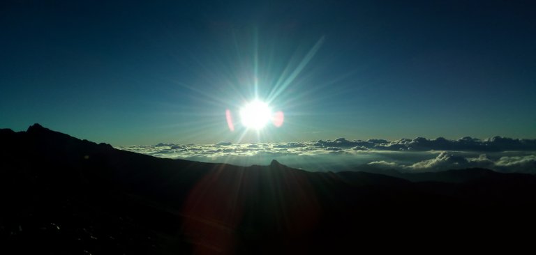
Source: Author. Sendtel Flare. Fotos 2: 1/3200 seg f/2,2 3,5 mm. ISO 117 B. 6248 x 2977.
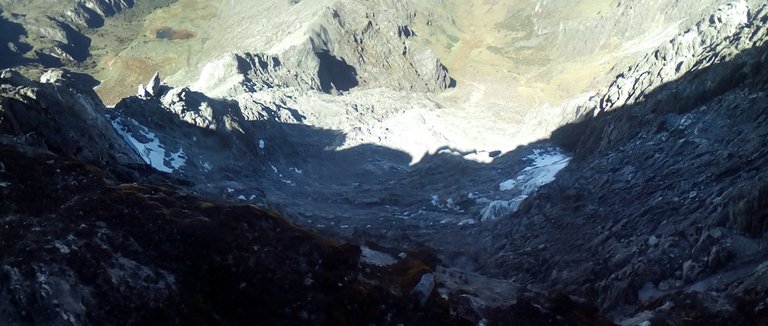
La Charca, water intake
Source: Author. Sendtel Flare. Fotos 4: 1/640 seg f/2,2 3,5 mm. ISO 116 B. 10177 x 2590.
Source: Author. Sendtel Flare. Fotos 1: 1/1000 seg f/2,2 3,5 mm. ISO 118 B. 2320 x 480.
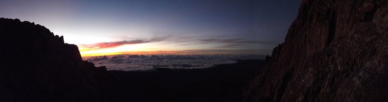
Sunset of height
Source: Author. FinePix S2950. Fotos 1: 1/80 seg f/6,4 5 mm. ISO 64 B. 4752 x 1248.
.jpg)
Source: Author. FLARE. Fotos 1: 1/125 seg f/2,2 3,5 mm. ISO 127 B. 3263 x 1320.
Towards the Highest, Pico Bolívar
Source: Author. FinePix S2950. Fotos 1: 1/60 seg f/3,1 5 mm. ISO 400 B. 4800 x 1264.
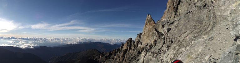
Source: Author. FinePix S2950. Fotos 1: 1/320 seg f/6,4 5 mm. ISO 64 B. 4704 x 1248.
Source: Author. FLARE. Fotos 1: 1/1000 seg f/2,2 3,5 mm. ISO 116 B. 2160 x 544.
Source: Author. FLARE. Fotos 1: 1/250 seg f/2,2 3,5 mm. ISO 116 B.1280 x 544.
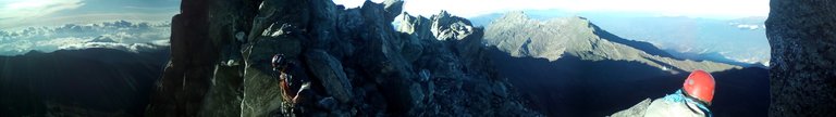
Source: Author. FLARE. Fotos 1: 1/400 seg f/2,2 3,5 mm. ISO 116 B. 2624 x 368.
Source: Author. FLARE. Fotos 1: 1/1250 seg f/2,2 3,5 mm. ISO 118 B. 1782 x 544.
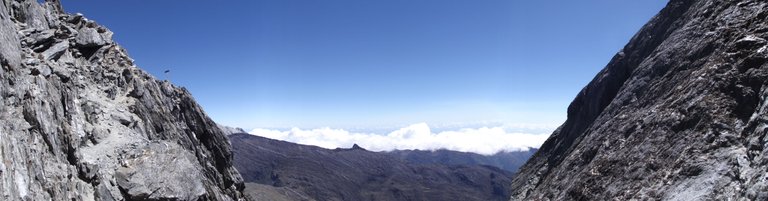
Descent, towards Pico Espejo
Source: Author. FinePix S2950. Fotos 1: 1/250 seg f/6,4 5 mm. ISO 64 B. 4832 x 1264.
Source: Author. FinePix S2950. Fotos 1: 1/250 seg f/6,4 5 mm. ISO 64 B. 4832 x 1264.
End.

"The feeling for Nature is the most refined expression of Civilization. The clean body is restored with the subtle air of the heights, and the soul is cleaned and restored with the silence of the summits". (Unamuno)