Ali region is the only region in the Tibet autonomous region. It was called "yangtong", "nari" in the yuan dynasty, and "oreisi" in the Ming dynasty.[1] located in the southwest border of China, the west of Tibet autonomous region and the north of qinghai-tibet plateau (qiangtang plateau).
it is bounded by hotan region of xinjiang uygur autonomous region and bayingolin Mongolian autonomous prefecture in the north, nagqu city in the east and xigaze city in the southeast, and Nepal, India and Kashmir in the southwest and west.According to the second land survey, the total area of the whole area is 337,174.95 square kilometers, [3] the second largest prefecture-level unit in Tibet, second only to nagqu city.
By the end of 2017, the region had jurisdiction over seven counties, seven towns and 30 townships, 11 neighborhood committees and 134 village committees.[4] the administrative office is stationed at no. 6 wenhua road, shiquanhe town, ggar county.The permanent population is 107,400, and the registered population is 107,100.[6] in 2017, the GDP of the whole region reached 4726.44 million yuan, an increase of 9.9% over the previous year, and the per capita GDP was 40,544 yuan.Local government revenue reached 37.094 million yuan, an increase of 24.68 percent over the previous year
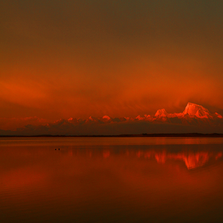
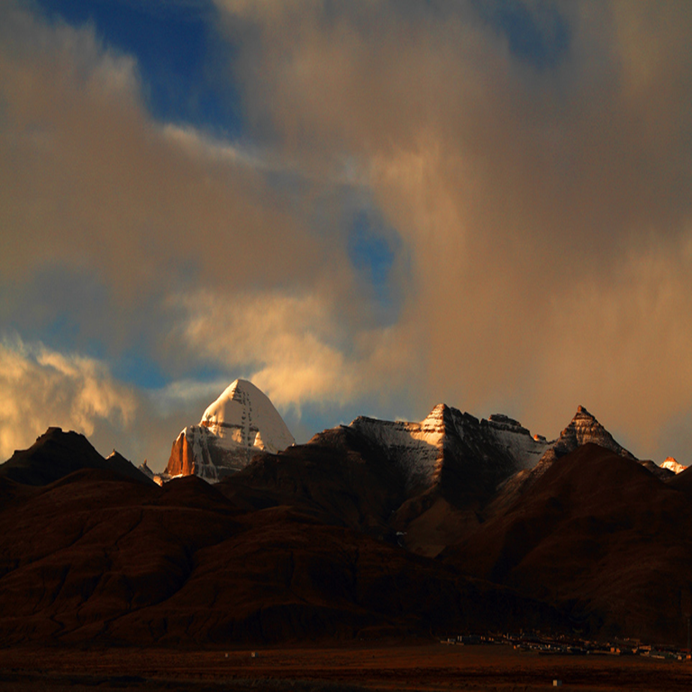
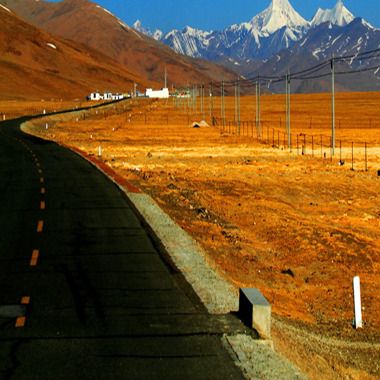
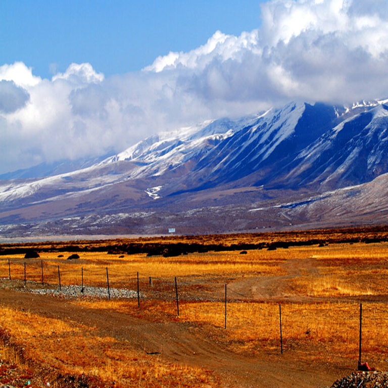
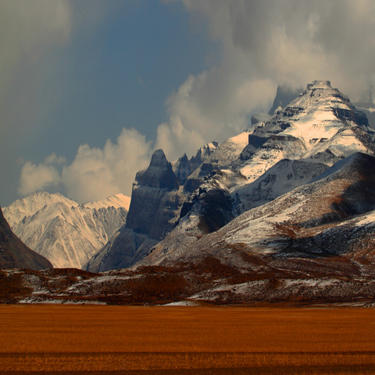
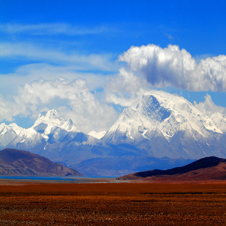
With an average elevation of more than 4500 meters, ali is known as "the roof of the roof of the world", "the third pole of the world" and "the forbidden zone of life".[8] the main mountains within the territory are the Himalayas, gangdese mountains, karakoram mountains, etc. The main rivers are shiquan river, xiangquan river, kongquehe river, etc.[2] the main tourist attractions are the ruins of the kingdom of guge, the torin temple, the zhada Turin and so on.
Location is produced
Standard map of ali region (2 copies)
Ali region is located in southwest China, west of Tibet autonomous region and north of qinghai-tibet plateau (qiangtang plateau).In the east, it is separated by the mountains of dazheng mountain, guogan jiannian mountain, malgang wood mountain, geza mountain and weijia naboshan, adjacent to the city of nagqu;Southeast to the middle of the gangdise mountains, according to shigatse city;In the north, at the southern foot of the kunlun mountains, it is adjacent to hetian region of xinjiang uygur autonomous region and bayingolin Mongolian autonomous prefecture.To the southwest and west lies the western section of the Himalayas, bordered by Nepal, India and Kashmir.[15] lying between 78°24 '-86 °20' east longitude and 29°41 '-35 °52' north latitude, the east-west span is 742 km, and the north-south span is 688 km, covering an area of 337,200 km2.
landscape
In ali region, landforms include mountains, valleys, soil forests, ice erosion, impact fan, moraine and volcano, etc. [17] historically, such features have been summarized as "pulan" surrounded by snow and ice, "guge" surrounded by rocks, and "mayu" surrounded by lakes, which is generally referred to as "ali sanwai".
Image of ali region
Image of ali region
mountains
The main mountains are the Himalayas, the gangdise mountains and the karakoram mountains.Deep gullies, valleys and sporadic impact fan zones in the south and southwest;The terrain in the east and northwest is relatively gentle, forming wide valleys and endless grassland gobi.The overall topography is from the south to the north of the plateau, the second uplift,
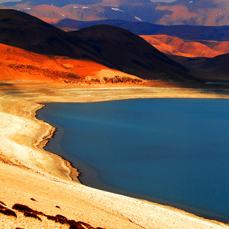
and the main ridge of the mountains gradually reduced, the highest point is the namunani peak in pulan county, with an elevation of 7694 meters, the lowest point is the ranchin zangpo river valley near shbuqi, zada county, with an elevation of 2800 meters, and the maximum relative elevation difference of 4894 meters.[17]
climate
Ali belongs to category ii wind zone, with annual average wind speed of more than 3.2 meters per second, high wind frequency of more than 8, and annual wind days of about 149 days.The annual average temperature is 0℃, and the daily average temperature varies greatly.In winter, shiquanhe town has a low temperature all year round, with an average annual temperature of less than zero.
In winter, the extreme minimum temperature in shiquanhe town is 41 ° c, and the extreme maximum temperature in summer is 21 ° c. The temperature difference between day and night is quite large.
The annual rainfall in ali is quite low and seasonal.From October to April of the following year, only 10% ~ 20% of the annual precipitation, while from may to September, rainfall is very concentrated, generally accounting for more than 80% of the annual precipitation.
Ali region because of high altitude, cold and dry climate, the annual rainfall is quite small, day and night temperature difference.The winters in ali are long and bitter.
Population and ethnic editor
population
According to the sixth census, there are 95,465 permanent residents in ali.Among them, there were 22,962 households with a population of 87,357, with an average population of 3.80 per household.In the resident population, there are 49,802 males and 45,663 females according to gender, accounting for 52.17% and 47.83% respectively. The sex ratio (100 females) is 109.06.According to the age structure, 25,367 people aged 0~14 years old, accounting for 26.57%;65,576 people aged 15 to 64, accounting for 68.69%;4,522 (4.74%) were aged 65 or above.By region, there were 9,657 people in pulan county, 6,883 in zada county, 16,901 in gaer county, 9,738 in ritu county, 15,483 in geji county, 22,177 in geze county, and 14,626 in cuoqin county.
Land resources
According to the second land survey, by the end of 2009,
ali area land area of 33.7175 million hectares, of which 03500 hectares of cultivated land, garden land area of 00100 hectares, the forest land area of 344200 hectares, 26.0212 million hectares, the grass town village of 05900 hectares, and industrial and mining land transportation land 16100 hectares, water area and water conservancy facilities, land area of 1.7793 million hectares, 5.5471 million hectares of other land.[16]
Of the 3,500ha of cultivated land, 3,100 ha of irrigated land and 4,040 ha of dry land;The slope is 0.16 million hectares at 2° and below, 0.12 million hectares at 2°~6°, 0.06 million hectares at 6°~15°, and 0.01 million hectares at 15°~25°.200,000 hectares of basic farmland, including 1,900 hectares of irrigated land and 0.01 million hectares of dry land.
Source
Plagiarism is the copying & pasting of others work without giving credit to the original author or artist. Plagiarized posts are considered fraud and violate the intellectual property rights of the original creator.
Fraud is discouraged by the community and may result in the account being Blacklisted.
If you believe this comment is in error, please contact us in #disputes on Discord
This post has been appreciated and featured in daily quality content rewards. Keep up the good workHi @wanglizhuifeng, your post has been reviewed by the TravelFeed content team, but it does not qualify for an upvote since you did not post through TravelFeed.io.
Feedback
Based on your post, we have the following feedback for you:
Thanks for using TravelFeed!
@worldcapture (TravelFeed team)
PS: Why not share your blog posts to your family and friends with the convenient sharing buttons on TravelFeed.io?
Because I encountered a problem when publishing to TravelFeed.io. Pictures cannot be uploaded to TravelFeed.io. Always showing uploading.
Depending on your device and internet speed, uploading can take a while, as on any site. Can you try waiting for some time and see if it is uploaded then? If it still doesn't work, which browser are you using?
I tried waiting for some time but it still shows uploading.I will try it next time.I use chrome browser.
We just looked into our image uploading and found an issue that can affect a few users, we just rolled out an update that should fix this. Please let us know if you experience further issues!
These sites are incredible to behold. How do you travel so often, are you a journalist of some kind?
I'm not a journalist. These pictures were taken by someone else.I add text to the pictures.